
In a scenario that almost reminds a Northeast Monsoon Onset day for rains have lashed many parts of Tamil Nadu since the wee hours of Thursday. While delta areas recorded heavy rains during the morning hours of Thursday, Chennai joined the party a little later to see on and off spells of rains right through the day.
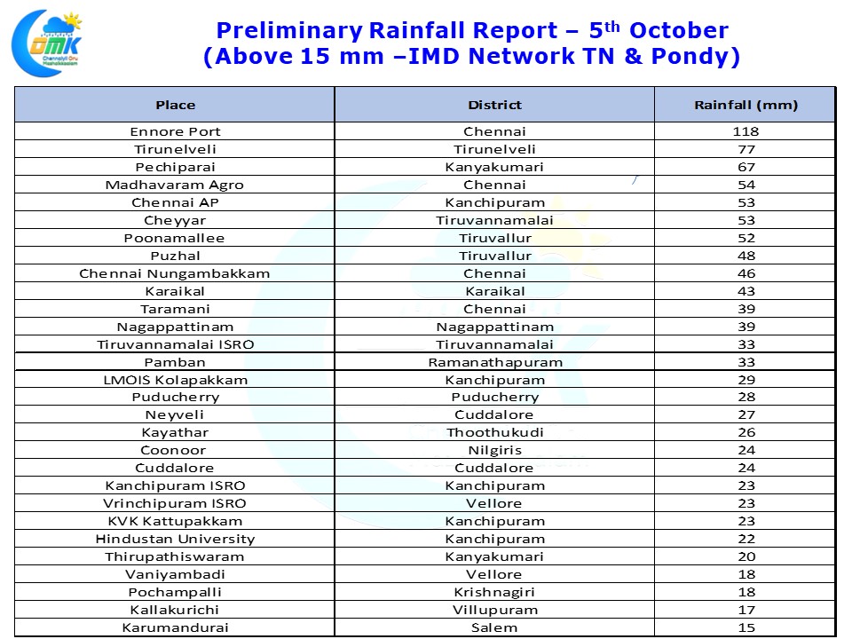
Ennore Port recorded the first century of the season for it as regular bands of rains just kept moving in from the sea over Norther suburbs and adjoining parts of South AP coast. Chennai AP recorded 53 mm till 5:30 AM while Nungambakkam recorded 46 mm. Parts of South Tamil Nadu also recorded moderate to heavy rains with Tirunelveli & Pechiparai recording 7 cms as of 5:30 AM today morning.
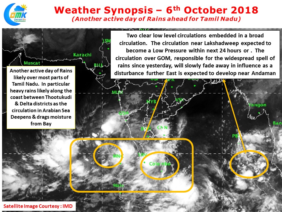
With two clear Low Level Circulations persisting off South TN Coast it is likely to be another active day of rains across Tamil Nadu. The circulation near Lakshadweep is likely to be announced as a Low Pressure Area today while the one over GOM that has been giving the rains since yesterday may slowly start fading away as a disturbance further west near Andaman Islands could slowly evolve into an organized disturbance in a day or two.
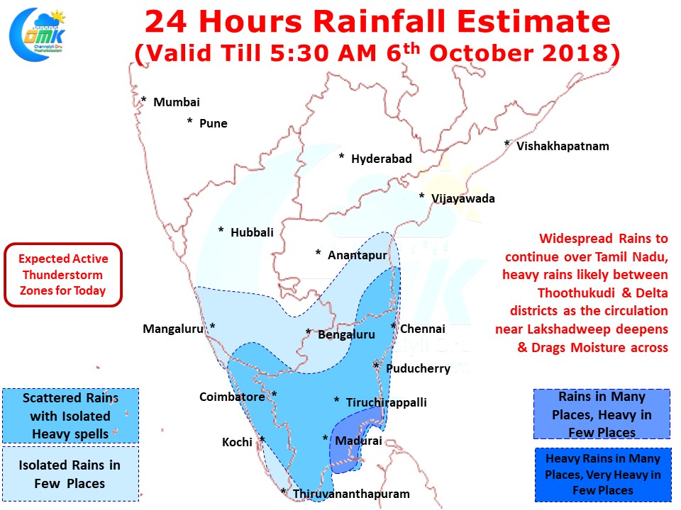
As the disturbance in Arabian Sea deepens and starts dragging more moisture from Bay of Bengal we could possibly see an increased rainfall activity over places along the Western Ghats & Kerala. Few Places in South TN could possibly see heavy rains today along the coast between Thoothukudi & Delta districts while rest of the coast could see heavy spells of rains at times.
Chennai is likely to see conditions similar to yesterday with on and off spells of rains likely to continue of varying intensities. At times the spells could be heavy too.