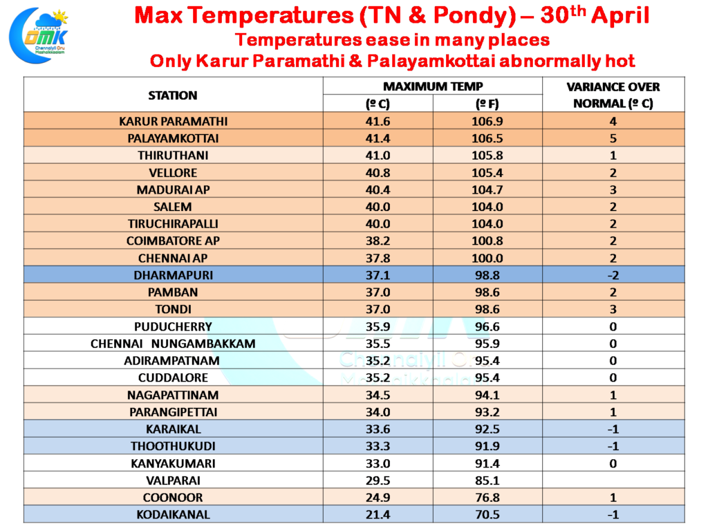
After a hot spell that started in most of Tamil Nadu around middle of April and continued for almost all of the second fortnight a temporary reprieve on the temperature front is expected to give some much needed relief to large parts of the state. Yesterday saw only K.Paramathy & Palayamkottai (Tirunelveli) record abnormally hot temperatures while most places were closer to normal or a shade above normal. In the instance of Dharmapuri the maximum temperatures were two degrees lower than normal.
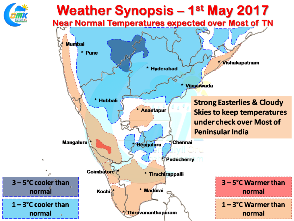
Things are expected to be even better today going by what models are indicating with many parts of North Tamil Nadu adjoining the Deccan Plateau areas & Coastal areas expected to possibly see slightly below normal temperatures. Parts of South TN & West TN could see marginally above normal temperatures but overall the pattern is going to be of moderately hot conditions rather than the oppressively hot conditions that was prevailing for most of second fortnight of April.
Strong Easterlies under the influence of the Trough that is running along the interiors of Peninsular India all the way from Bihar will play a crucial role not only in the moderation of the temperatures in the region but is likely to be a key trigger as well in the creation of unstable atmospheric conditions over the Deccan Plateau region bringing in cloudy skies and a reduction in temperatures.
Wind instability induced rains are likely to happen today as well over many areas of Deccan Plateau along with parts of Coastal Andhra Pradesh and along the Western Ghats due to the presence of a upper air cyclonic circulation over Coastal AP. Pockets of interior Tamil Nadu could see heavy spells of rains along the Erode / Salem / Dharmapuri region and parts of Coimbatore & Nilgiris districts.
Powered by WPeMatico


