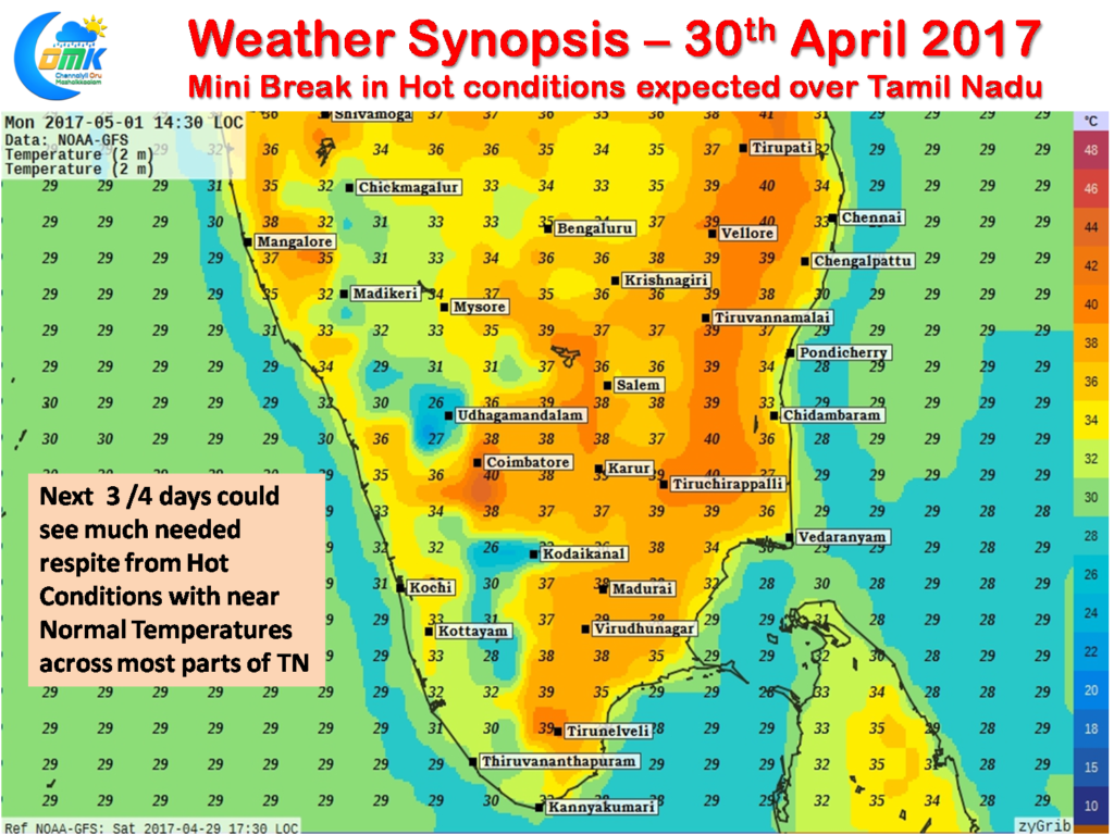
Since the start of April the interiors of Tamil Nadu has been seeing pretty much an early summer with temperatures staying above normal and well above normal. Not often does one gets to see Heat Wave warning issued by IMD during the month of April with 20 districts of Tamil Nadu falling under the heat wave category during the middle of the month. The last few days though has seen temperatures slightly ease under more favorable conditions with increased cloud cover and the absence of strong Westerlies.
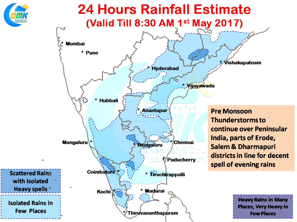
The Pre Monsoon thunderstorms season has been continuing over many parts of Interior Peninsular India as yesterday saw hailstorms in Belgavi and Bengaluru in Karnataka while good rains were reported in Dharmapuri district of Tamil Nadu where the Agro observatory at Paiyur recorded 28 mm rains.
Things look good another day of rains over South Karnataka and many parts of Andhra Pradesh & Telengana as well. Going by numerical models another day of hailstorm cannot be ruled out in parts of Bengaluru and adjoining areas of the metropolis.
As far as Tamil Nadu goes the West Interior districts of Erode, Salem, Dharmapuri & Krishnagiri are ideally placed for a day of thunderstorms with a few places in this belt in line for spells of intense thunderstorms in the late evening. In particular one or two places in Erode & Salem districts could see possibilities of hailstorms.
As far as temperature goes starting from today there is some much needed respite on the cards for most parts of Tamil Nadu with near normal temperatures expected to prevail for the next few days until possibly middle of next week. Numerical models indicate temperatures are likely to stay closer to normal across Tamil Nadu with the exception of South TN where marginally above normal temperatures might prevail. North Coastal Tamil Nadu could possibly enjoy below normal temperatures if the Sea Breeze manages to pick up strength as estimated by the numerical models.
Powered by WPeMatico


