அனைவருக்கும் இனிய தமிழ் புத்தாண்டு நல்வாழ்த்துக்கள். இனி வரும் ஹேவிளம்பி ஆண்டு அனைவருக்கும் இனியதாகவும் பருவ மழை நேரம் தவறாமல் பெய்து தமிழகத்தை வறட்சியின் பிடியில் இருந்து காக்கும் என்ற எதிர்பார்ப்பு நிறைவேற சென்னையில் ஓர் மழைக்காலம் வானிலை வலைபதிவாளர்கள் சார்பில் வாழ்த்துகிறோம்
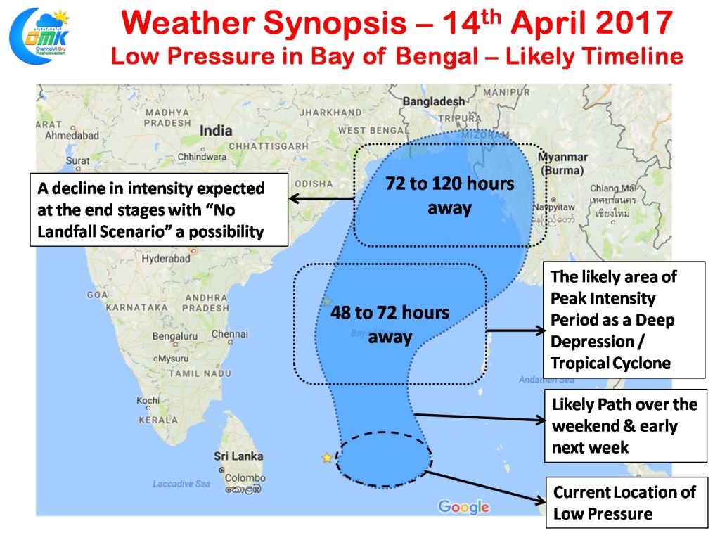
As we had indicated in our post yesterday a Low pressure has formed in South East Bay area near the Andaman Islands and is expected to intensify into a Depression in the coming 24 to 48 hours on its way towards the North Bay area. Numerical Models are fairly in agreement on the possible path with reasonable consensus on the intensity part as well.
Going by Models the peak intensity period for this bay disturbance is likely to be 48 to 72 hours from now when it possibly could be a Deep Depression or a marginal cyclonic system after which we can possibly expect some decline in the organization and intensity of the system as it heads into a high shear zone in North Bay area. While most models indicate a likely landfall along the Myanmar / Bangladesh region there exists a firm possibility of the system not making an organized landfall as it weakens over open waters and possibly drifting towards Bengal / Bangladesh border.
So what is in store for Tamil Nadu from this low pressure in Bay of Bengal? Overall from the rain perspective Tamil Nadu is unlikely to benefit much from this system with the isolation of some stray thunderstorms in the interior places of the state along the Western Ghats and surrounding areas for the next day or two.
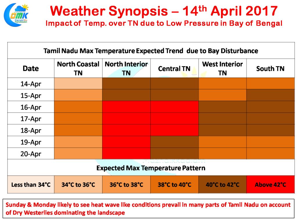
To the contrary we are going to see an increased amplitude of Westerly Land Breeze as the Bay disturbance climbs up the latitude stopping the effects of the moderating Easterlies that have been the saving grace for Coastal Tamil Nadu including Chennai so far. In what could be a prelude to the summer ahead once the seasonal wind change process completes and the Westerlies become a permanent phenomenon for the next few months.
Going by model outputs we are likely to see the peak temperature period on Sunday and Monday over Tamil Nadu with Tuesday also possibly being very close in terms of increase in temperature compared to normal pattern. During this three day period there is a genuine probability of Chennai Meenambakkam clocking its first 40°C for the year 2017 with Nungambakkam possibly seeing its first 100°F day.
Powered by WPeMatico


