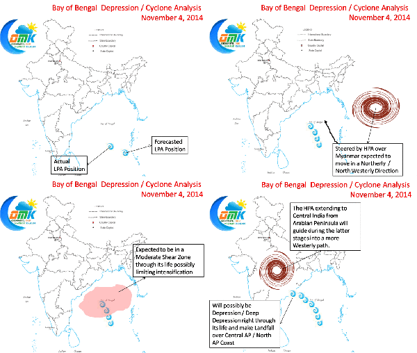
A Low Pressure Area has formed over Bay of Bengal (not officially confirmed yet by IMD). It has formed to the North West of what was expected to be the point of formation. The point of genesis is very important for the development and life cycle of any Tropical System. The current genesis point possibly puts the system under slightly unfavourable conditions compared to what could have been the conditions if it had formed closer to Andaman Islands.
The system could possibly face moderate shear earlier in its life cycle possibly impacting its development. Please find our analysis based on conditions that are evolving. We could possibly have a situation that the current disturbance could end up being a marginal cyclone at best.
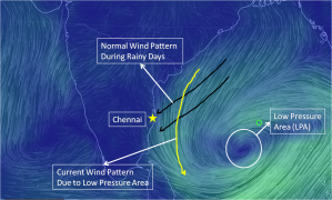
In the meanwhile because of the LPA the wind patterns have changed for Chennai which has created a break in rains. Chennai could see dry days over the course of this week though isolated rains cannot be ruled out. As the current disturbance in the Bay makes its journey we will have sunshine as our companion. Watch this space for further updates in a simple and clear manner
Edit: RAMMB has started tracking the Bay disturbance.https://rammb.cira.colostate.edu/products/tc_realtime/storm.asp?storm_identifier=IO912014


