Professional boxing bouts run up to 12 rounds during which both the boxers try to outwit each other. Each round lasts 3 minutes for men and 2 minutes for women. It may not be a surprise if people in Peninsular India feel they are witnessing an atmospheric boxing bout. Since early March Rain and Heat has been trading blows alternatively. The last few days had seen rain take an upper hand with April rainfall tally for TN & PDC standing at 24.9 mm. The seasonal rainfall tally stands at 71.6 mm which is nearly 3 times of the normal rainfall. But it is time for the pendulum to swing the other way. Round two of active summer is now all set for North Tamil Nadu.
A combination of easterly wave and interaction between easterlies and westerlies brought a bounty of rains. In particular places along the Ghats and interior areas of Peninsular India saw heavy rains in many places. Tiruppur recorded more than 15 cms on Friday night leading to localised flooding in a few areas. In the previous post the possibility of a disturbance in Bay of Bengal was mentioned as part of the rainfall prospects for Peninsular India. The post also talked about a spell of heat between the wind discontinuity event and the development of the disturbance. Now weather models have started to gradually lean towards second round of active summer over North TN.
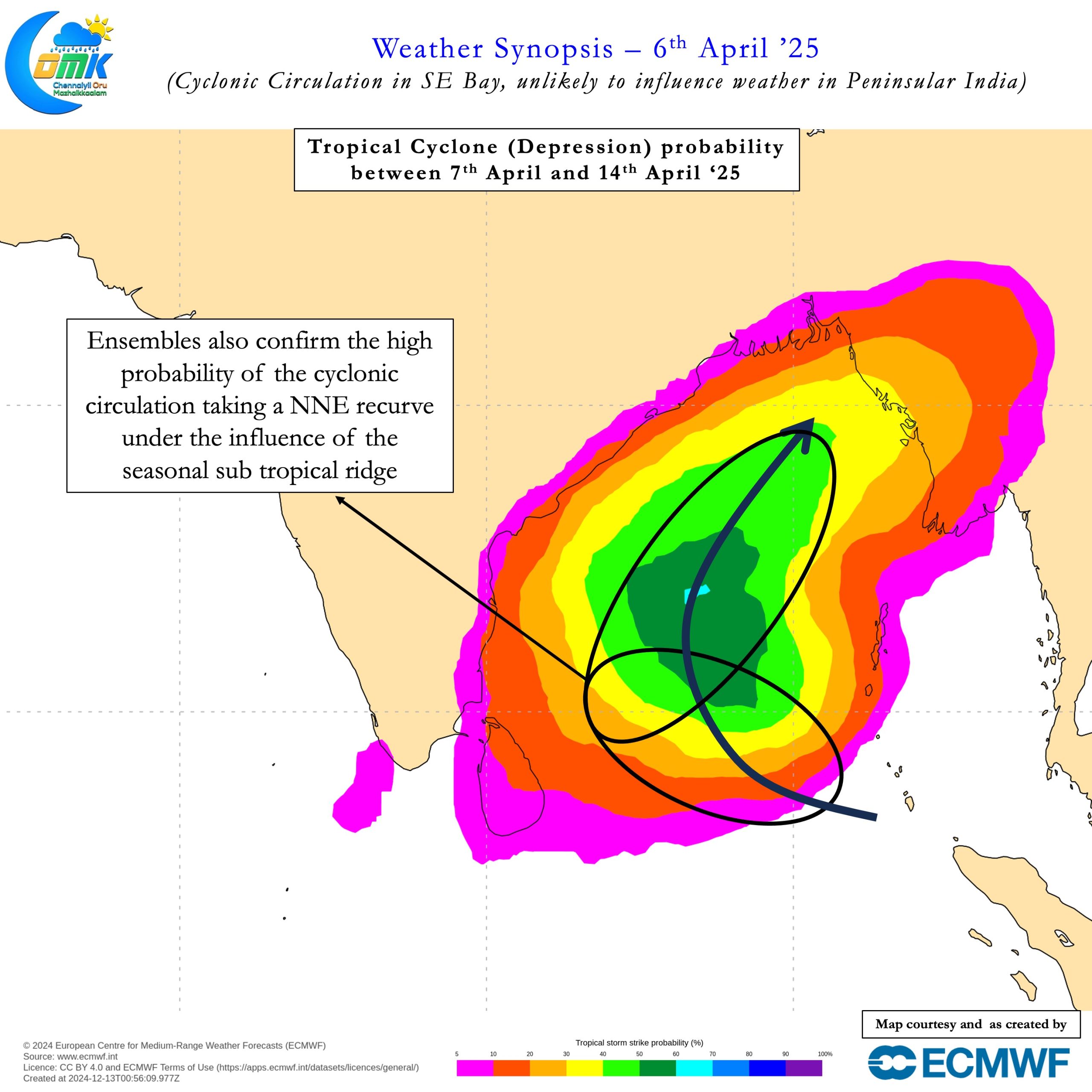
With increasing consistency among weather models about this disturbance moving North the return of increased temperatures become more likely. It is not unusual to see disturbances move up during the month of April. Historically more than 80% of the disturbances have moved towards North Bay. The seasonal sub tropical ridge plays a crucial role in this movement. There is a 50:50 chance the cyclonic circulation currently prevailing over SE bay could become an LPA. Irrespective of its eventual intensity the probability of the circulation moving North is fairly high.
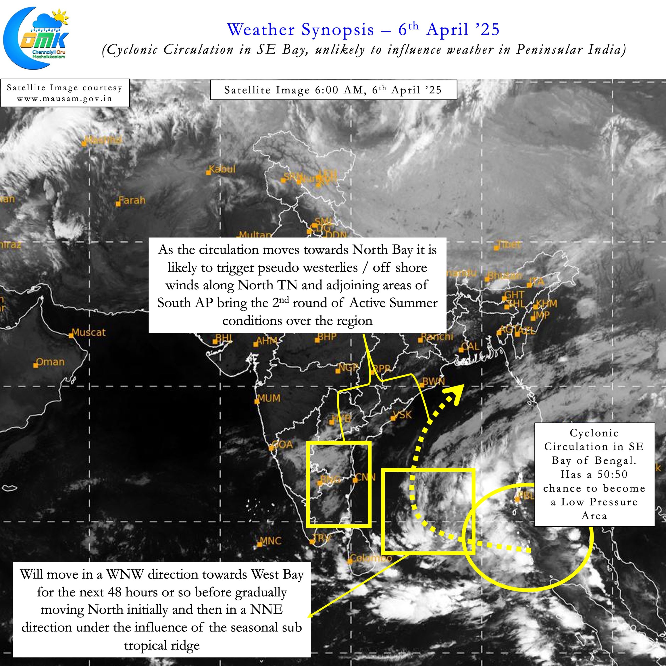


This could mean North Tamil Nadu and adjoining coast of South AP may come under pseudo westerlies / off shore winds. This would bring the 2nd round of active summer for places like Chennai and adjoining areas. With offshore winds the influence of sea breeze influence could stay limited. Temperatures are likely to gradually increase from today with a high possibility of another round of roaring 40s for places in North TN later this week. It may not be a surprise if Chennai AP also scores its first 40°C of the year as well during this period.
Amidst all this it is easy to forget seasonal models have been consistently indicating North Coastal TN may be the most anomalously hot region of Peninsular India this summer. With seasonal models indicating anomalously positive precipitation for west coast during May it could only mean stronger westerlies. Stronger westerlies could mean increased temperatures along the places like Peninsular coast. Interiors though may benefit from thunderstorms time to time as the pendulum keeps swinging back and forth.
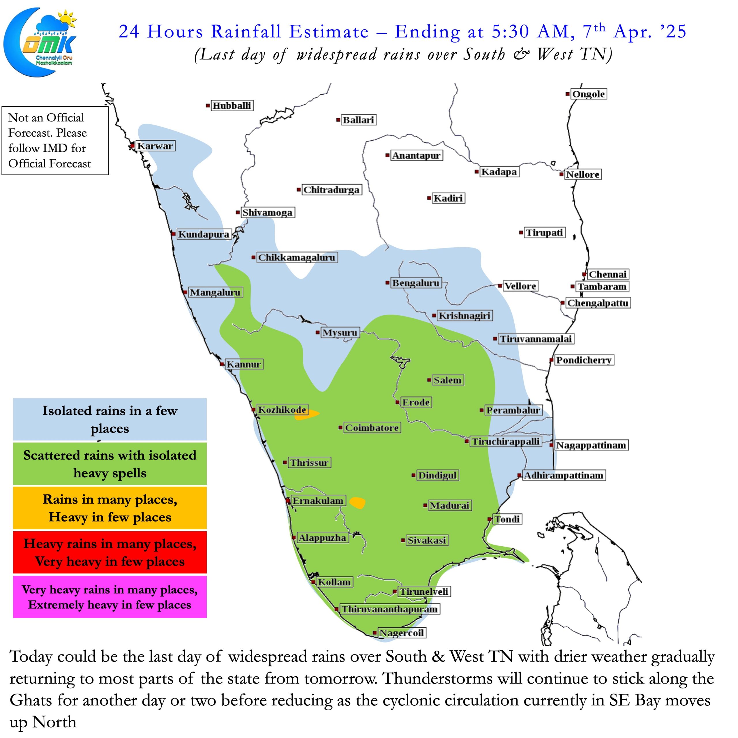
Today could be the last day of fairly widespread thunderstorms along the Ghats and interior areas of Peninsular India. From tomorrow weather could lean towards drier conditions. As the cyclonic circulation moves North deepening in the process we could expect a significant reduction in thunderstorm activity over Peninsular India. This phase will also coincide with the second round of active summer for places like Chennai and rest of North TN.