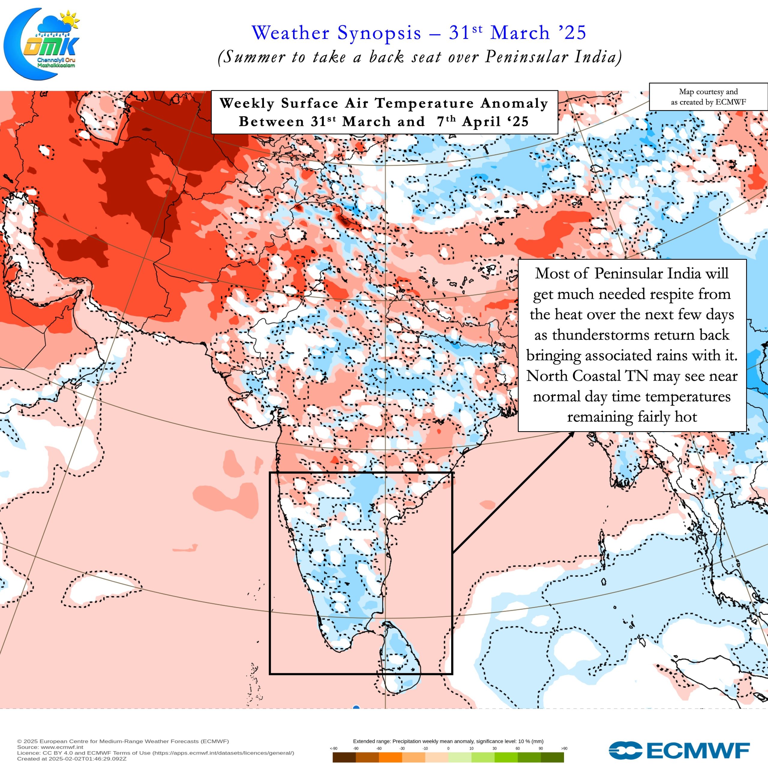
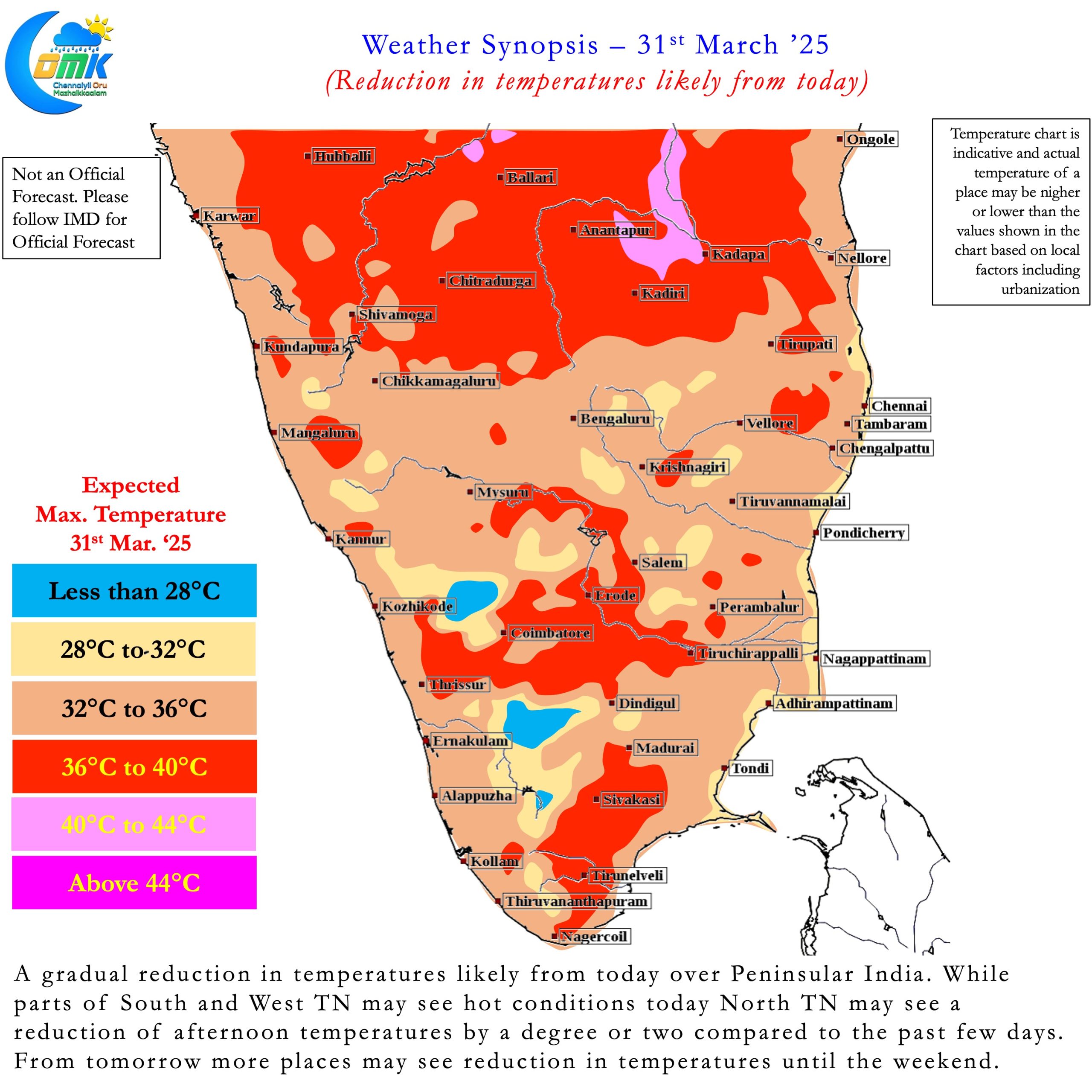
The past few weeks Peninsular India has alternated between heat and rains like a swinging Pendulum. If one may use the boxing parlance like two boxers heat and thunderstorms have been trading blows every other week. The last few days saw most parts of Peninsular India come under searing heat. During this spell Vellore became the first place in Tamil Nadu to record 40°C for the year. A couple of days later Madurai AP became the 2nd place in the state to record 40°C. Now it is the turn of wind discontinuity to bring back the rains.
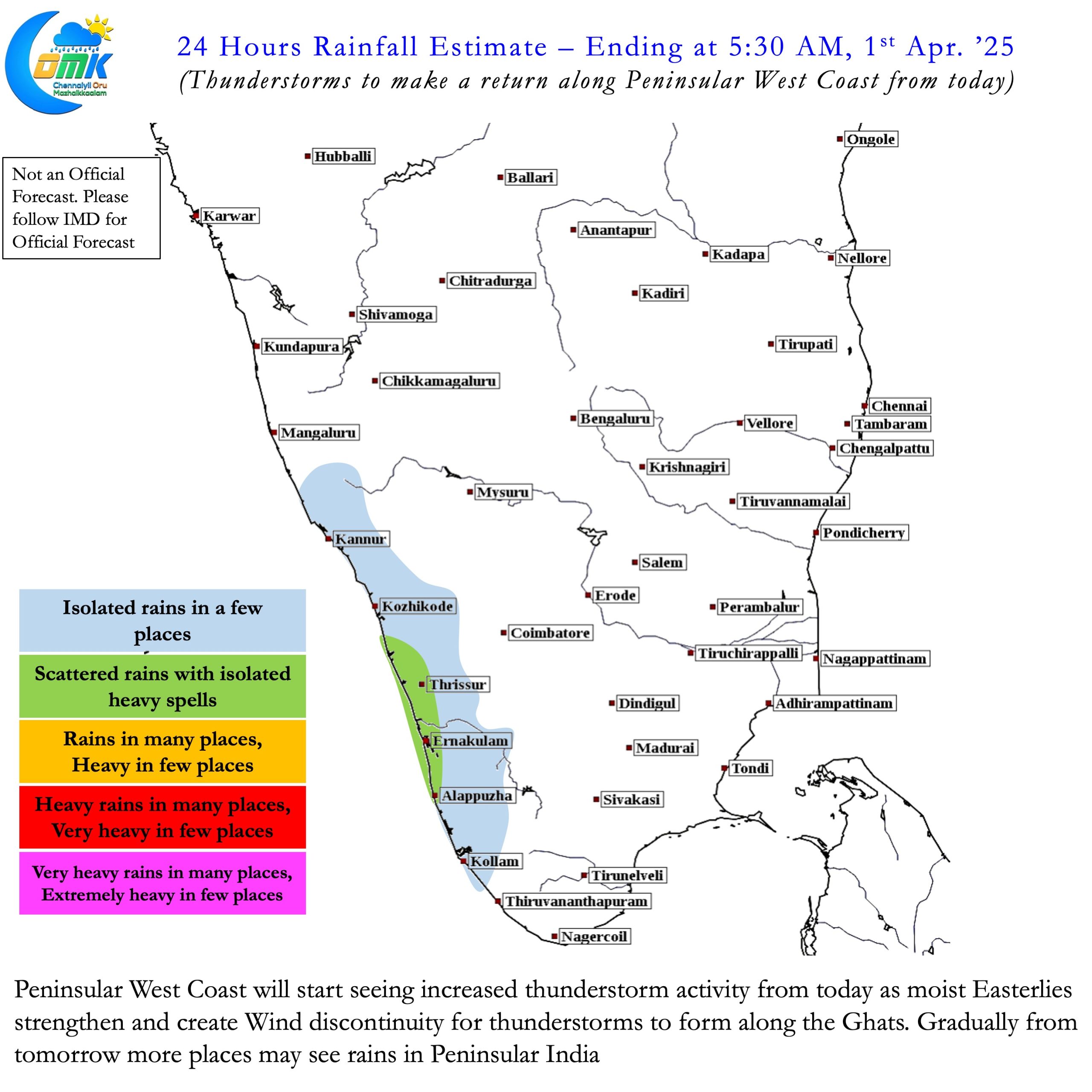
Weather models indicate two back to back rainfall events to influence Peninsular India during the first fortnight of April. While there is time for the second event to firm up there is clarity on the first event. A combination of wind discontinuity and a potential interaction with westerly trough is likely to bring back thunderstorms. Starting from today places along the Peninsular West coast may see increased thunderstorm activity. These thunderstorms created by the seasonal wind discontinuity will gradually establish itself from now on.
Later this week as rains pick up again a potential interaction by westerly trough will start enhancing the thunderstorms. We saw parts of Karnataka and Interior Tamil Nadu come under intense rains last week through similar interaction. Once again interior areas of Peninsular India will be the biggest beneficiary of this spell of rains. But there is potential for damage to crops due to hailstorms in some of the places. Some of the crops like Mango and Coffee which are flowering now is likely to get damaged if hailstorms happen.

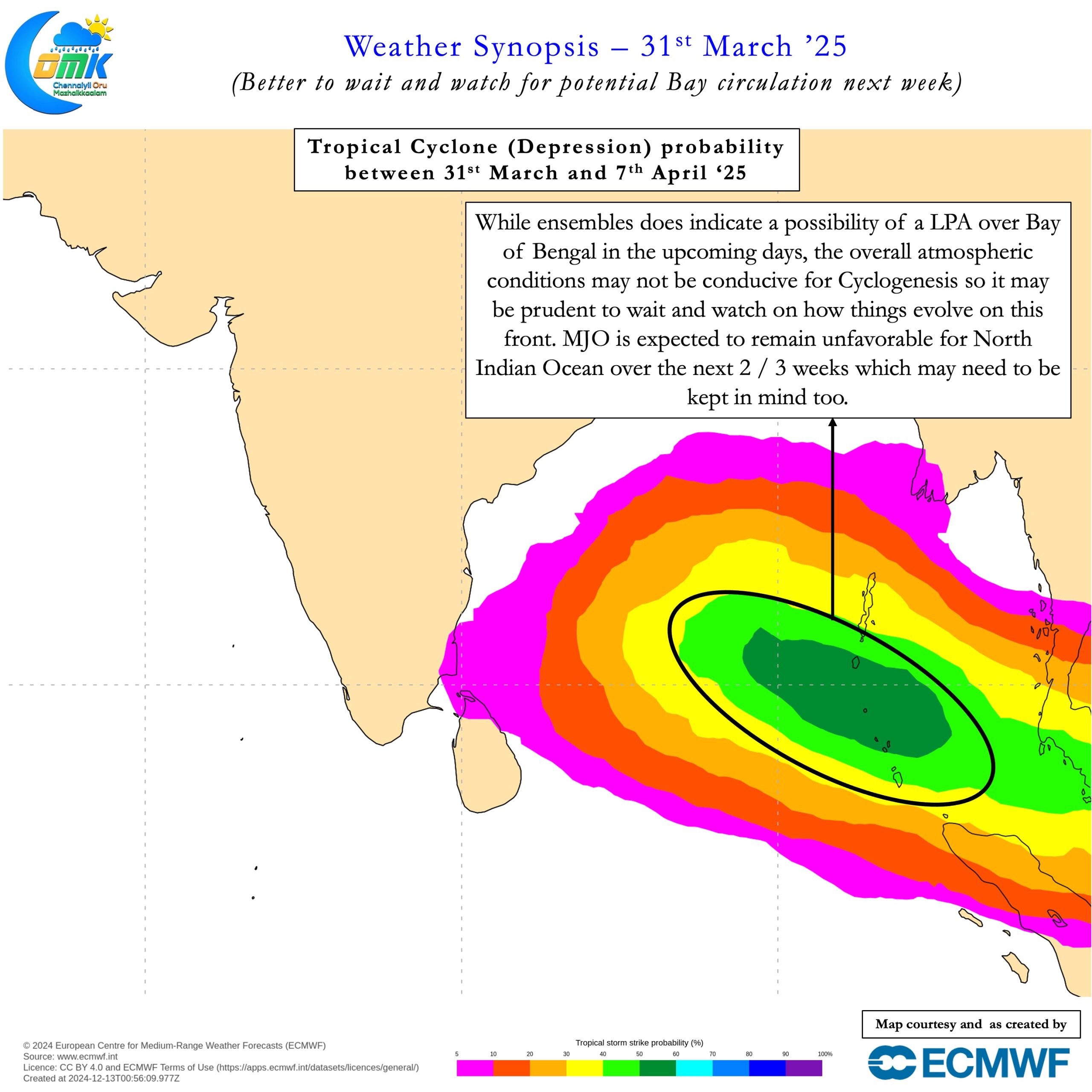
Coastal areas in North Tamil Nadu like Chennai typically do not benefit much from wind discontinuity at this time of the year. Rains for Chennai will depend on potentially a circulation coming closer to the coast. As of now there is time for the second event which some models expect to become an LPA in Bay. We will wait and watch on how things evolve from the upcoming rainfall event. With MJO not exactly in a favourable phase we may eventually end up seeing it as just a Cyclonic Circulation.
But there is a good chance of one spell of short duration searing heat between the two rainfall events. This has been the pattern over the past few weeks in Peninsular India. Towards end of this week we may see a couple of days of increased afternoon heat. Additionally looking at sub seasonal weather models North Coastal TN may continue to remain fairly hot except for one or two days when the rainfall events happen. As things stand Kerala, Interior Karnataka, parts of Rayalaseema in AP and parts of Interior TN and South TN may benefit from rains this week. There is less chance for Chennai to see any significant rains in the next few days. If the next rainfall event turns out favorable we can look forward to some rains. More on that as things get clearer.