“Justice Delayed is justice denied” is a popular legal maxim. With NEM remaining weak over Coastal Tamil Nadu it may not be surprise if people think rains similarly. For the agricultural community one can say “Rains Delayed is Rains denied” especially those who are rain fed. As we see changing rainfall pattern this type of incidents may become frequent. During La Nina years we have seen Northeast Monsoon stay longer than El Nino years. Similarly we have been seeing Southwest Monsoon contribution to Chennai increase recently.
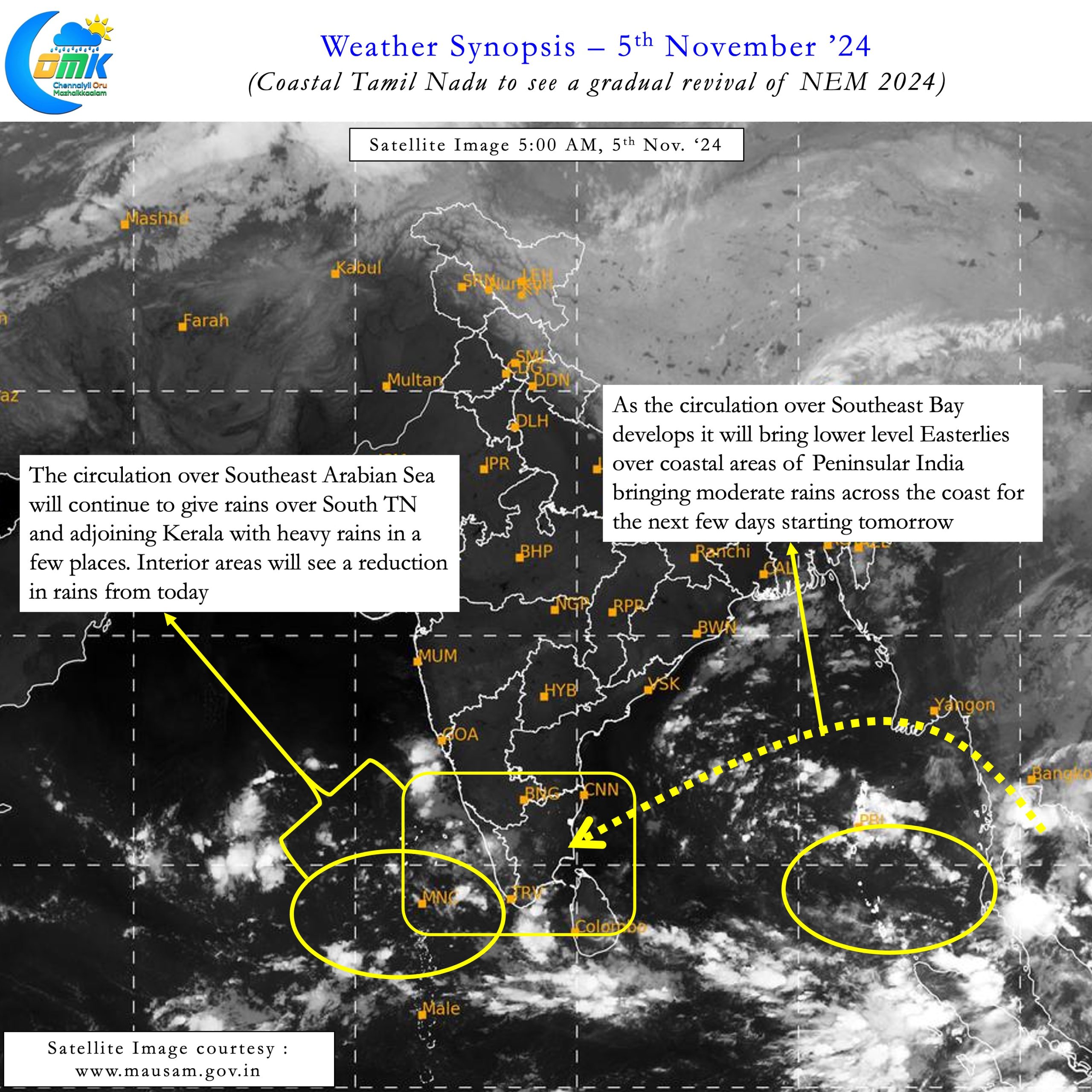
A couple of years back COMK had carried a post on how the role of Mid Latitude Westerlies is like a Trapeze act. A fine balance that could either give extreme rains to Coastal Tamil Nadu or push away the rains to the Northeast. A similar scenario is unveiling over South Bay as a fresh Low Pressure area is under development. Similar to a Chapati dough the circulation will get elongated wedged between two ridges. This could make the circulation behave like a North South Trough rather than a classical LPA.
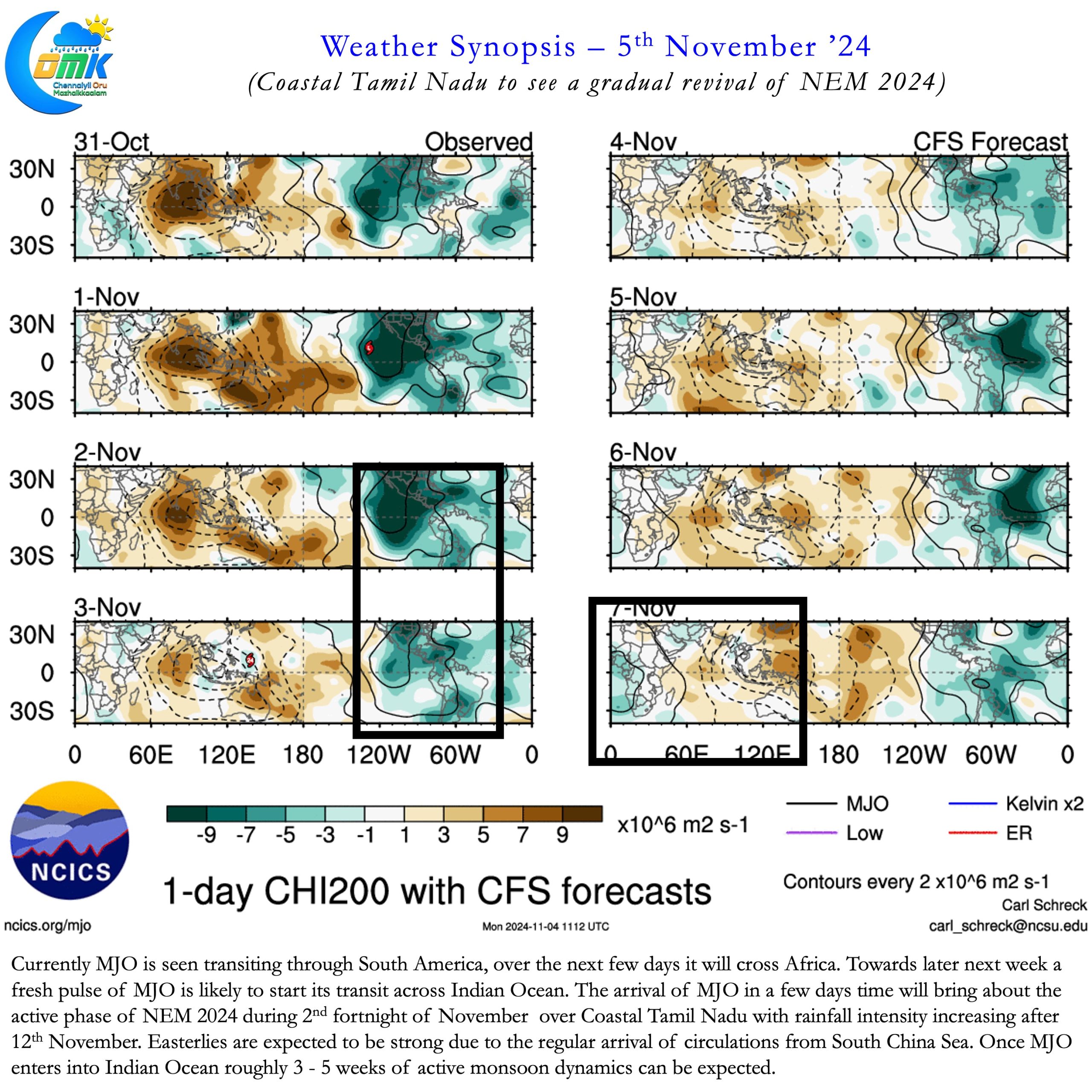
While on the face of it this may look bad for the prospects of NEM 2024 it is likely to be a temporary setback. So far Northeast Monsoon has seen regular arrival of circulations from South China Sea. While many have moved NW a few like Dana have moved northward leading to a lull in monsoon dynamics. This lull phase also coincided with the suppressed atmospheric conditions influenced by MJO transit. MJO currently seen crossing South America and is likely to cross Africa in the next 7 to 10 days. With a fresh pulse of MJO travelling through Indian Ocean it will give a period of 3 to 5 weeks of active monsoon dynamics.


Given the conditions currently prevailing it may be prudent to take one week at a time. There is fair consistency among models about the Westerly Trough interacting with the LPA. This interaction is likely to shear the convection to the NE for the next 48 hours or so. Subsequently with the trough influence fading Easterlies will bring back convection towards Coastal Tamil Nadu. This could also mean a few days delay in the widespread rainfall event. The rainfall event could be restricted to coastal TN due to the North South orientation.
To cut a long story short.
- Coastal areas including Chennai will start seeing rains in the next 24 to 48 hours.
- Interior areas may see reduction in rains due to the orientation of the upcoming Low Pressure.
- Widespread rainfall activity likely earlier next week instead of later this week.
- MJO is expected to arrive into Indian Ocean 6 to 10 days from now bringing with it favourable atmospheric conditions for NEM 2024.
- Northeast Monsoon is expected to remain active during the 2nd fortnight of November once MJO influence becomes favourable for us.
- 2 or 3 disturbances likely during the reminder of November that will ensure Easterlies remain strong and favourable.
- 3 to 5 weeks of active monsoon conditions after the arrival of MJO will ensure 2024 ends the year on a high as far as rains go.
- The probability of extremely heavy rains look less for the next 7 to 10 days but it may be prudent to keep a watch during the 2nd fortnight of November.
Weather blogging tests your patience and most Northeast Monsoon seasons stay true to this. 2024 is unlikely to be an exception.

