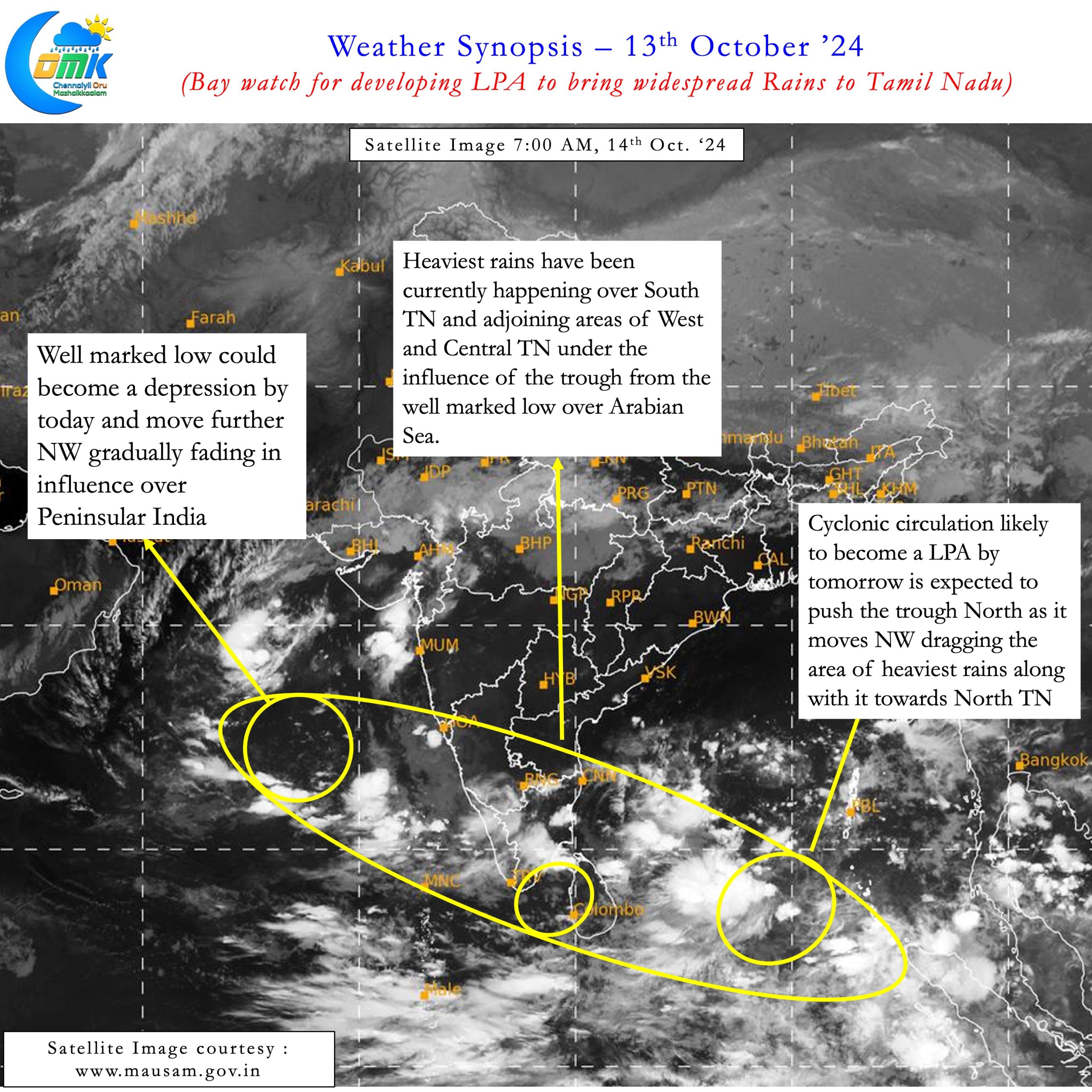
For most people across the globe Bay watch will remind them of the most popular American Television series. But for the weather bloggers of Tamil Nadu Bay watch can only mean one thing. A possible disturbance in Bay of Bengal that is worth keeping a tab on. Northeast Monsoon season has already started off on a good wicket. The as on date seasonal performance stands at 48% excess. The presence of MJO over North Indian Ocean has now thrown up a train of circulations. The first one is now a Well Marked Low over Arabian Sea. This is expected to become a Depression today. The 2nd one is seen as a cyclonic circulation over Comorin Sea. This is acting as a conduit between the 1st and 3rd circulation over South Bay.
The third circulation over South Bay is the one that has triggered Bay watch. This is expected to become a Low Pressure Area and possibly strengthen into a well marked low. Weather models are in tight agreement about this circulation moving towards North TN Coast. There is also an increasing agreement among models about this LPA crossing North TN coast closer to Chennai on 16th / 17th October. As always no Northeast Monsoon season passes without testing global models for their performance.
This year the test is expected to start early in the season. The presence of multiple circulations will possibly impact the consolidation of the south bay circulation. Effectively this would mean models may see both temporal and spatial error in the rainfall pattern based on realtime conditions. Keeping this in mind the coastal stretch between Chidambaram and Kavali should keep a vigil for a heavy rainfall event starting from tomorrow. While models indicate two clear zone of convergence (Heavy rainfall impact zone) this is likely to change in real time as explained earlier the paragraph.


With the likelihood of the LPA crossing North TN coast close to Chennai there is increasing agreement on Chennai and suburbs seeing a heavy rainfall event. This heavy rainfall event is likely to stretch for 36 hours starting from tomorrow which could extend to 48 hours depending on the movement of the LPA. Considering the complex dynamics involved we are refraining from giving an expected quantum of rains. But there is a fair degree of confidence by the end of this rainfall event both the IMD observatories in Chennai may have come close to reaching their October average.
It also becomes important to point out over the past couple of days the actual rainfall numbers from the heavy rainfall zones have exceeded most model estimates by a huge margin. There is a very high possibility Coastal TN may also see a similar scenario with actual rainfall exceeding model forecasts. In this context it may be prudent to take one day at a time without dropping the guard because there is a delay in the rains.

