It is not often one sees the IMD observatories at Chennai, Mumbai and Kolkata all record heavy rains on the same day. Yesterday the IMD observatory at Santacruz recorded 17 cms from persistent rains since afternoon. Similarly the IMD observatory at Dumdum, Kolkata recorded 8 cms from rains right through the day. Both IMD observatories at Chennai recorded 7 cms making it a day of rains in 3 out of the original Big 4 metros of India. In a way yesterday is the precursor to the Monsoon transition dynamics that is all set to pick up pace.
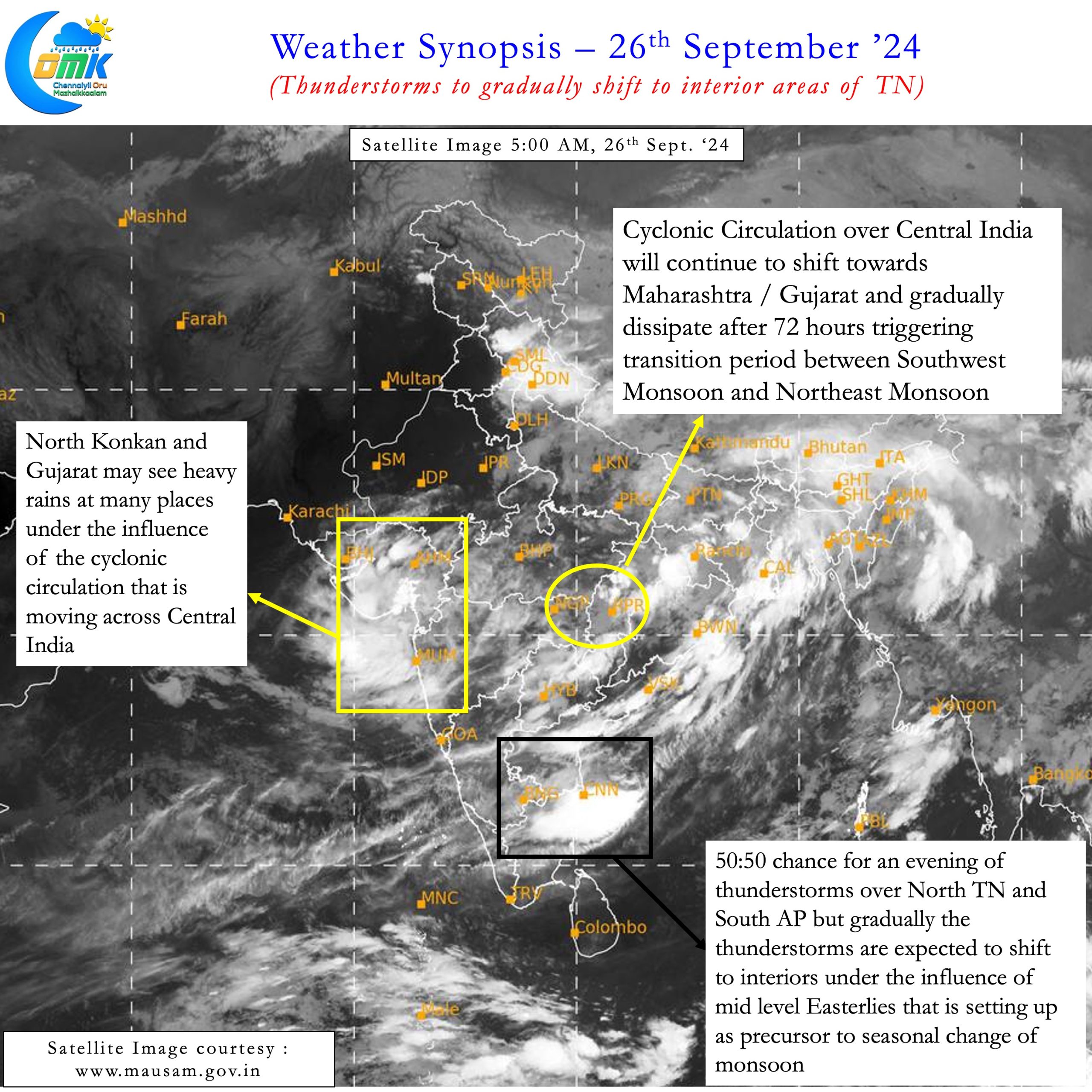
The withdrawal line for Southwest Monsoon over the past couple of days has been over Rajasthan. With the cyclonic circulation persisting over Central India monsoon withdrawal may remain slow for the next couple of days. Once this circulation completes its life cycle then we can expect Monsoon Transition to start picking up pace. With Indian Sub continent expected to be under unfavourable atmospheric dynamics the withdrawal over North India may be fairly quick. But that process will start after the cyclonic circulation dissipates early next week.
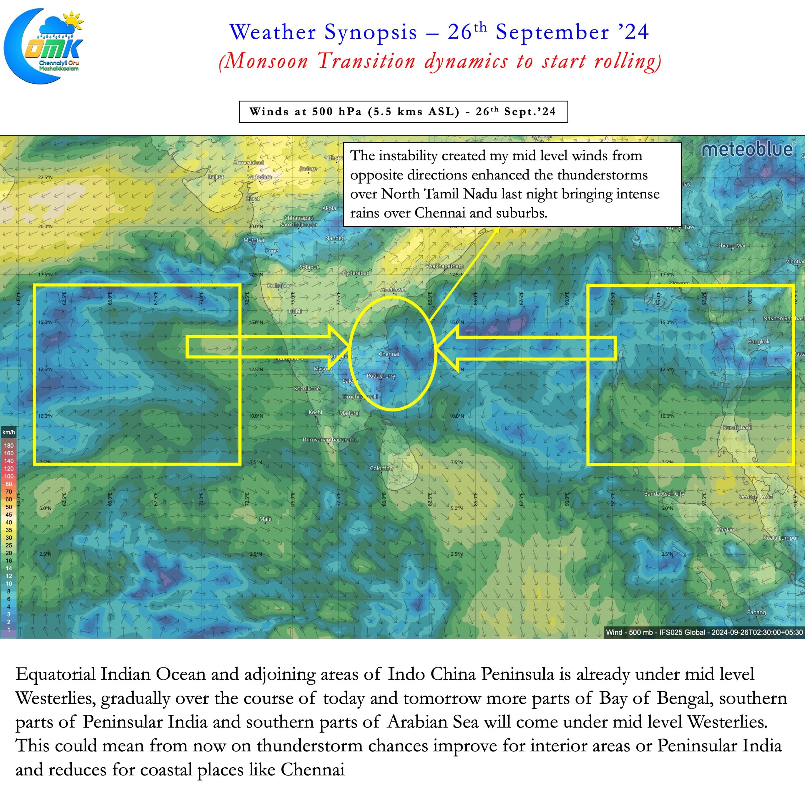
It may not be time yet to look at Northeast Monsoon considering the rainfall forecasts over East and Northeast India. But there is certain degree of assurance the Monsoon transition dynamics is under way and likely to roll from now on. Last night’s intense thunderstorms over Chennai and suburbs in a way is also indicator of the changing dynamics. North TN saw a zone of wind instability created by this converging mid tropospheric winds. This enhanced the thunderstorms that came in from the west. The mid tropospheric winds are changing to Easterlies gradually as a precursor to the seasonal change towards the Easterly regime. The area around Equatorial Ocean and adjoining areas of Bay has seen the mid levels wind shift to East. Indo China Peninsula is also under Mid Level Easterlies at lower latitudes.


Over the next 24 to 48 hours gradually most of South Bay, southern parts of Peninsular India and South Arabian Sea will also see mid level Easterlies. Weather models indicate this shift to Easterlies is in anticipation of seasonal shift in winds rather than a temporary event. The lower level westerlies though will continue to persist until Southwest Monsoon withdrawal completes. As of now that phase may be a week to 10 days away. Once there is fair amount of consistency among weather models about the lower level westerlies weakening we can start looking at the possible onset window for Northeast Monsoon.
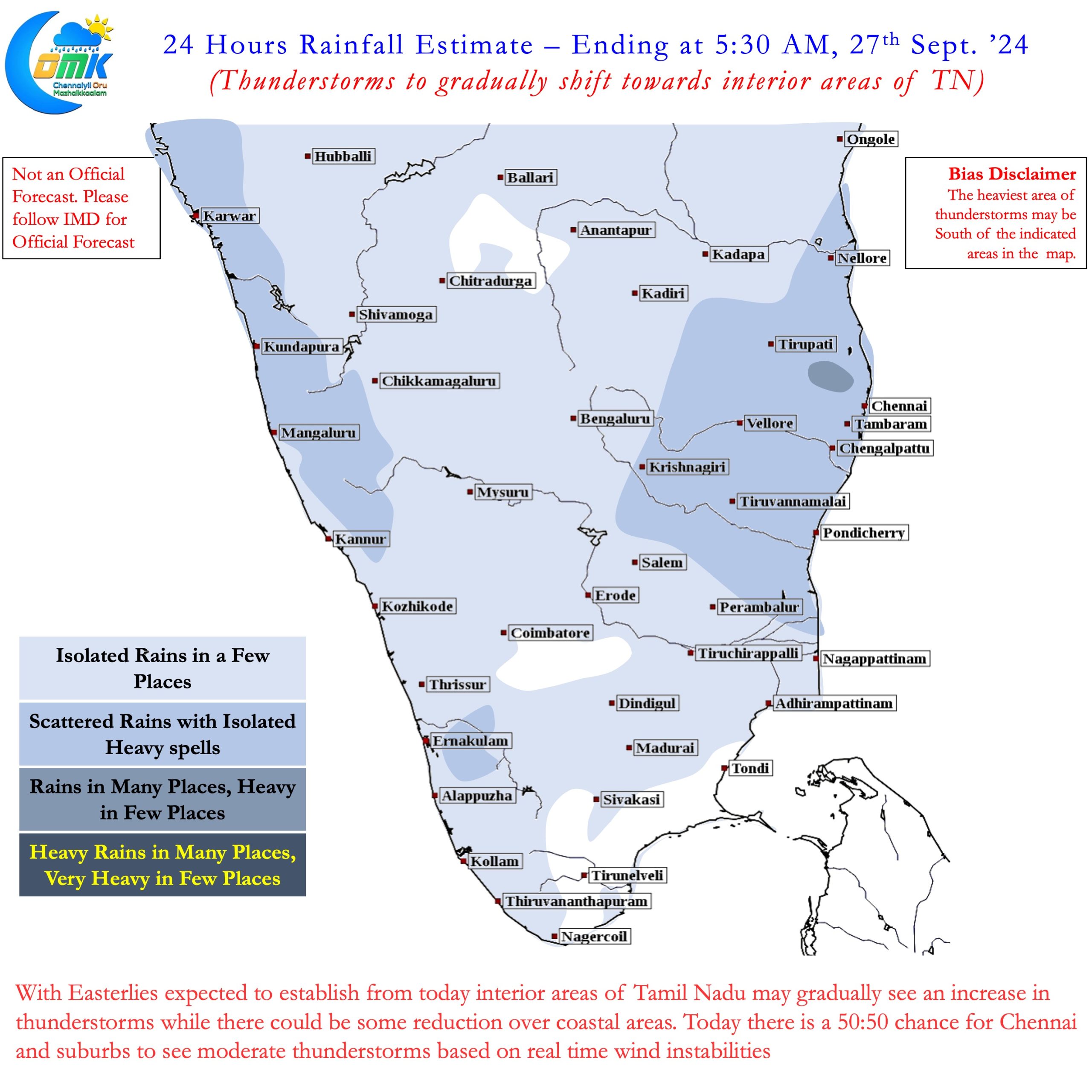
This change in winds also mean interior areas of Peninsular India can now look forward to some much needed rains. Weather models indicate some bit of rains over North TN today but there is a chance it may not materialise. Gradually from now on coastal areas like Chennai may see lesser rainfall activity compared to the interior areas. Over the course of next week to 10 days thunderstorms will struggle to push towards the coast due to persistent mid level Easterlies.
After a 2nd straight SWM season which has brought in 800 mm to parts of Chennai a break from rains may be a blessing in disguise before the start of Northeast Monsoon season. Every city needs a bit of breathing space to recover and be ready for the peak rainfall season.

