As we get to the 2nd fortnight of September SWM Withdrawal becomes the most anticipated event for the Chennai Weather blogging community. The start of monsoon withdrawal is the first step towards things falling in place for Northeast Monsoon. Just like Monsoon onset IMD has a fairly robust criteria for withdrawal too. A couple of years back IMD realigned the monsoon withdrawal along with onset dates in sync with changing dynamics. The withdrawal date over Northwest India was shifted from 1st September to 17th September. Even with the revised dates withdrawal has seen a few days delay over the past couple of years. 2024 will also join in the list of years when withdrawal will start behind schedule.
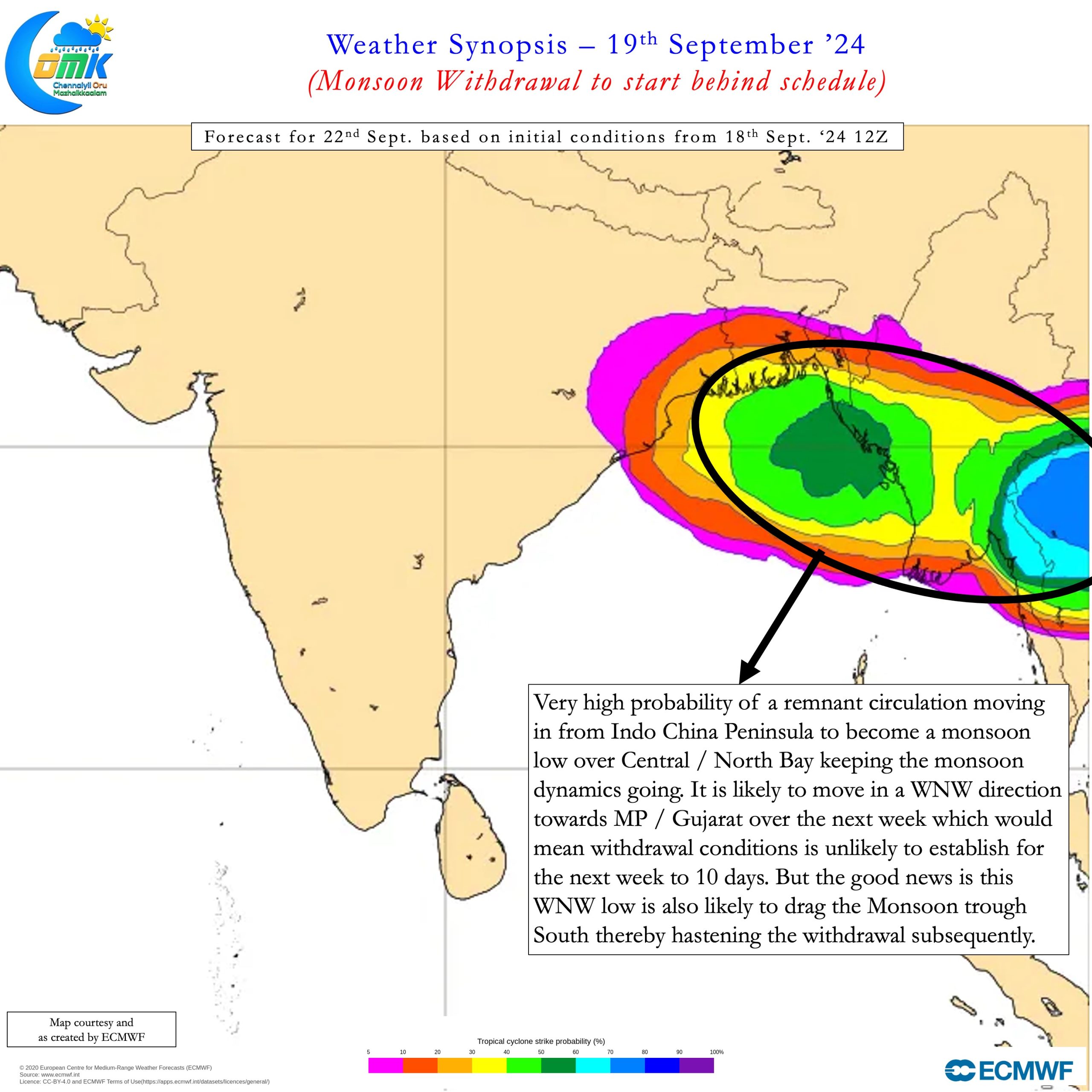
Over the past couple of months we have seen disturbances move into Bay of Bengal from South China Sea regularly. Some of these disturbances strengthened into Depressions and in one instance became Cyclonic Storm Asna as well. The remnant pulse of Typhoon Yagi is still persisting over MP / Rajasthan / UP as a Low Pressure area. Sub seasonal model forecasts indicate there could be one more Monsoon Low developing over Central / North Bay. The tropical depression currently off the Vietnam coast is likely to move across Indo China Peninsula to reach Bay soon. There is a high chance this may become a monsoon low and move across Central India.
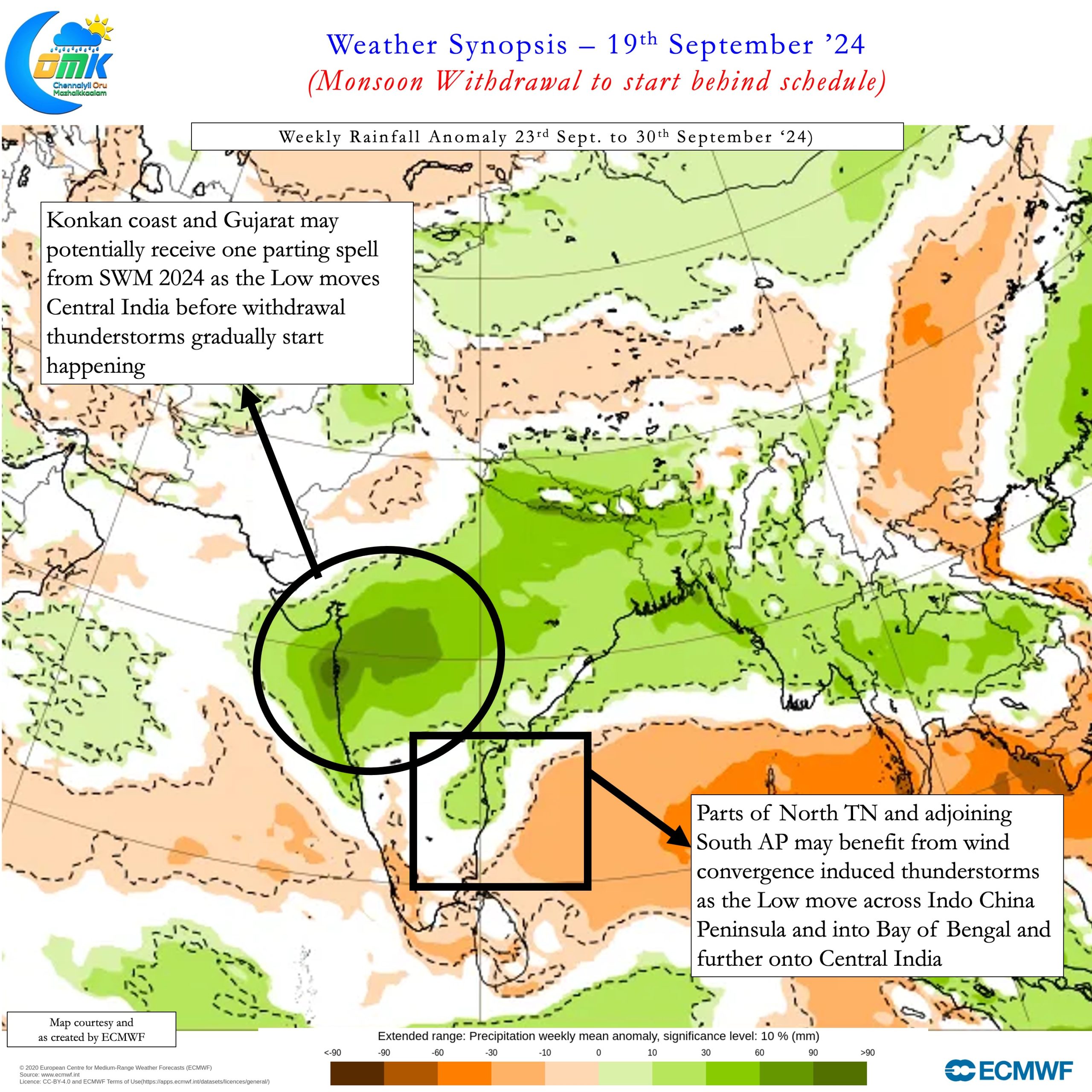
Sub seasonal weather forecasts indicate spell of rains may happen over NW India during the last week of September. This could potentially mean conditions for withdrawal may start falling in place only towards end of September. It becomes essential to point out while the upcoming low may also be a blessing in disguise too. With possible genesis over Central Bay and a WNW movement it is likely to bring down the monsoon trough as it passes through Central India. This is likely to hasten the withdrawal of Southwest Monsoon subsequently over the Indian Subcontinent. With unfavourable tropical wave conditions likely over early October we could potentially not only see a rapid withdrawal but thunderstorms as well.


Over the next day or two we can see the return of Convective thunderstorms over Peninsular India from the above circulation moving into Bay. Initially thunderstorms may pick up over AP and parts of North Tamil Nadu. As we get to next week more areas may come under thunderstorms when the low completes its life cycle. This phase may also coincide with weaker westerlies as monsoon dynamics gets ready for withdrawal. The last couple of days have see a narrow band of wind convergence trigger storms over parts of TN. On Tuesday night it was over parts of Villupuram district while Wednesday night it was parts of Chennai and suburbs. Gradually we may see more places come under favourable wind convergence triggering late evening / night thunderstorms.
While it may not yet be time to say complete good bye to heat yet we can certainly look forward to some reduction in the next few days. There is a fair chance today there could be isolated rains around Chennai and adjoining North TN. From tomorrow not only the probability increases but also more places could see thunderstorms.

