The Monsoon Jet or more commonly called Somali Jet is an integral component of the Indian Summer Monsoon (ISMR). Monsoon has been in existence from time immemorial. The term Monsoon which originated in French can trace its roots to the Arabic word “Mausim”. As early as 334 BC Aristotle had mentioned about reversal of monsoon winds in his work “The Meteorologicals”. India was a key player in the olden days Maritime trade on account of its location. With monsoon winds reversing seasonally it allowed trade to happen back and forth between Maritime Continent and Middle East. Not to forget Monsoon was one of the key factors in the expansion of Chola Empire into Southeast Asia.
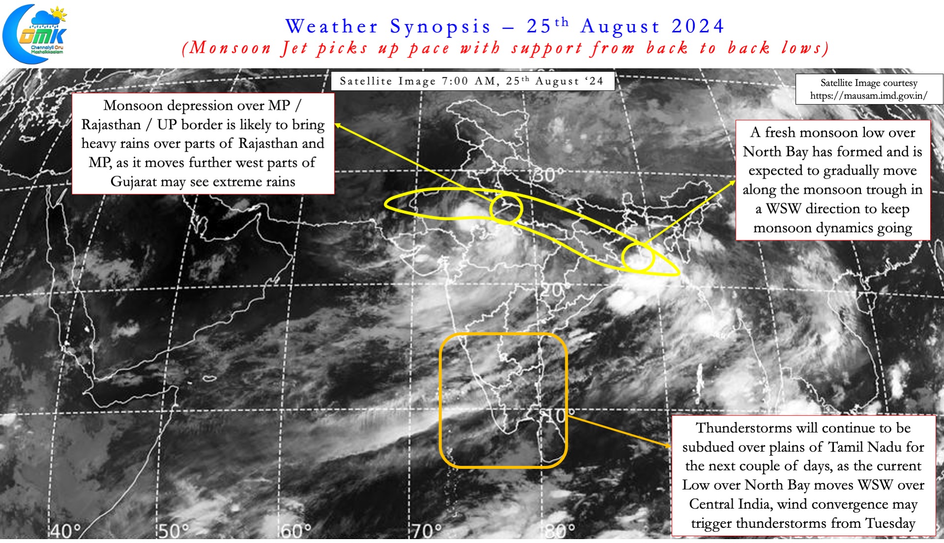
During the 1st fortnight of August while Monsoon did not have a classic break in monsoon event it did slow down though. With a fresh pulse of MJO passing through Indian Ocean now there are signs of Monsoon picking up pace. With two low pressure systems over the Indian Sub Continent it’s only a matter of time for Monsoon Jet to strengthen. The first Monsoon Low seen over UP / MP / Rajasthan has strengthened into a depression. This will move westward bringing widespread heavy rains over parts of NW India and Gujarat. Few places in Gujarat may see very heavy to extremely heavy rains as well today and tomorrow.


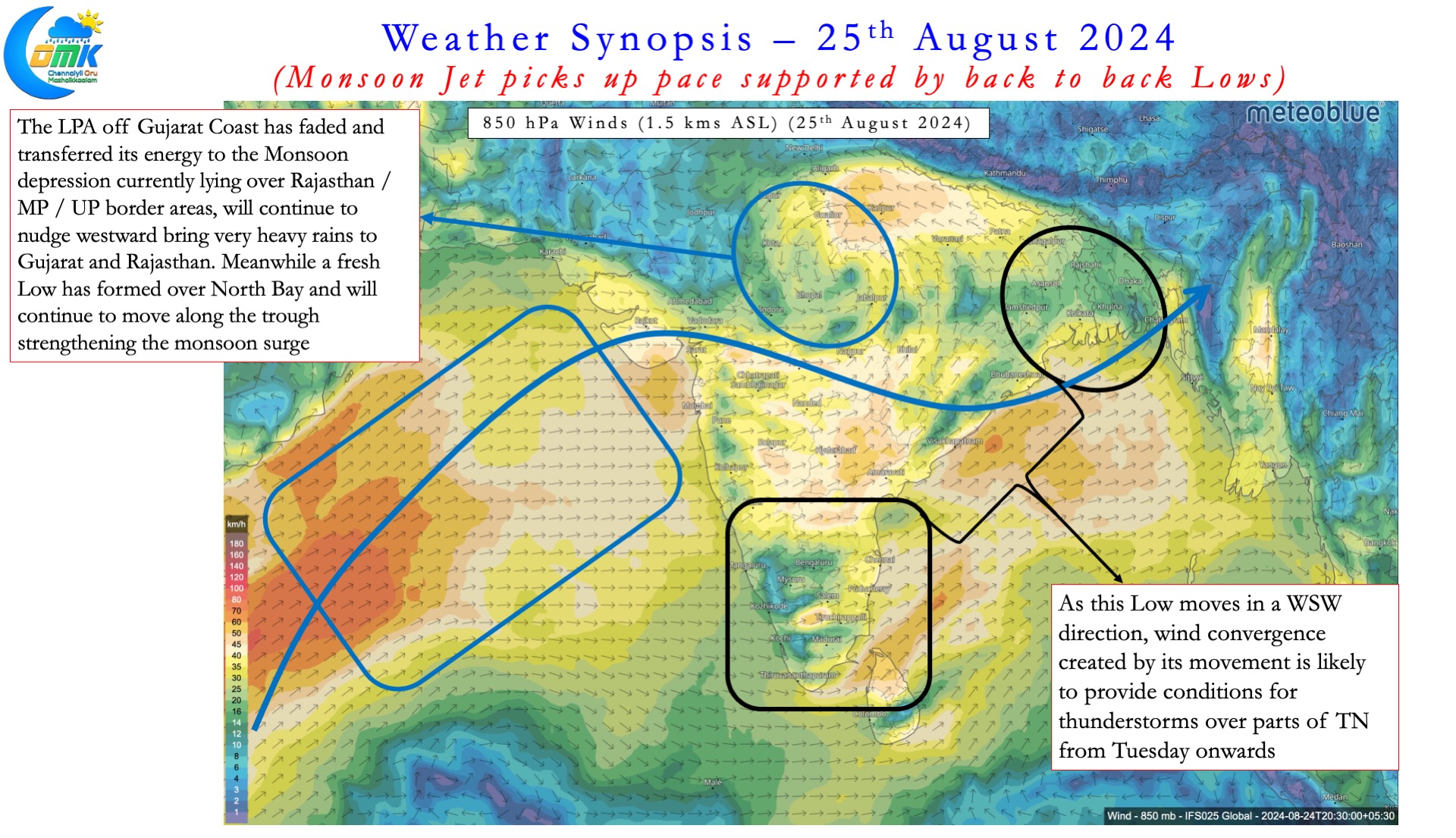
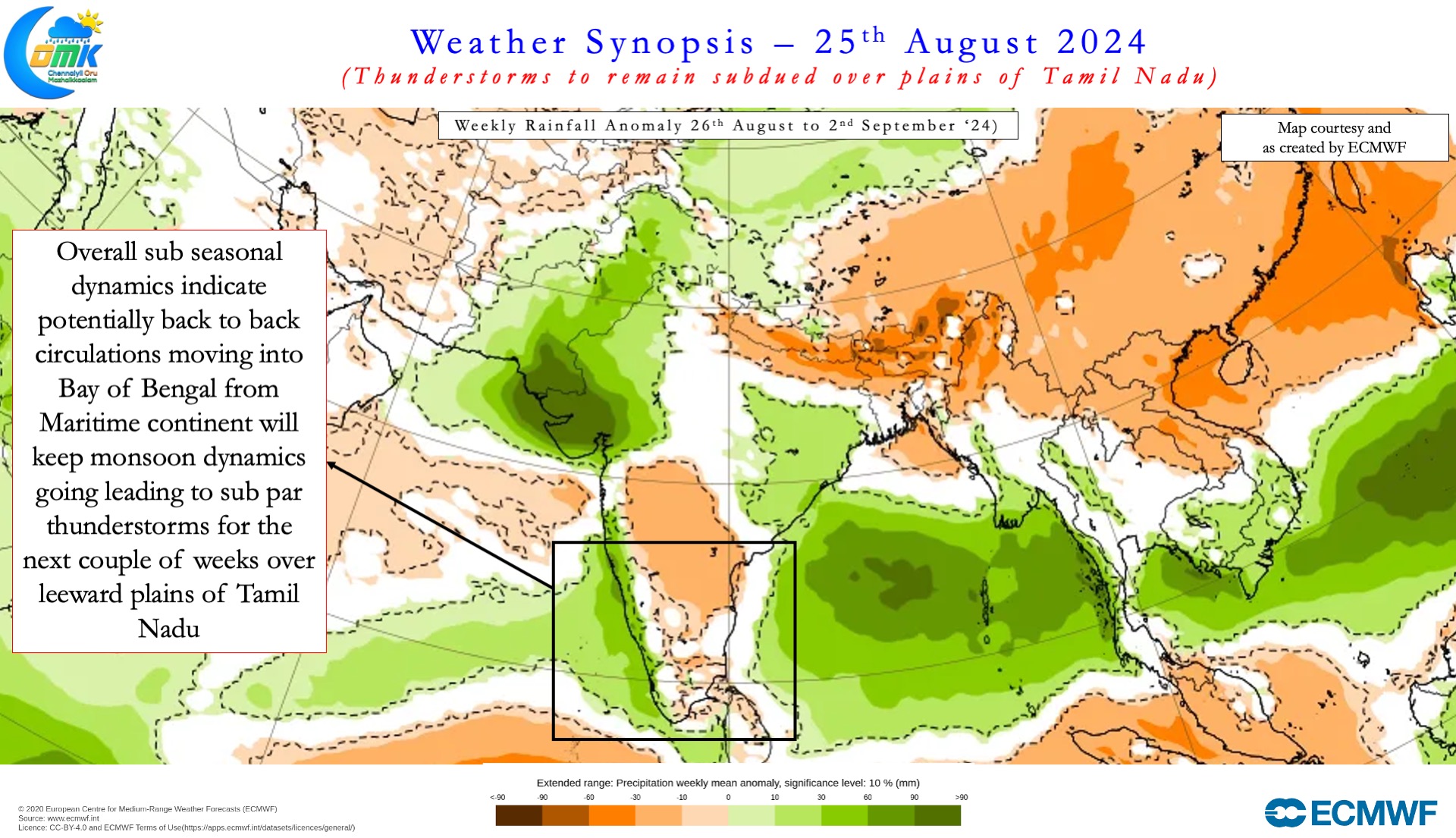
The 2nd low seen over North Bay is likely to gradually move WSW pulling back the trough along with it. This is likely to strengthen the monsoon winds over Arabian Sea. For the next 2 / 3 weeks sub seasonal models indicate strong monsoon winds to continue. As things stand there is a very high chance for Monsoon to remain active for the next couple of weeks though Peninsular India may not see a repeat of July 2nd fortnight. MISO is expected to favor Central India and MJO is likely to move further towards West Pacific by 2nd week of September. This could mean the next couple will be effectively bring about a partial recovery for Monsoon over Peninsular India.
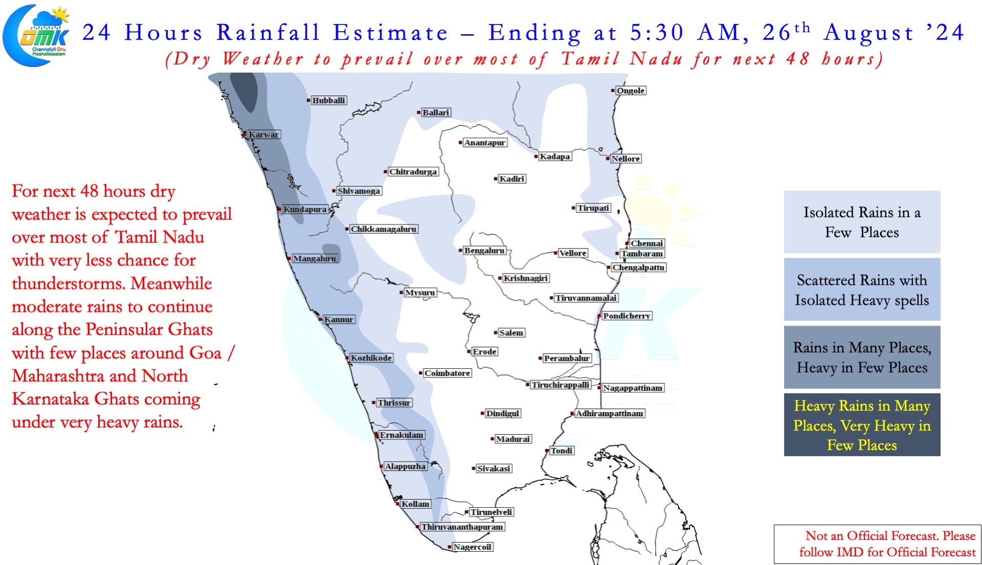
This could also mean thunderstorms over leeward areas of Tamil Nadu will remain subdued. One possible window for thunderstorms is when the Monsoon Low over North Bay moves WSW creating favourable wind convergence. This window will possibly be available from Tuesday till Friday over the leeward plains of Tamil Nadu. It remains to be seen how much could places like Chennai which has been seeing dry weather for the past week to 10 days benefit from this wind convergence.
It is highly likely the best phase of thunderstorms for Chennai and rest of North TN is already over. Sub seasonal models indicate a weaker than normal conditions for thunderstorms during the remaining period of Southwest Monsoon season. But there is hope in transition season thunderstorms during October for interior areas of Tamil Nadu.

