The Indian Summer Monsoon is often characterised by alternating phases of active monsoon and break in monsoon phases. In a paper co-authored by Dr M Rajeevan and Prof Sulochana Gadgil a clear protocol was established about these events. “Active and break events are defined as periods during the peak monsoon months of July and August, in which the normalized anomaly of the rainfall over a critical area, called the monsoon core zone exceeds 1 or is less than −1.0 respectively, provided the criterion is satisfied for at least three consecutive days.” Not so surprisingly in a year when MJO has been struggling against the base state transition Monsoon 2024 has not neither an active or a break phase so far this year.
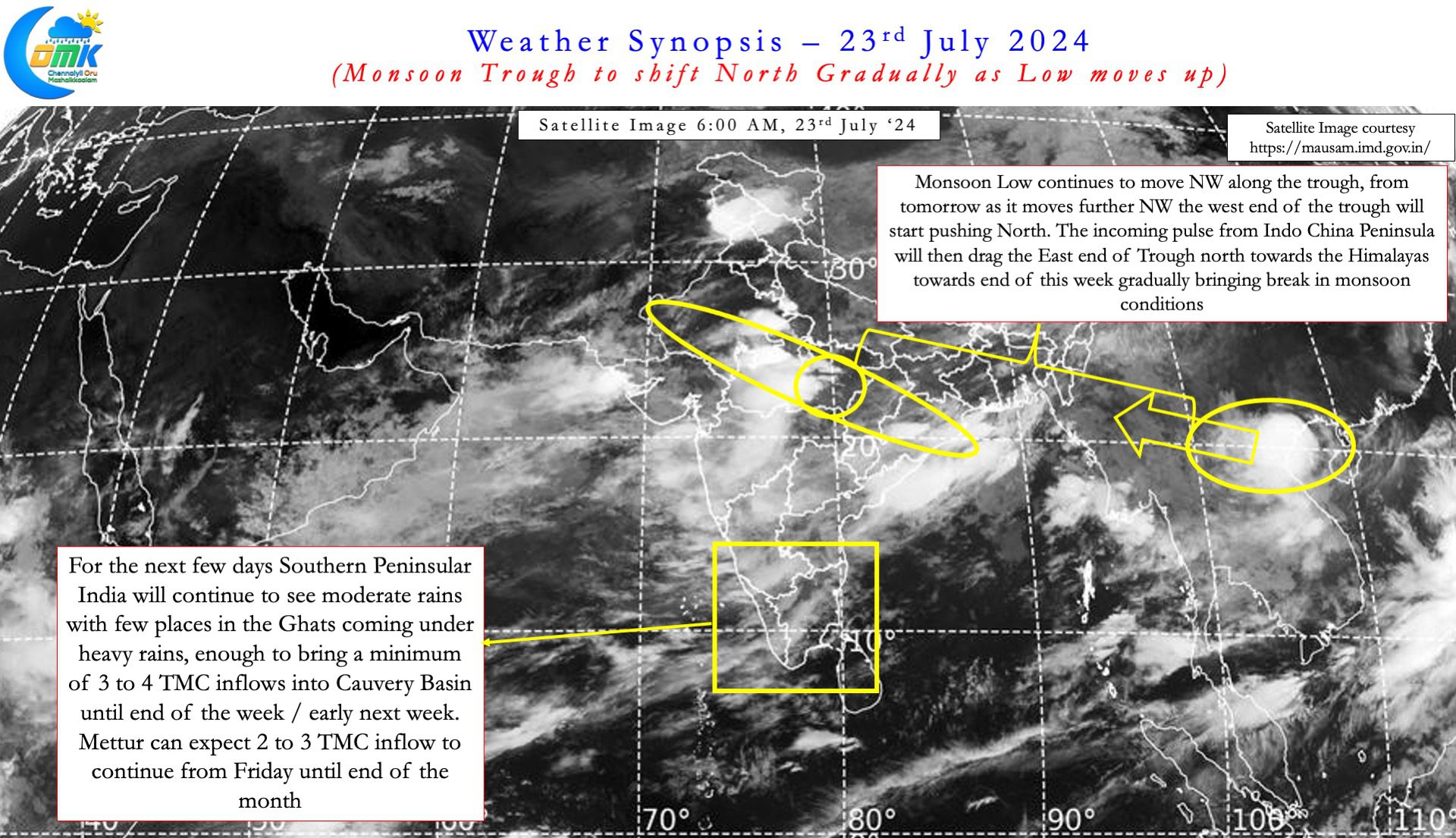
The last week or so saw fairly active monsoon conditions over Peninsular India that brought much needed inflow into the Cauvery Basin. Between 15th and 22nd July the Cauvery Basin cumulatively saw a net inflow of nearly 64 TMC bringing near FRL to the dams in Karnataka. Mettur also has seen storage climb up from about 14 TMC to 40 TMC between 15th and 23rd July. With the next few days likely to bring close to 20 TMC the situation is much much better compared to two weeks back. There is increasing confidence by Friday Mettur could possibly be near 100 ft levels in sync with the estimates put as part of our earlier post.
Looking at the short range weather forecasts Monsoon may not be vigorous over Peninsular India during the rest of the month. But there is likely to be enough rains to bring in about 3 TMC daily inflow into Mettur between Friday and month end. Keeping this in mind it seems the best window to open Mettur dam for delta irrigation is not very far away. Karnataka dams are near FRL and even if monsoon slows down over Peninsular India as indicated by sub seasonal outlooks there will be enough inflow to bring in about 1 TMC into Mettur on a daily basis.
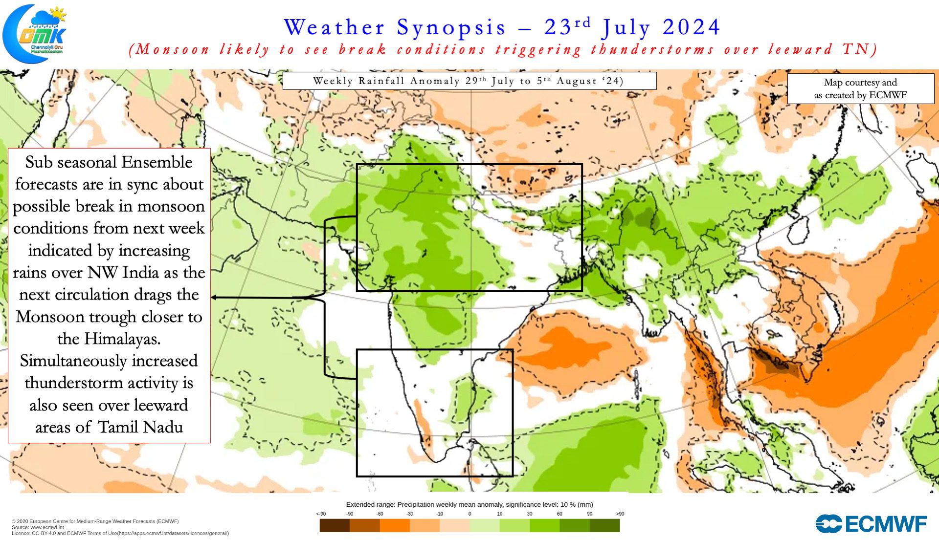
Sub seasonal ensembles indicate subsequently Southwest Monsoon could possibly head for a break as the monsoon trough shifts North. Two factors seem to confirm this development. The first one is the possible weak transit of MJO influenced MISO that is expected to move towards North India / Himalayas by end July. The second factor is the arrival of a pulse, currently over Indo China Peninsula, into East India. As mentioned above MJO this year has been struggling against the transition of base state from El Nino to La Nina. Contrary to initial model forecasts of La Nina arriving by middle of the year (Jul-Sep.) we are still in a neutral state shifting towards La Nina slower than model estimates.


This slower than estimated transition is playing havoc on how MJO moves around the Globe. Since June MJO has been unsuccessful in this battle against the base state and there is increasing probability we could see this continue to for the next couple of months. It may be prudent to keep a watch on whether similar scenario unfolds during Northeast Monsoon period also which could mean a train of low intensity pulses from MTC that may keep Bay very active. The seasonal performance of Southwest Monsoon over places like Chennai already is near normal with more than 2 months still to go. It appears 2024 may add to the list of recent years that saw NEM start with a very high soil moisture on the back of good SWM season.
In the meanwhile the Pendulum may shift from West Coast to East Coast towards the end of the month as gradually the Monsoon trough shifts North. As explained above a combination of factors is expected to push the Monsoon trough closer to the foot hills early next week. That could mean leeward areas of Tamil Nadu may see the return of thunderstorms during evening / night hours. Weather models continue to struggle in their forecasts of MJO evolution so it may be wise not to look beyond two weeks even in sub seasonal scale.
There is fair confidence among models first week of August may see rains reduce along Peninsular West coast and increase along the East coast. But before that places like Chennai may have to bear with an increase in day time temperatures as moisture comes down gradually along the west coast. Like the Surf Excel ad that used to say கறை நல்லது a few years back Heat is also good.

