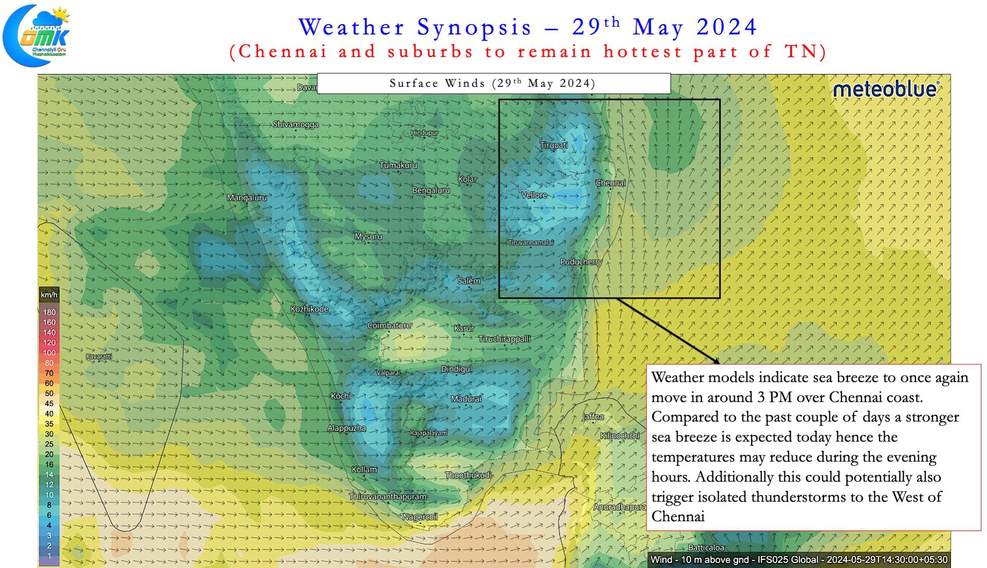
On Tuesday both the IMD observatories at Chennai recorded their hottest day of this year’s summer. While the airport observatory recorded 41.3°C the city observatory recorded 41.1°C. On Monday the Nungambakkam observatory recorded its first 40°C of the summer by reaching 40.6°C. Chennai AP observatory saw temperature of 39.8°C at 5:30 PM indicating how weak the influence of sea breeze was. Chennai weather blogging community through its PWS network provides gives large scale observation not available in many cities of India. This showed how on Tuesday even a station right off the coast at Palavakkam saw sea breeze only at 3:30 PM.
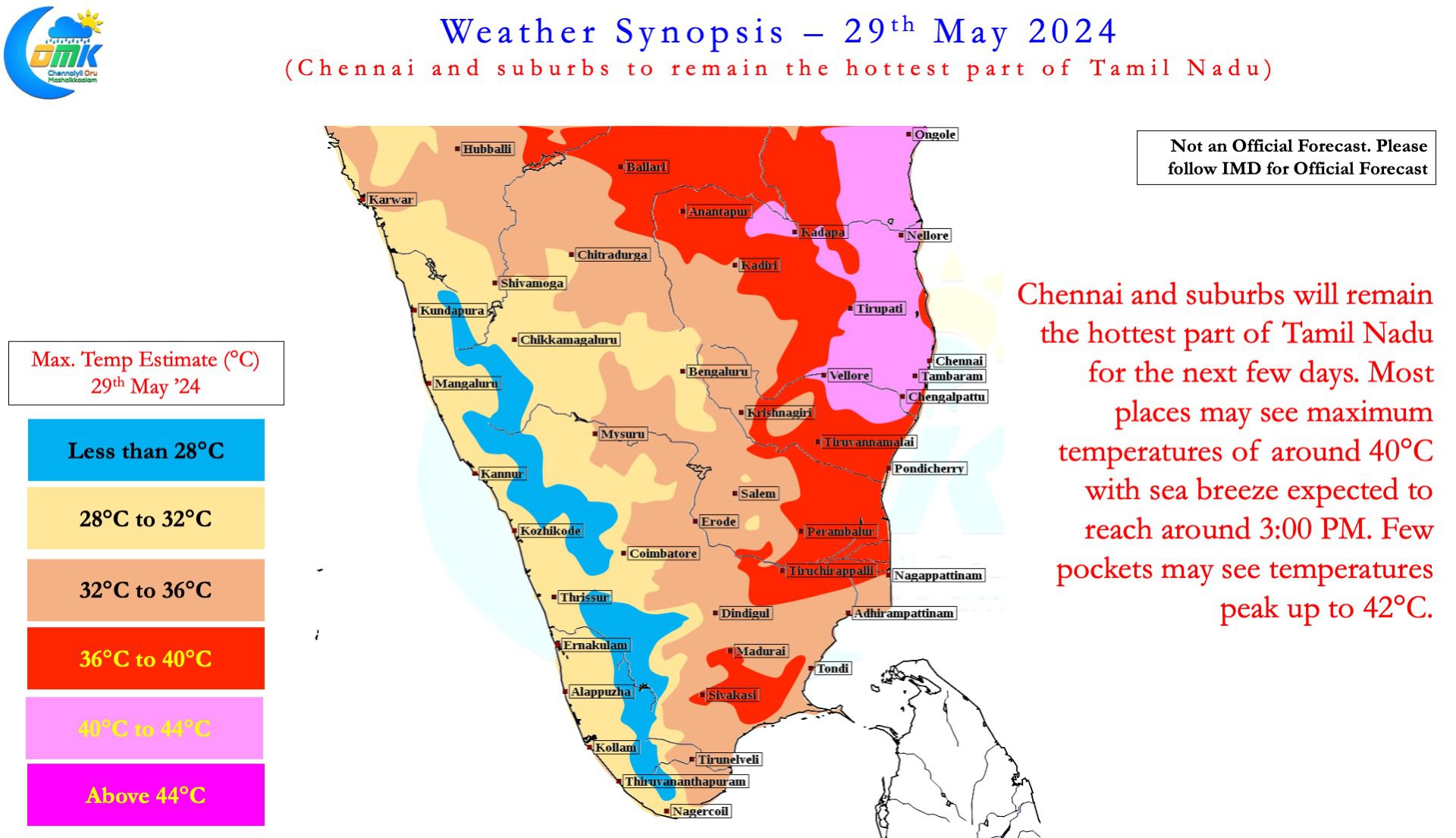
If one looks at the temperature trends over the past couple of days another important point would be visible. Both the Chennai observatories have been the hottest places in the state. Monday saw Chennai AP and Nungambakkam were hottest with 40.6°C. On Tuesday Chennai AP was the hottest place in the state with 41.3°C. On both days the only observatories to record above 40°C in the state were from Chennai. Weather models indicate similar trend to continue until Saturday with Chennai and suburbs remain the hottest part of the state. At the cost of repeating it is essential to point out the peak summer for Chennai is always when westerlies strengthen. The hottest period is always when a strong cyclone heads to North Bay triggering WNW winds over Chennai. Cyclone Remal certainly strengthened the westerlies though it was not strong enough to trigger heatwave conditions.


One may wonder why IMD has not called for heatwave over Chennai. The mean maximum temperature for this time of the year is 38.9°C and 38°C for Chennai AP and Nungambakkam respectively. For heatwave to be declared at least two stations need to see 3°C or more for two consecutive days. There is a very high possibility for Chennai Nungambakkam to record 41°C for two consecutive days. But for IMD to declare a heatwave over Chennai AP has to record 41.9°C or more for two days. Weather models do not indicate a high probability for Chennai AP to record 41.9°C or more for two consecutive days.
Thursday and Friday may be the peak days of heat from this spell as indicated by weather models. Sea breeze may struggle to provide respite for the next few days. There is a very high chance for both observatories to record 42°C once during this spell. The current spell of heat for Chennai and suburbs may persist until Saturday before a reduction in temperatures. The reduction in temperatures may be accompanied by some thunderstorms over interior areas of Tamil Nadu. There is a 50:50 chance for Chennai to catch a spell of rains with the westerlies strengthening gradually.
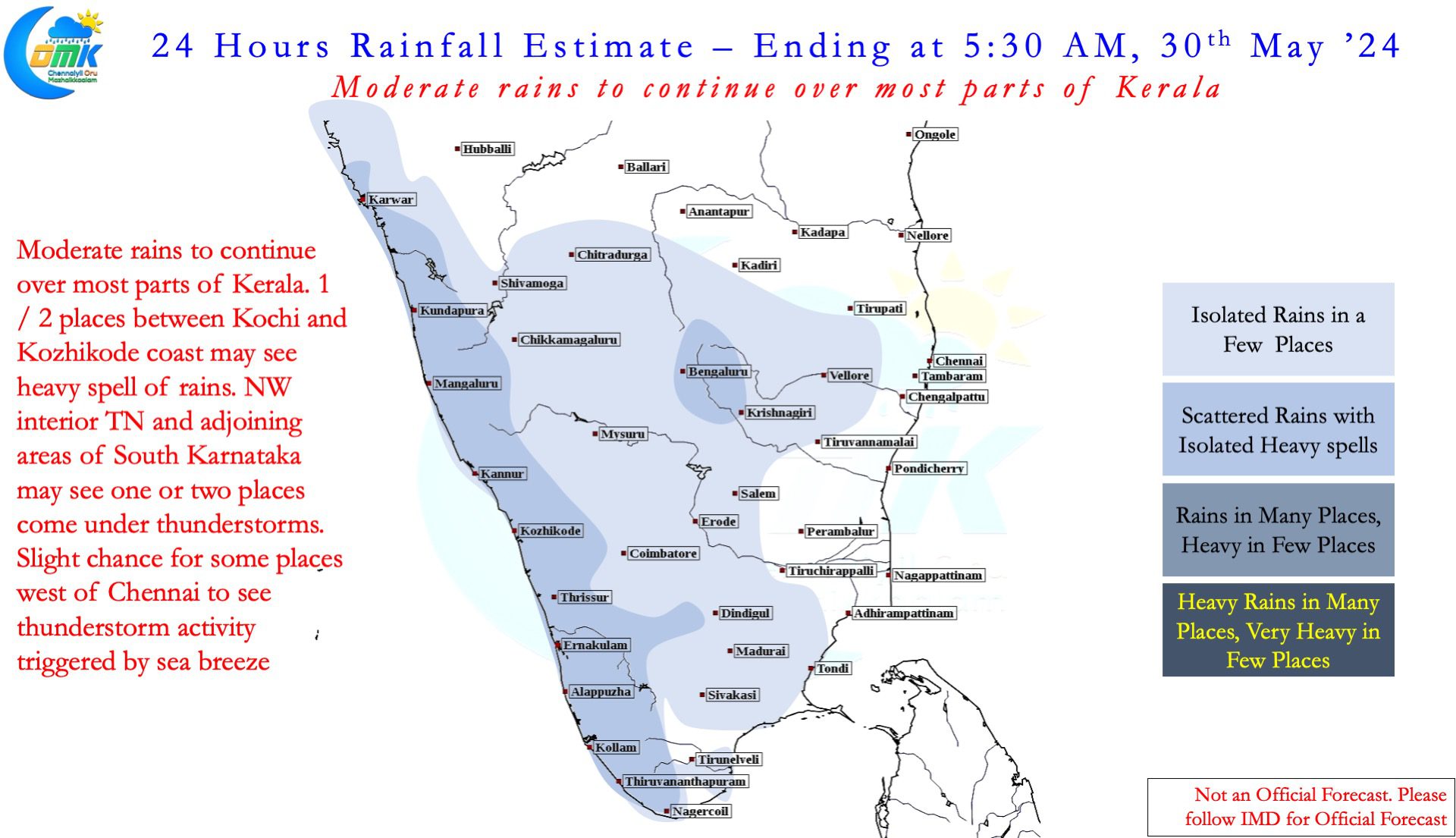
IMD is expecting Southwest Monsoon to hit the Kerala coast in the next couple of days. This would mean from now on temperatures over places like Chennai will depend on wet / dry phases of Monsoon. A weak monsoon may increase the afternoon temperatures while a strong monsoon may provide insulation in the form of higher moisture at lower atmosphere. On the rainfall front Kerala may see moderate rains continue at many places today. A few places between Kozhikode and Kochi coast may see heavy rains. With weather models indicating a stronger sea breeze today could it trigger thunderstorms west of Chennai? Fingers crossed.

