For most common people summer in Tamil Nadu is associated with Agni Nakshathiram / Kathiri veyyil period etc. Just as summer season is not the same across Indian sub-continent peak summer season changes within Tamil Nadu too. Kanyakumari and parts of West TN share a closer connect to Kerala than rest of TN in terms of climatology. These places see summer first within the state with temperatures picking up by late February / early March. To the contrary places like Chennai in North Coastal TN is a late bloomer to this summer season. As a matter of fact Chennai is a late bloomer for the thunderstorm season as well.
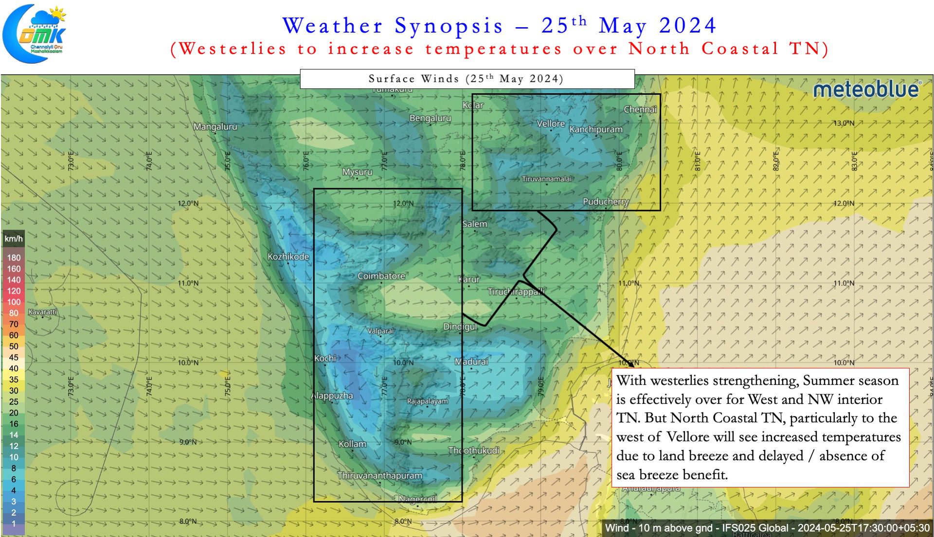
Most of us know seasons are created by the earth’s tilt and its spin around its axis while it orbits around the sun. While this is true on a larger scale, winds play a very important role as well in temperature advection. This is true in both ocean and land where winds carry heat / chill depending on the conditions. West TN faces its hottest season when strong Easterlies bring in land heat from interior areas into places like Coimbatore. Similarly North Coastal TN faces its hottest season when westerlies bring land heat from the West towards Chennai and suburbs. Regular weather watchers know the hottest period for Chennai is when a strong cyclone recurves towards Myanmar / Bangladesh strengthening winds from WNW.
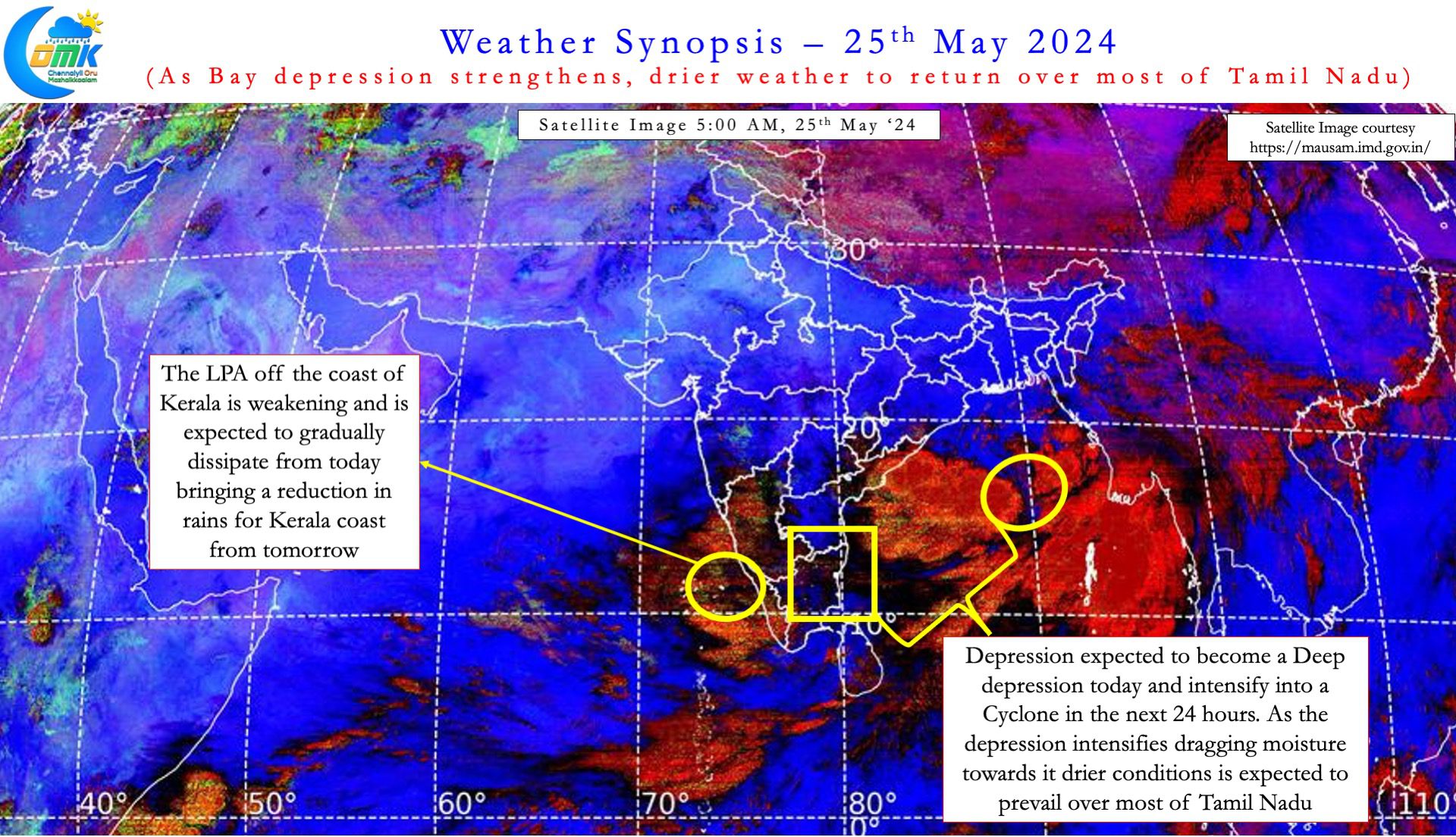
Over the past few days westerlies have strengthened over Peninsular India under the influence of the circulation currently over Central Bay. The depression over Central Bay is likely to intensify into a cyclone over the next 24 hours or so. Weather models are consistent about the cyclone heading towards the Sunderbans delta for a possible landfall around Sunday. Effectively this north moving disturbance has brought back summer over Chennai and rest of North Coastal TN.


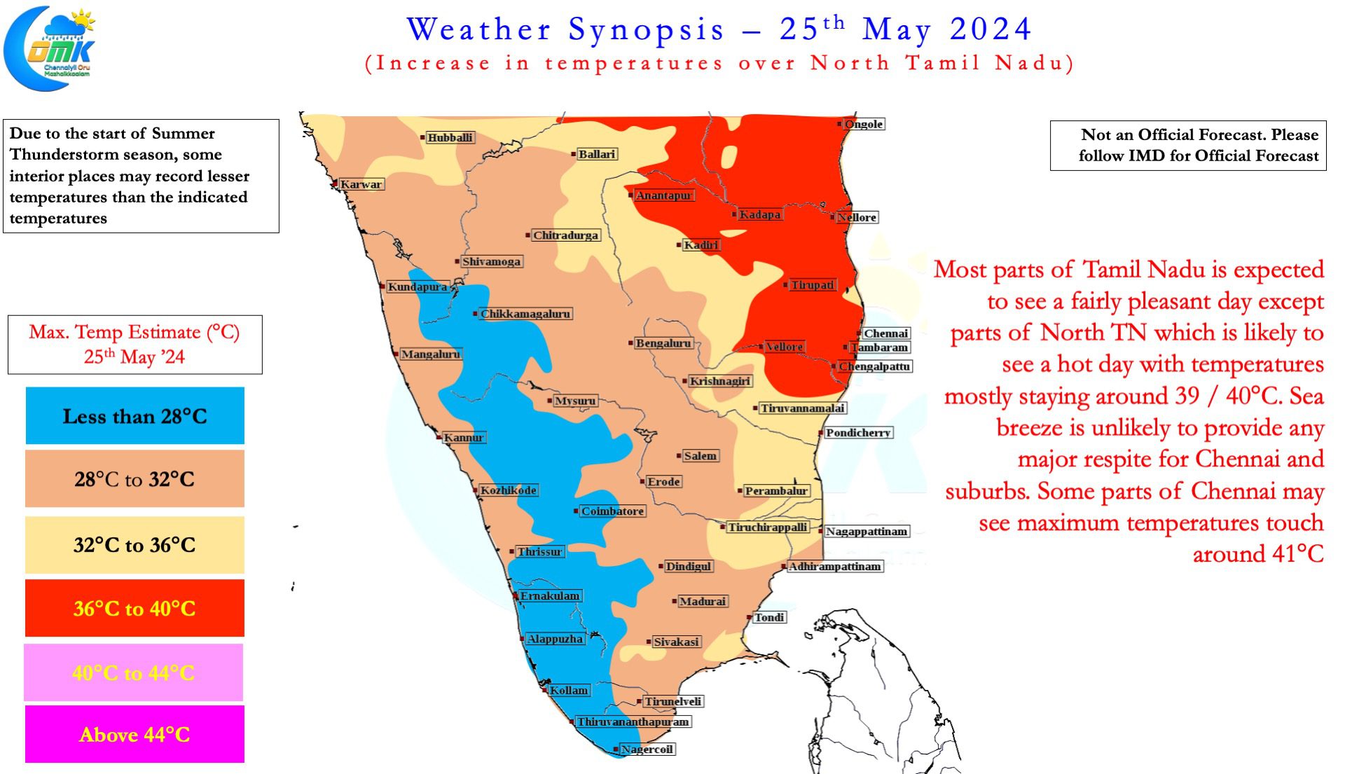
Fortunately Cyclone Remal is likely to be of moderate intensity. This would mean while Summer returns over North Coastal TN it may not be heatwave conditions. This is just a marginal respite though the temperatures are likely to stay around 40°C for the next few days over the region. As rains reduce from today and drier weather returns we can possibly see suburbs of Chennai touch as high as 42°C the upcoming week. The upcoming week is likely to see minimal influence of sea breeze over Chennai and suburbs. This would mean temperatures potentially could stay around 36 / 37°C even during the late afternoon / evening hours.
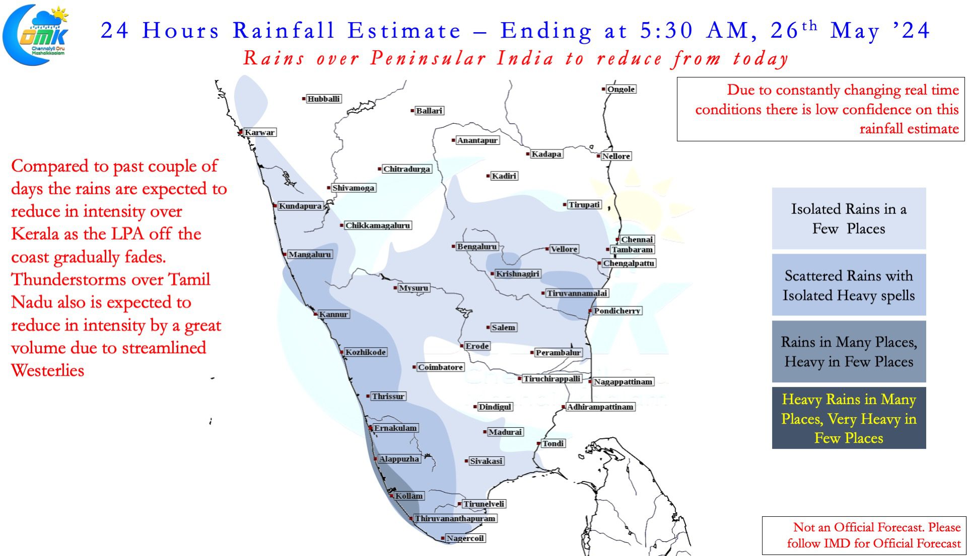
On the rainfall front thunderstorms will gradually reduce in intensity from today over Tamil Nadu. The LPA off the coast of Kerala may fade away bringing a reduction in rains along the west coast. Isolated rains may continuefor TN but widespread thunderstorms like past few days is unlikely from now on. On the monsoon dynamics we may have to wait and watch for the cyclone to complete its lifecycle.

