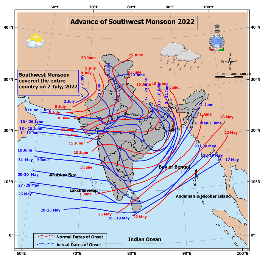
IMD yesterday announced Southwest Monsoon has covered the entire country after touching down over the last few districts of Rajasthan like Barmer, Jaisalmer, Jodhpur etc. In the normal context Southwest Monsoon is expected to completely cover India by 8th of July. This year it has covered India nearly a week ahead of schedule despite going through hiccups in between after making an early onset over Kerala on 29th May instead of 1st June.
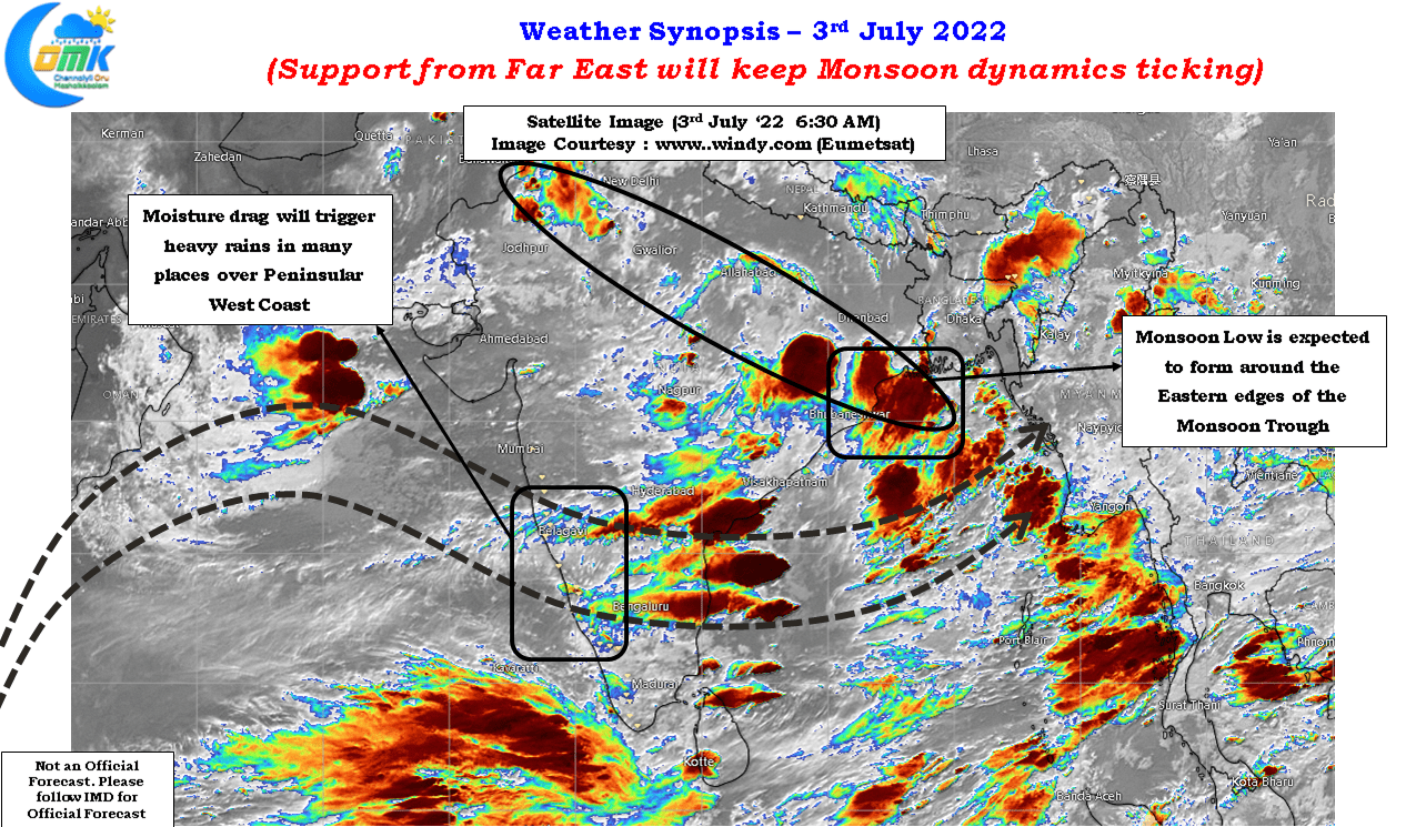
With an expected Low pressure to form over North Odisha and adjoining areas of North Bay along the Eastern fringes of the Monsoon trough the next week or two could bring a lot of momentum to the monsoon dynamics. While most of it will be through the localized support mechanism which the Monsoon trough is expected to provide the presence of MJO over the Maritime Continent and adjoining areas of Indo China Peninsular region will also ensure pulses get pushed into Bay of Bengal as they wind up their life cycles. These pulses could eventually keep the momentum going over the Indian Sub Continent.


Though monsoon started early and has also completed its journey over India early as well the performance has been erratic without doubts so far with Northeast India coming under ravaging floods while Kerala & Mahe, Konkan & Goa and Coastal Karnataka have accumulated 48%, 15% and 17% lower than normal so far with the first month of the Southwest Monsoon season gone. Hopefully the coming couple of weeks could go a long way in bridging some of the deficit accumulated so far.
In response to the developing low over the Bay the off shore trough along the West Coast may keep the monsoon surge active bringing some heavy rains along the Peninsular West Coast and over the Ghats as well. Karnataka & Kerala Ghats may see heavy to very heavy rains in many places which augurs well for the catchment areas of Cauvery basin too. Today could be one last chance day for Coastal TN to witness thunderstorms while the pendulum swings its way back towards West Coast.

