One of the most common debates that happen among weather bloggers is whether LPA or Cyclone gives more rains, there are enough evidences to support both sides of the arguments. Yesterday turned out to be another case of additional support for those who argue for LPAs’. A weak LPA under right conditions can dump a lot of rains as many places along the Ghats in Kerala & South TN recorded 20 to 30 cms of rains. Peermed in Idukki district recorded 301.5 mm while Upper Kodayar recorded a whopping 363 mm rains for 24 hours ending today morning, Papanasam about 20 kms to the North of Upper Kodayar recorded 275 mm indicating the surge seen yesterday due to the LPA.
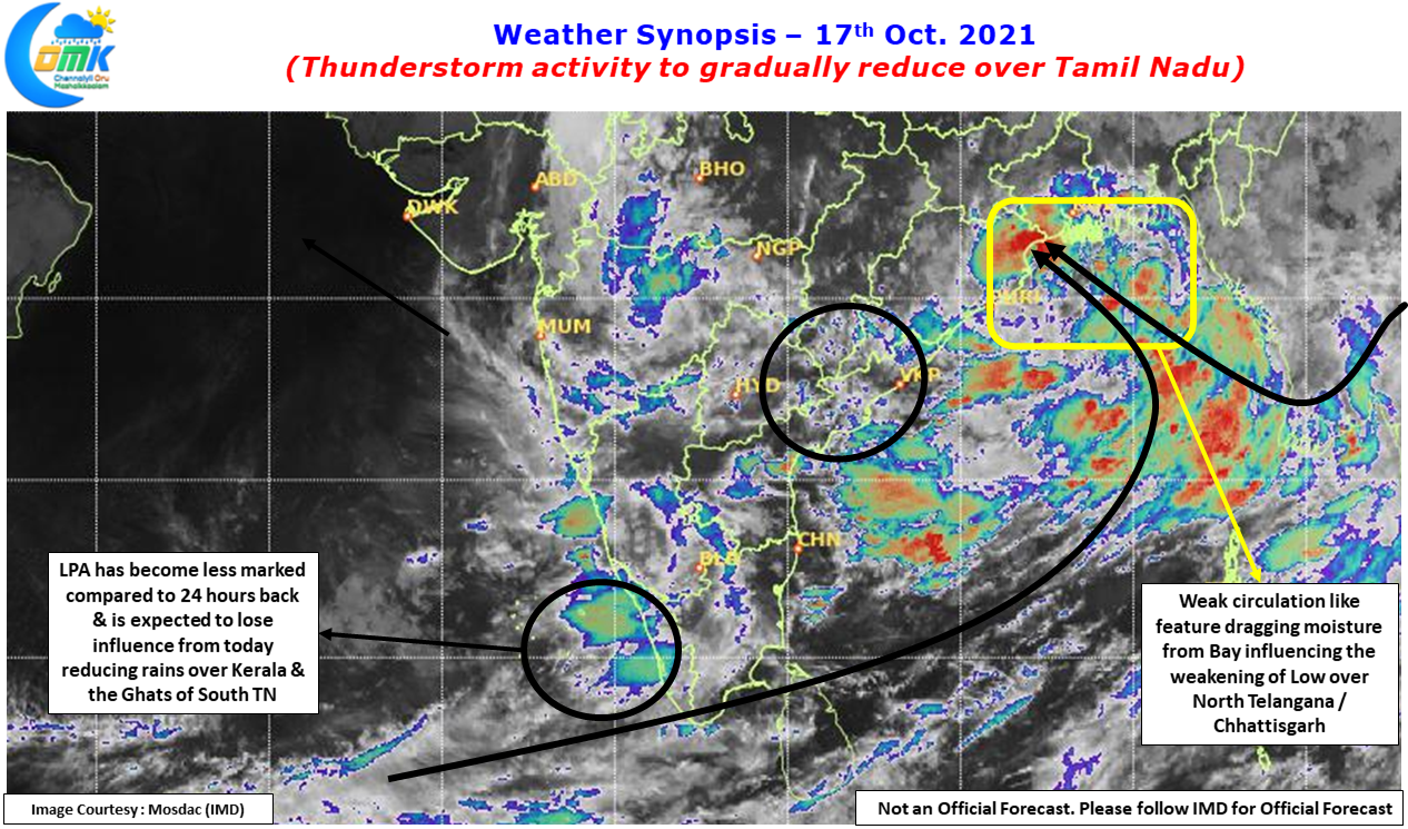
Many parts of Kanyakumari district came under floods as almost all the major dams in the district including Pechiparai started discharging high volumes to modulate the heavy inflows triggered by the extreme rains in the Ghats. Similarly Idukki & Kottayam districts also saw flooding in many places as the extreme rainfall in the high ranges triggered a burst of volume in water inflows into rivers like Manimala, Pampa etc. But the good news is the rains are expected to reduce from today due to the fading influence of not only the Low over Arabian Sea which is now less marked but also the Bay Low which is seen over North Telangana & adjoining areas.
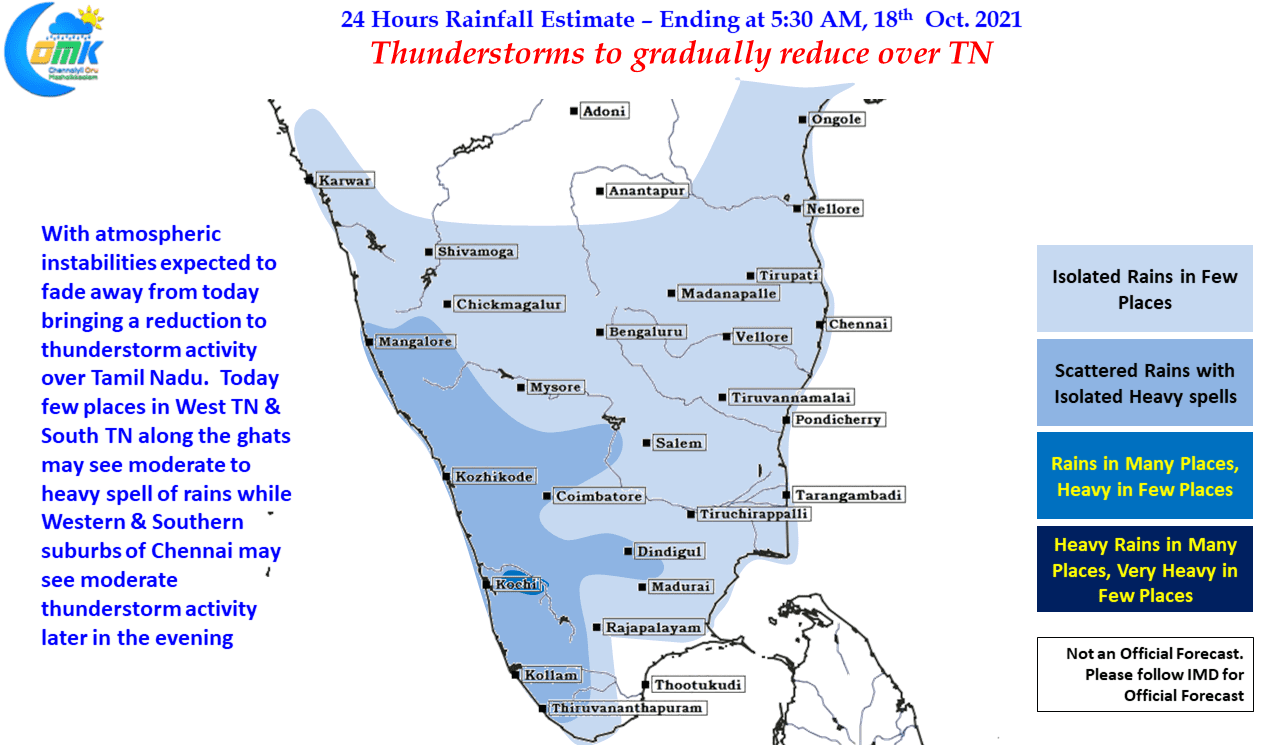
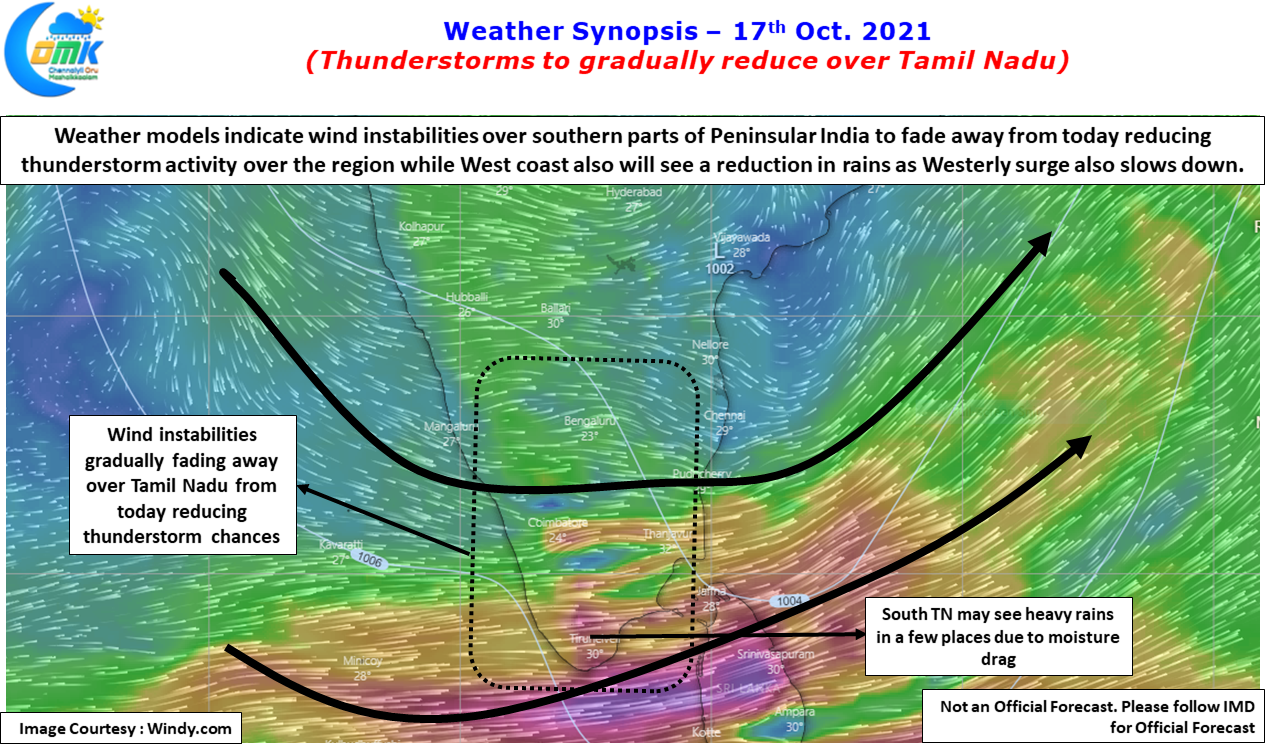
With both the lows fading in influence we may also see a weakening of the atmospheric instabilities triggered by the Wind Convergence over Tamil Nadu. This in turn will also mean reduction of thunderstorm activity over the leeward areas of Tamil Nadu. Today could possibly see thunderstorms in a few places over West Interior TN & North TN while places along the Ghats in South TN may see moderate to heavy spell of rains in a few places. But overall rains should reduce from today for the next 3 /4 days before once again wind instabilities will pick up in anticipation of the seasonal wind change from Westerlies to Easterlies.
Western & Southern suburbs of Chennai may once again benefit from light to moderate thunderstorm activity with the streamlined westerlies giving some hope for one final day of thunderstorms before we start looking East for our rains.


