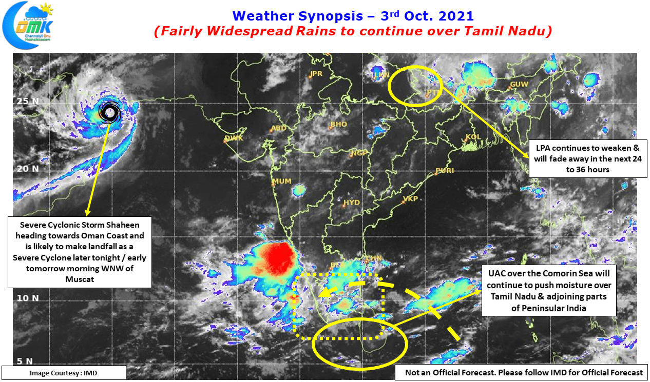
Rains continued over many parts of Tamil Nadu under the influence of the Upper Air Cyclonic Circulation which is now lying over the Comorin Sea area as it continues to jog in a general westward direction gradually. Erode which has already seen one intense episode of rains a couple of days back saw moderate to heavy spell of rains once again yesterday while parts of Kanyakumari district saw moderate to heavy spell of rains late in the night. Though Chennai city areas missed the rains mostly, places to the south of Chennai recorded moderate rains with Cheyyur about 80 kms to the South of Chennai on the coast recorded nearly 4 cms of rains.
While the southern parts of Peninsular India has been seeing Northeast Monsoon type conditions Severe Cyclone Shaheen, remnant of Gulab, is heading towards the Oman coast where it is likely to make landfall later tonight or early tomorrow morning as a Severe Cyclonic storm. Interestingly already creating a unique record of becoming a cyclone in both Bay of Bengal & Arabian Sea this one may set one more record by becoming a rare cyclone to make proper landfall over the Oman Coast in recent years. One may remember the Super Cyclone Gonu, one of the strongest to come towards the Arabian Peninsula, in the year 2007. Technically though Cyclone Gonu brushed the Oman coast to the east of Muscat it made a proper landfall in the Makran coast of Iran after weakening over the Gulf of Arabia as a cyclonic storm.
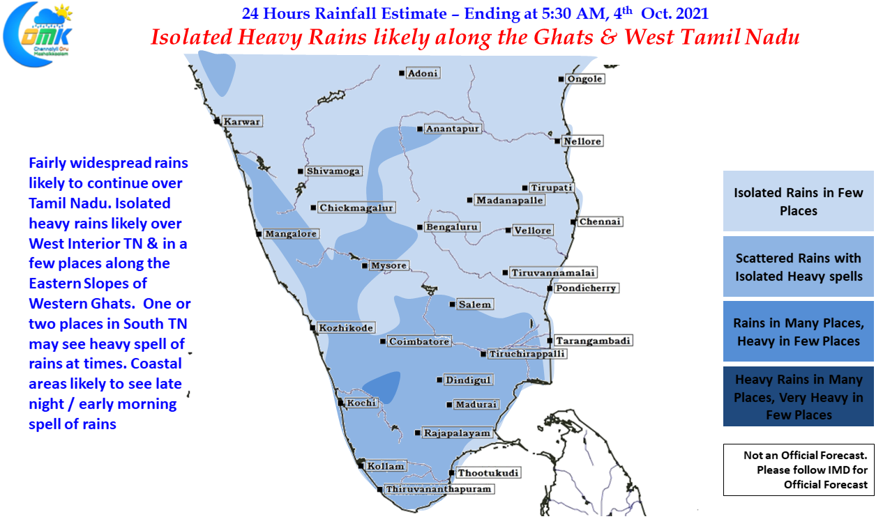
Down South today also we can see fairly widespread rains continue over the southern parts of Peninsular India with South TN & West Interior TN in line to see isolated heavy spells of rains. The Eastern Slopes along the Western Ghats could see isolated heavy rains in one or two places due to the moisture drag created by the west moving circulation. In the meanwhile Kerala which already saw intense spells of rains in a few places last night will also see moderate to heavy rains in a few places. Coastal places like Chennai may see late night / early morning rains that could be moderate in intensity over a few places.


