Yesterday once again showed the foolproof period for Chennai as far as thunderstorms go is just as the LPA deepens and gets ready to move inland from the Bay. While day before yesterday saw moderate to heavy rains over many places in Tamil Nadu yesterday saw action pretty much confined to Chennai & surrounding districts, Composite Kanchipuram, Tiruvallur & Chennai districts recording some moderate spell of rains at many places from evening thunderstorms. The 24 hour rainfall recordings ranged between 1 to 4 cms across the city & suburbs.
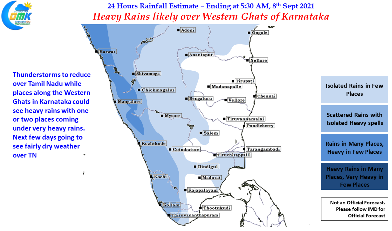
It could mean yesterday’s spell of thunderstorms over Chennai & Suburbs could be the last good spell of rains for leeward areas of Tamil Nadu. The next few days will be relatively quiet and possibly a spell of dry weather is likely to persist until towards end of the week. This spell of dry weather may come as a welcome relief for farmers from many parts of the state as some of them are amidst their harvest of first crop while some of their getting ready to sow their crops / transplant their saplings which will need a bit of dry weather to ensure the crops survive the first few days.
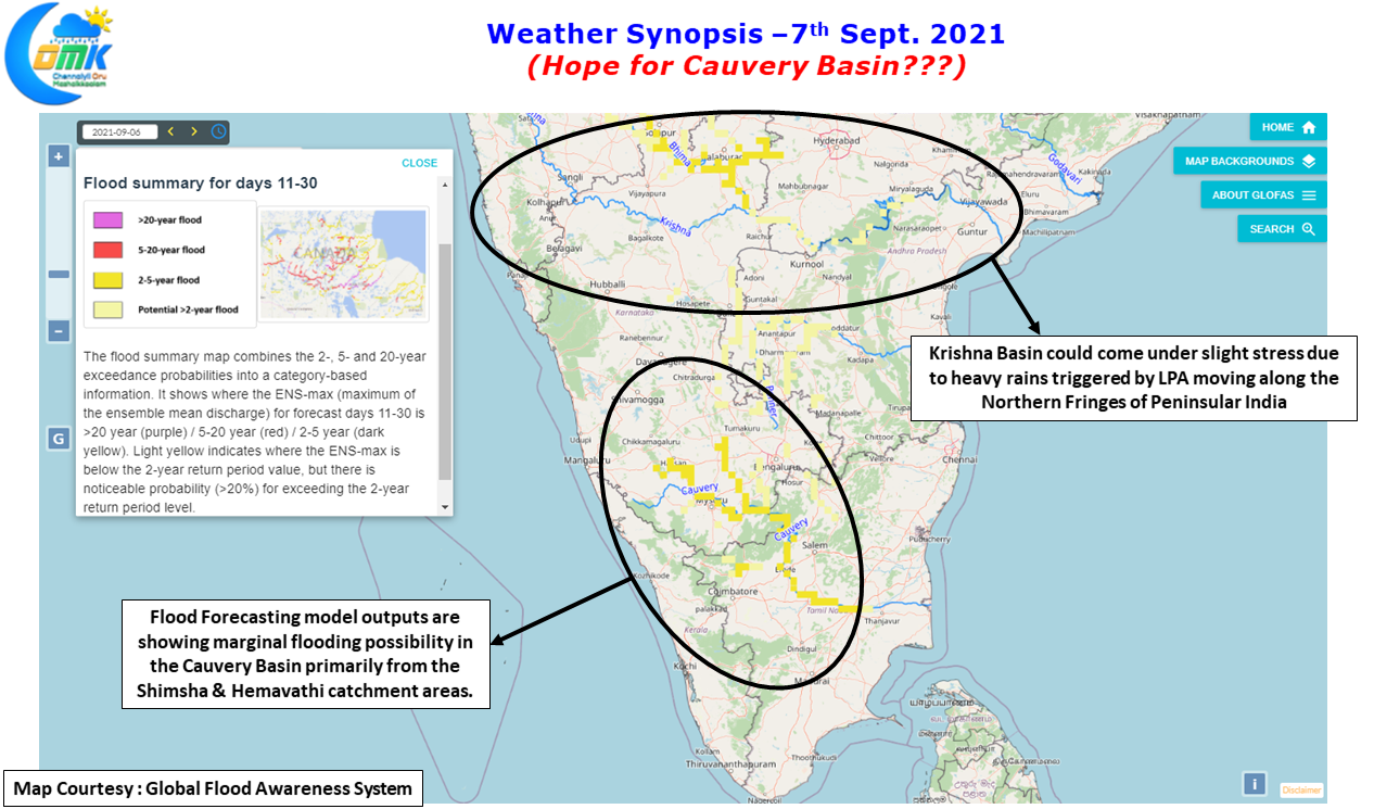
In the meanwhile thanks to the LPA the northern areas of Peninsular India round AP & TS states along with the Western Ghats of Konkan & Karnataka may come under heavy rains. While this could put more pressure on the Krishna basin which is already seeing most of the dams at full capacity it could mean some bit of hope for the Cauvery Basin where the level at Mettur has dropped alarmingly over the past few weeks. It is interesting to note the flood forecast maps are showing bulk of the inflows to come out Shimsha & Hemavathi catchment areas with the more traditional Kodagu & Wayanad catchment areas not showing any alarming flood potential. It is a different story that as long as the Cauvery Basin dams get their due inflows in both Karnataka & Tamil Nadu one should not worry too much which component of the basin contributed.


