Summer 2021 has been mostly kind for Tamil Nadu with no major heatwave conditions seen except for the last few days of March and early April which saw day time max temperatures soar about 4 to 6 degrees above normal over many parts of the state. The persisting Easterlies till the arrival of Cyclone Tauk’tae meant sub par Summer continued well into the month of May keeping temperatures under check.
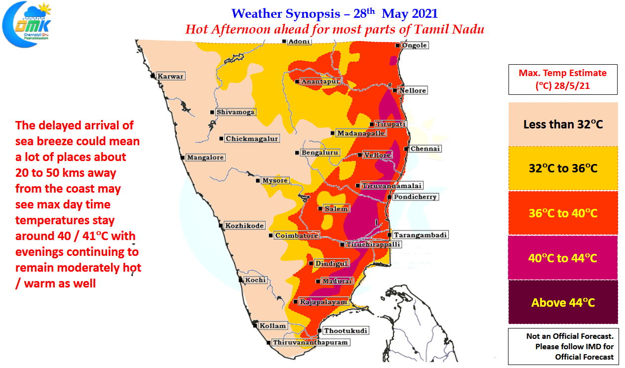
While Cyclone Tauk’tae put the seed for Westerlies, the movement of Cyclone Yaas towards North Bay on the way to landfall over Odisha coast meant the Westerlies were able to strengthen bringing the heat back over parts of North Tamil Nadu yesterday. Last two days have seen the IMD observatory at Nungambakkam cross 40ºC while the observatory at Chennai Airport recorded just shot of 40 degrees. One of the key reasons for the increased heat is the delayed intrusion of sea breeze or for that matter weak sea breeze intrusion in some of the areas which means temperatures stay around the 100ºF mark till late afternoon / evening
Today the temperatures are expected to stay once again around 40ºC mark for most places in the belt that is up to100 kms away from the East Coast, as typically these are the areas that benefit from sea breeze though as we go further away from the coast the effect of sea breeze wanes. This means the belt about 10 to 25 kms from the coast is typically the ones seeing the highest temperatures as they not only come under strong Westerlies but also see very little benefit from sea breeze as well.
But the good news is with the effect of Cyclone Yaas fading & the remnant circulation weakening into a Well Marked Low over Bihar & adjoining areas of Eastern UP we can look forward to some thunderstorms over Peninsular India as westerlies weaken for one last time before Southwest Monsoon tries to once again start its life cycle disrupted by the circulation over Bay of Bengal. While today may seem a tad early for thunderstorms to come, though convective thunderstorms may happen in one or two places over North TN & adjoining areas of South AP, the presence of an East West Shear Zone early next week is likely to enhance the probability of thunderstorms over North TN.


