Yesterday saw the return of Monsoon conditions over many parts of North Coastal Tamil Nadu as sharp showers hit Chennai & suburbs with places along the coast seeing some intense burst of rains. While there is a genuine worry & fear from people elsewhere along the coast particularly between Mahabalipuram & Delta which has so far seen no meaningful day of rains one has to keep in mind we have not yet seen streamlined Easterlies so far completely.

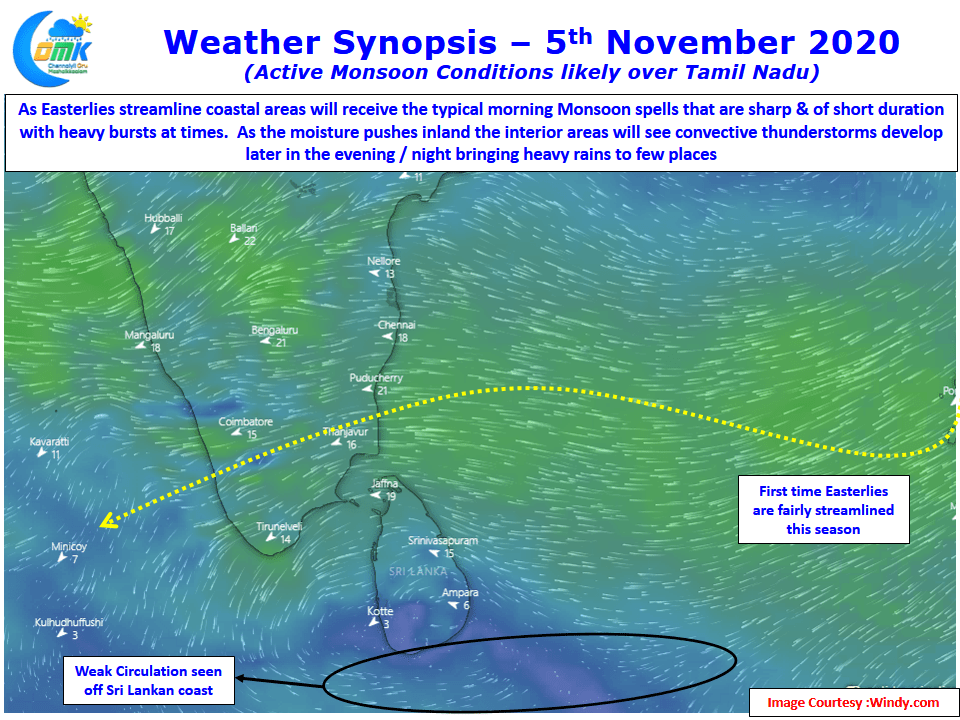
Wind charts indicate for the next couple of days southern parts of Peninsular India is likely to see streamlined Easterlies which will enhance the rainfall prospects for not only coastal areas of Tamil Nadu but also the interior places of the state. This spell for couple of days could be the first spell of rains for places in the Delta coast though a little to the south places in Ramanathapuram dt have recorded a spell or two of rains since the Northeast Monsoon season started.

Satellite image pretty much sums up the dynamics of how things are happening for the past couple of days. As Easterlies gradually push the moisture inland the coastal areas record some sharp spell of showers during the morning hours with the remnant moisture then developing as convective cells during the day as it moves further west triggering late evening night thunderstorms over the interior parts of the state in West & South TN.

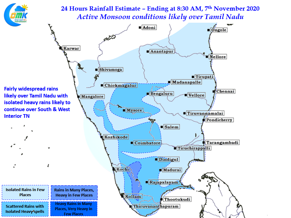
For the places in West TN which missed out in entirety the transitional season thunderstorms this spell of storms have come as a much needed relief bringing some cheer to the farmers who were anxiously waiting for a decent spell of rains. Isolated places along the ghats facing the East are likely to see heavy spell of rains today. West Interior TN will see moderate to heavy thunderstorms in a few places as widespread rains are likely to continue today too.
Chennai is likely to see some early morning spell of rains pushed in once again providing sharp spell of showers in places closer to the coast but overall the rains could be slightly more widespread compared to yesterday.


