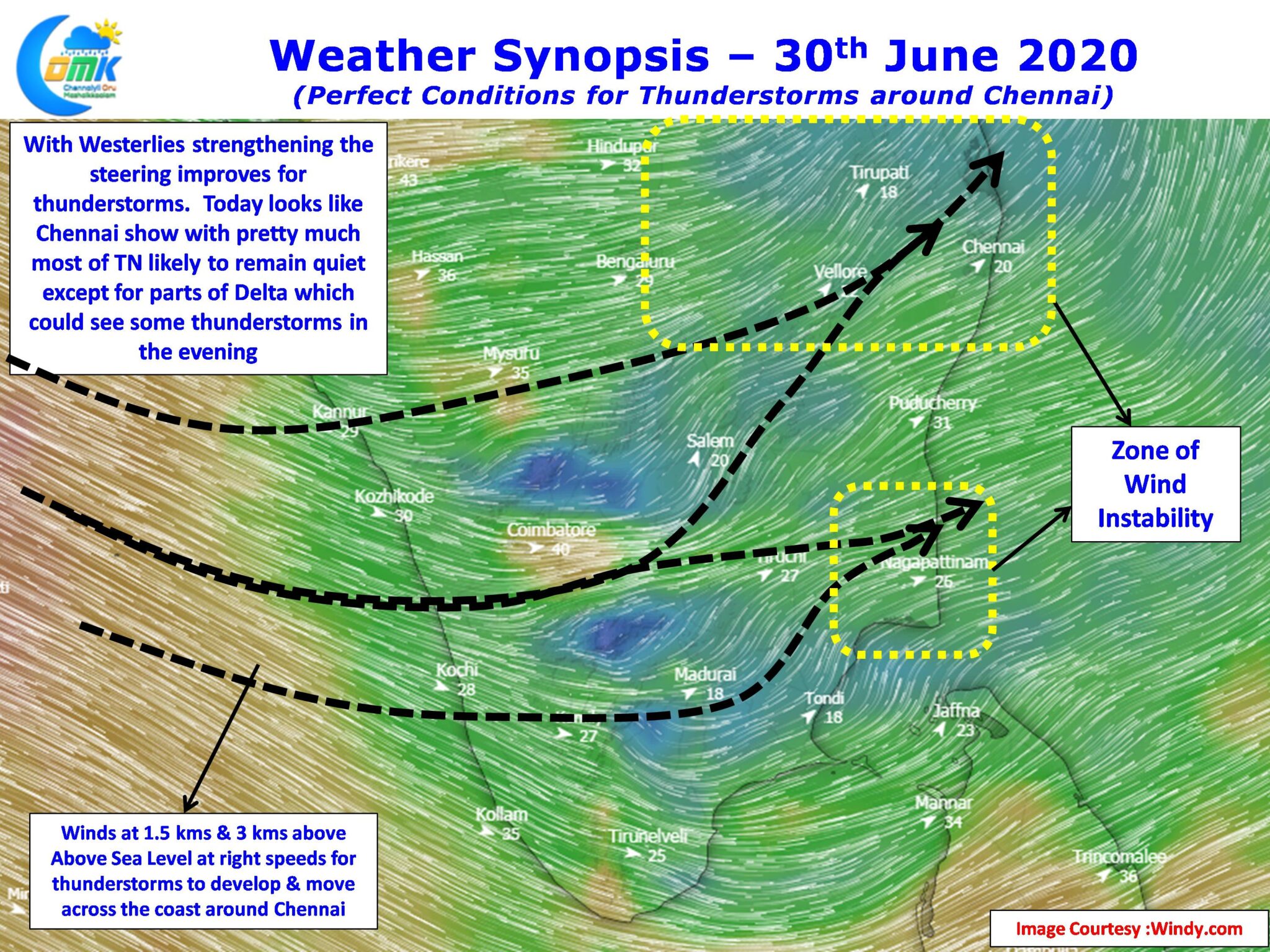
The past week has seen thunderstorms rock most of Tamil Nadu with interior areas seeing some of the most intense spells of the year. Yesterday many places in composite Vellore district recorded intense spells of rains late in the night. Similarly Tiruvannamalai district once again saw moderate thunderstorm activity while little down south places in Trichy, Madurai, Dindigul & Pudukottai districts along with parts of Delta also saw fairly active thunderstorm activity.

As far as Chennai goes thunderstorms have pretty much teased the city with only isolated spells happening though some of the suburbs have got couple of decent spells for the past week. Last night though many city areas saw midnight thunderstorms and crucially the storms crossed coast comfortably indicating the improvement in steering winds which have been the bane for so many days. As is the case always Chennai is pretty much the last man standing as far as Monsoon thunderstorms go. Conditions look perfect going by weather models in terms of wind pattern for Chennai to catch up a good spell today before the Monsoon mojo returns over West Coast.

With westerlies strengthening gradually we wills tart seeing the rains increase over the West Coast, yesterday after many days some of the monsoon heavy weights have started inching closer to century and Chinnakallar scored its first century of the season indicating the strengthening monsoon dynamics.
Hopefully as always the case Chennai scores when rest of TN remains quiet, today could be that day if luck favors us.


