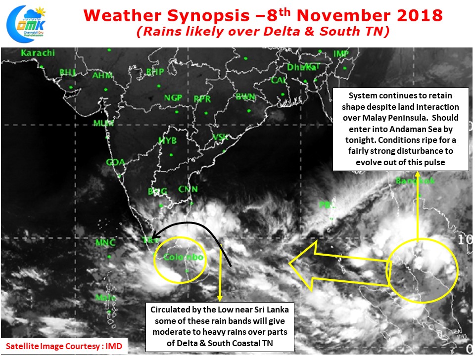
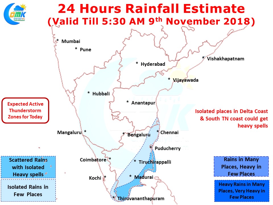
Parts of Delta Districts have got moderate to heavy spells of rains today early morning as rain bands circulated by the Low Pressure over Comorin Sea pushed some moisture to places south of Puducherry. Nagappattinam recorded 63 mm up to 5:30 AM while Kudavasal in neighbouring Tirurvarur district recorded 30 mm during the same period.
The rain bands to the East of Delta districts will possibly move towards the coast over the next few hours making it a rainy morning for most places in South Coastal TN & delta districts. Some of these bands will trigger thunderstorms later in the evening as they reach Western Ghats and get trapped bringing isolated heavy rains in the stretch.
There is a lot of buzz on the November mid system both in social media and among the weather bloggers. One of the key reasons for the increased buzz is the landfall locations shown for the past few runs (excluding the later runs last evening / night). With models showing Tamil Nadu coast as a potential landfall location the resultant buzz and hype was understandable.
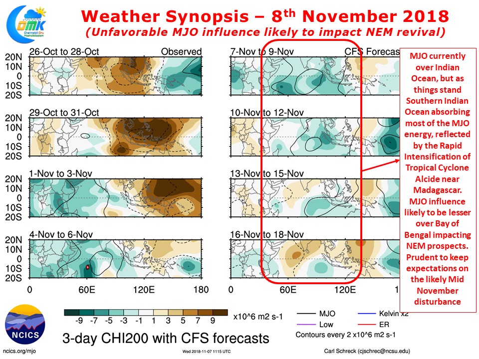
But look a little deeper we can possibly see things are not actually black & white. Weather bloggers had a lot of hope on the influence of a favorable MJO during the middle of November. Not only could it give a good impetus to Monsoon dynamics it may also throw a cyclone or two as well. As weather enthusiasts one should not just look at model outputs instead correlate with real life observations too.
The weather charts plotting MJO shows Southern Hemisphere absorbing a lot of energy from MJO. This is confirmed by the rapid intensification of Tropical Cycloe Alacide that’s heading the way towards Madagascar. This could mean lesser support for the systems North of equator explaining why yesterday’s Well Marked Low near Sri Lanka did not improve despite the prescence of MJO in the region. Similar conditions are likely over Bay of Bengal as well so keeping expectations under check for a drastic improvement on Monsoon prospects may be prudent.


