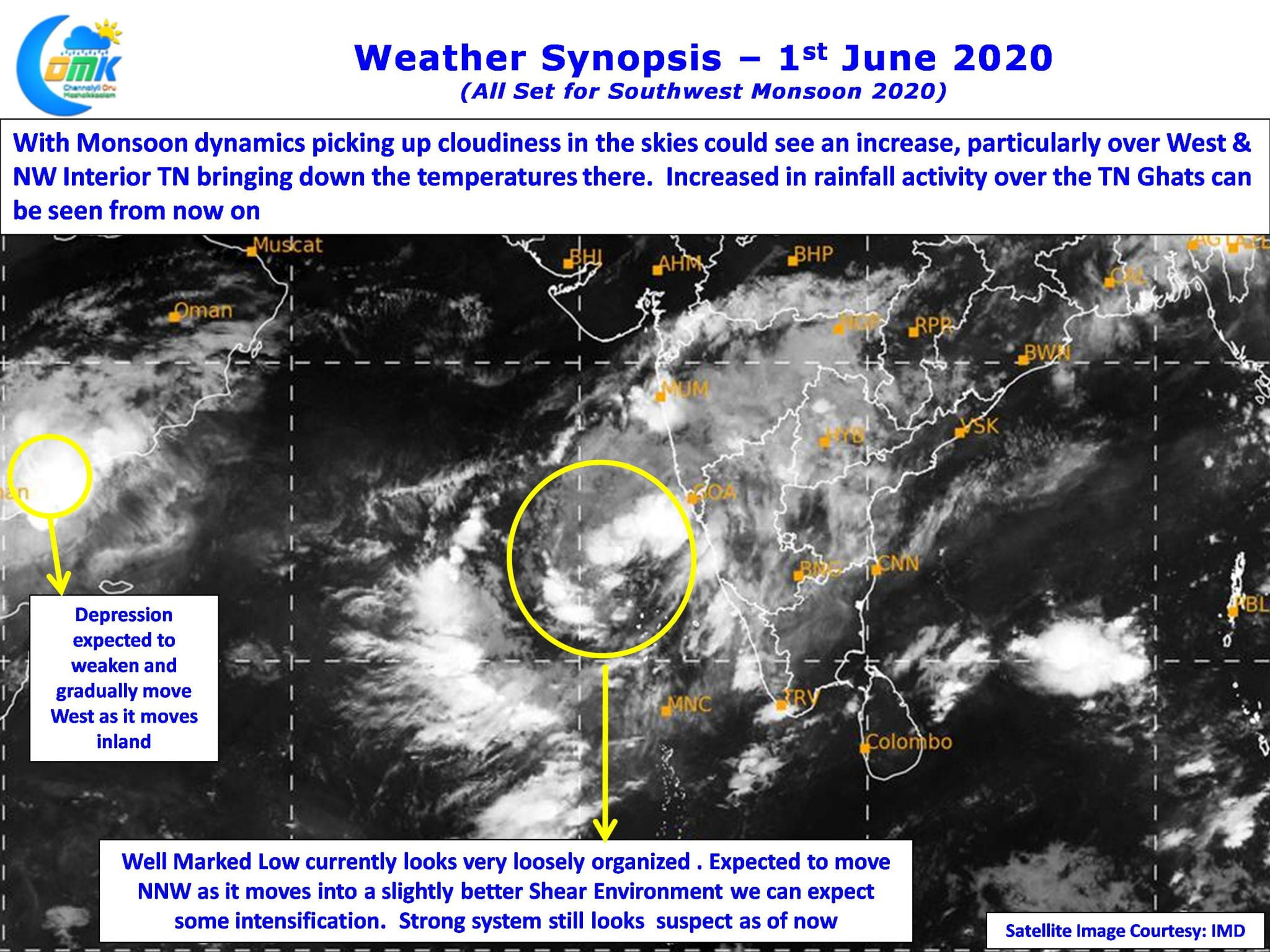
It is that time of the year when all eyes are over West Coast for the arrival for the annual Southwest Monsoon. Traditionally the Monsoon Onset date over Kerala has been 1st of June with a variance of +/- 7 days as per IMD. This year IMD has revised the dates for Onset & Withdrawal based on the actual dates for the past couple of days but the Onset date over Kerala remains the same.

With SE Arabian Sea now hosting a Well Marked Low off the coast of Kerala the monsoon winds have picked up over the southwestern parts of Peninsular India. Trivandrum city recorded heavy spells of rains during the wee hours today indicating the strengthening monsoon dynamics. While there still exists some concern on how much could the Well Marked Low even though most models are consistent on it becoming a Tropical Cyclone it currently looks very disorganized though a movement into a slightly better shear environment today could improve the chances for the Well Marked Low to intensify into a Depression.

With winds streamlining along the West Coast we can expect the rains to increase over Kerala with most places in line to get moderate to heavy spells of rains at times. Few places along the ghats could get heavy rains, similarly few places in the TN ghats are also in line to get some moderate to heavy spells of rains. As the Low climbs up in latitude places in Karnataka also will start receiving rains with models expecting the system to move gradually along the coast in a NNW direction.

While it is usual for Thunderstorms to slow down over Tamil Nadu as Monsoon dynamics picks up, it is not unusual for thunderstorms to form during the early days of Monsoon Onset as winds continue to streamline. One such opportunity exists for North TN over the next couple of days for some wind induced thunderstorms later in the night. Parts of Tiruvallur & Kanchipuram could see a sudden spell of sharp showers induced by thunderstorms. How close the city areas of Chennai will be to thunderstorms is a billion dollar question.


