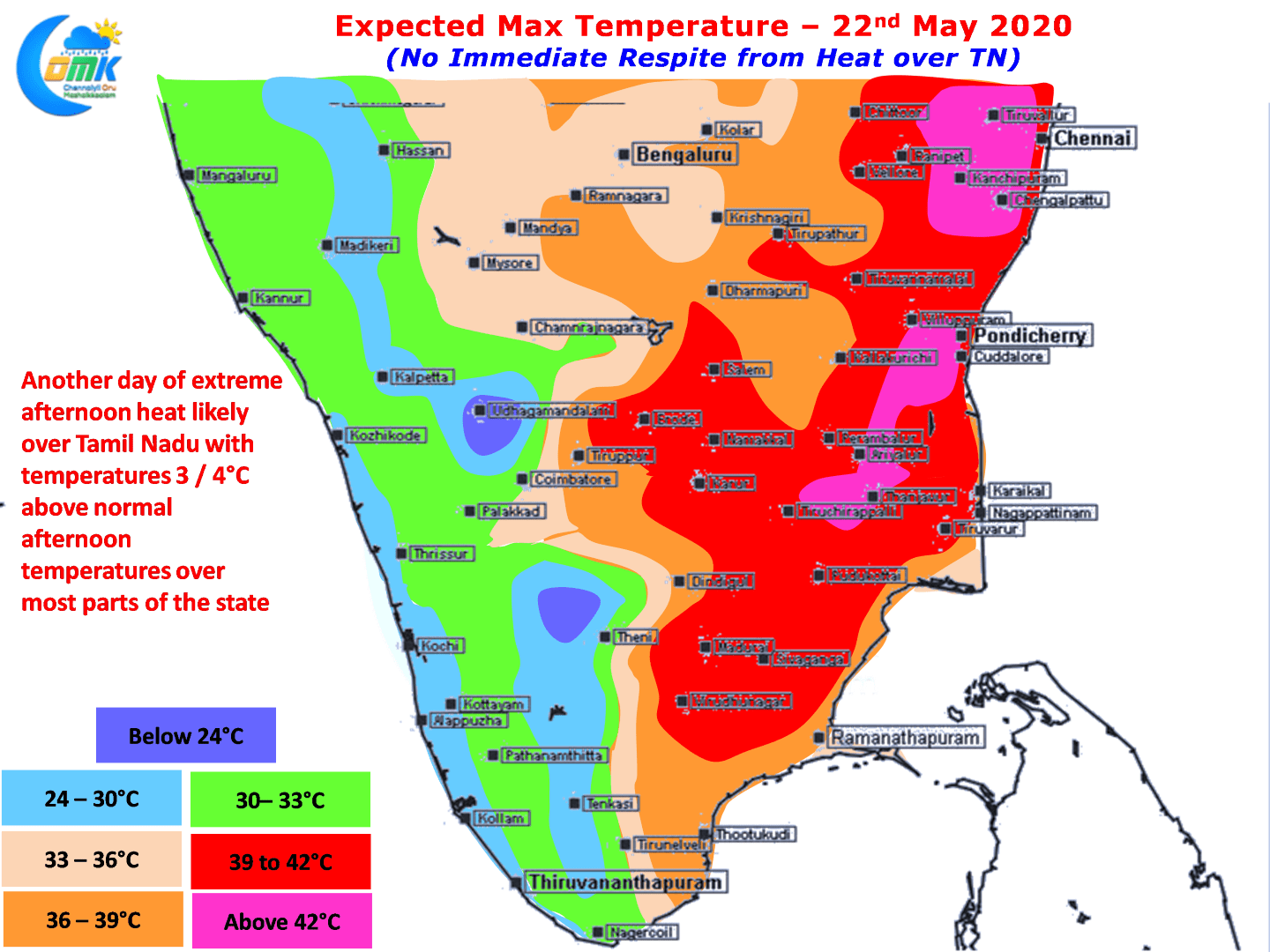
Since Tuesday the heat quotient over North TN has increased with both Chennai observatories recording above 41ºC for the past three days while the IMD Observatory at Chennai AP recording two consecutive days of 42ºC for the past couple of days touching 42.5ºC which was the highest recording since 10th of June last year. As a matter of fact yesterday saw 8 IMD observatories in Tamil Nadu cross 40ºC.

Weather models indicate some bit of weakening of the Westerlies which could mean a possibly help by sea breeze though it appears weak sea breeze could move in closer to the coast while places in the Inland may not actually benefit from the intrusion of sea breeze. This could mean another day of temperatures around 40 / 41ºC at many places across the state with few places in North TN over Tiruvallur, Kanchipuram, Chengalpattu, Villuppuram, Cuddalore districts could touch 42ºC.

Some of the places in Interior TN particularly around West & Northwest Interior areas could get some benefit later in the evening in the form of thunderstorms. It appears there could be a slight increase in thunderstorm activity from today. An East West Shear Zone may develop over 10N latitude in a day or two which needs to be monitored for favorable influence over thunderstorms in Peninsular India.


