So far Chennai has been seeing a relatively sub par summer with temperatures staying near normal or in some days lower than normal. The persistence of Easterlies on a near continuous scale has meant we have had a comfortable summer so far. But as we often repeat the worst summer for Chennai is after the Westerlies pick up and those days when we see Northwesterly winds bringing in the heat from adjoining Rayalaseema region for the entire day length.

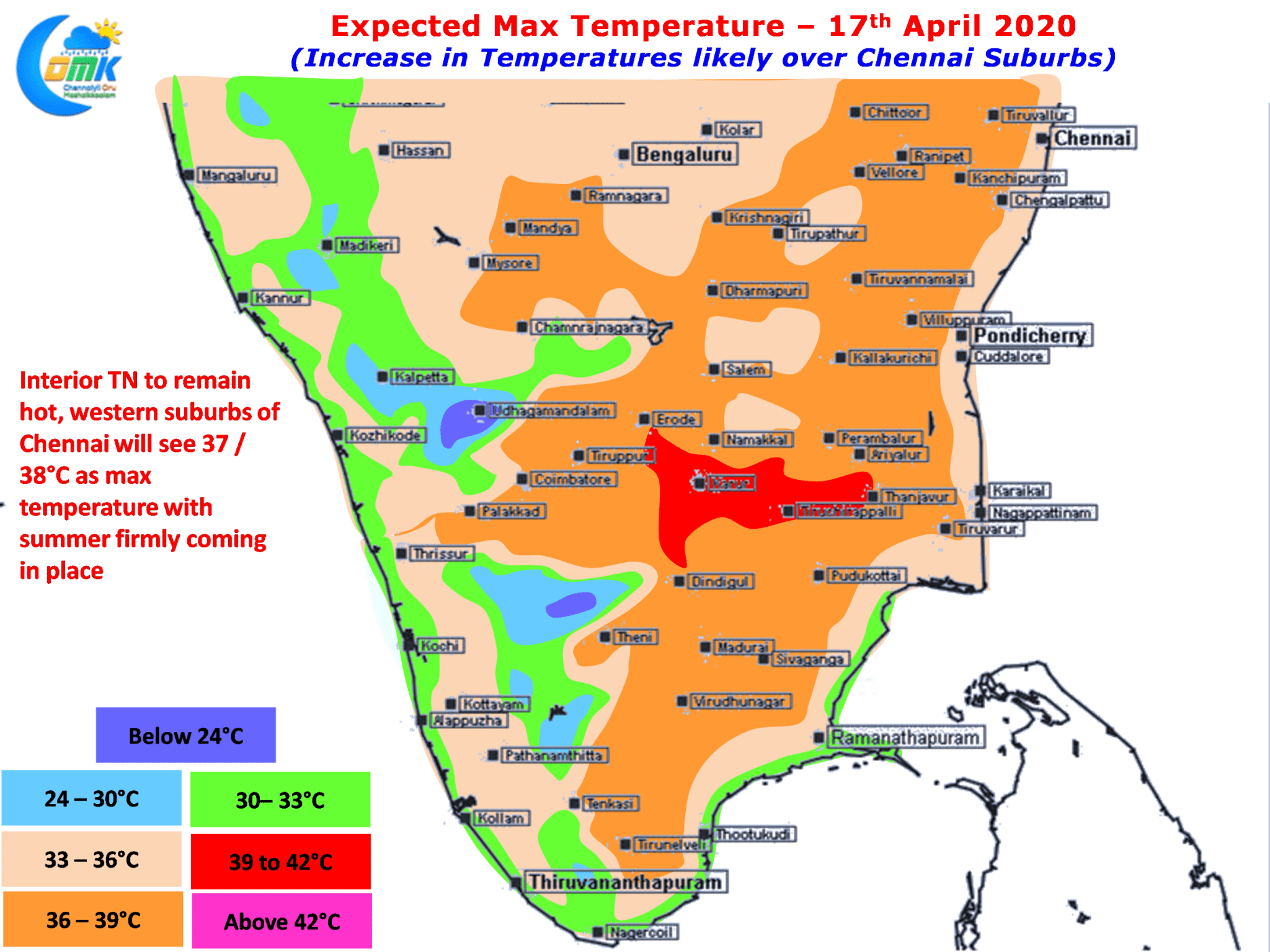
With the angle of Sun’s Rays now reaching up to Vedaranyam latitude on its way towards Tropic of Cancer its only a matter of time the heat quotient increases irrespective of the prevailing wind pattern. Weather models indicate most parts of Tamil Nadu to remain hot in the coming days. Like yesterday many parts of Central TN around Trichy / Karur districts are likely to see day time max of around 39 / 40ºC. Closer home while the city areas of Chennai may see temperatures around 35ºC the western suburbs like Avadi, Tiruvallur are likely to see temperatures touch 37 / 38ºC a good couple of degrees higher than past few days.

Thunderstorms are likely to continue along the Western Ghats with places in North Kerala & adjoining areas of South Karnataka and Nilgiris district of Tamil Nadu likely to see moderate to heavy thunderstorms in a few places aided by the Wind Convergence & associated Line of Wind Discontinuity. Coastal areas of South TN and one or two places in south Delta could see light early morning showers.


