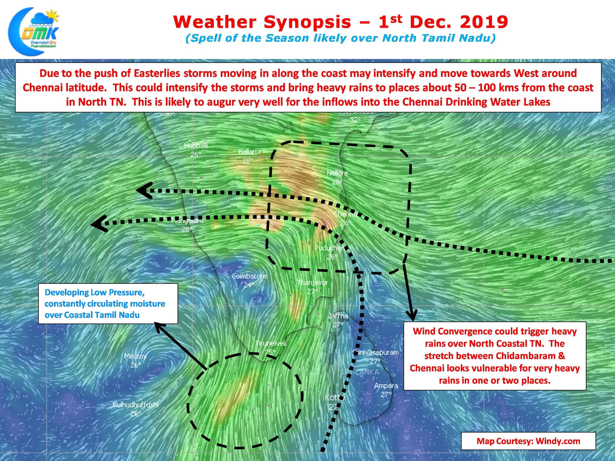
Northeast Monsoon saw one of its best days of the season yesterday as perfect conditions created by Easterlies and enhanced by the presence of MJO over the Indian Ocean brought widespread rains across almost all of Tamil Nadu with many places recording heavy rains. Chennai city has been getting spells of rains right through since last evening which is bringing back memories of 2015 to many.

With the protection provided by the Inter Tropical Convergence Zone multiple circulations currently persisting to the North of Equator has strengthened the Easterlies right through Bay & Arabian Sea. While the western most circulation is likely to become a Well Marked Low and the Eastern Most circulation may fade away in a day or so the one in the centre over the Comorin Sea has been working the magic for Tamil Nadu.

Ideally placed to constantly recycle moisture over Tamil Nadu it is at a perfect location to bring widespread rains to the entire state. With another low to its west it may adopt a pseudo stationary position for a day before slowly climbing North along the coast. This period of pseudo stationary movement is likely to bring heavy rains to coastal TN with North TN inline for some heavy spells of rains. As the system climbs up South TN and places along the Western Ghats will record very heavy rains due to moisture drag.

With the developing low over Comorin Sea creating moisture filled Southerlies North TN areas are likely to come under wind convergence zone due to the Easterlies around Chennai latitude. This wind convergence is likely to trigger heavy rains over the coastal stretch between Pondicherry & Chennai. Interestingly due to the push of Easterlies the storms while climbing along the TN coast will start moving West taking the support of the Easterlies along with it intensifying in the process. This could mean places about 50 – 100 kms away from the coast could see very heavy rains at times over North TN. This augurs well for the Chennai lakes as the catchment areas could see heavy spells of rains today.
As things stand it becomes even more necessary to take one day at a time. But considering how MJO is likely to travel over Indian Ocean fears of NEM2019 winding down for North TN immediately may be little far fetched.


