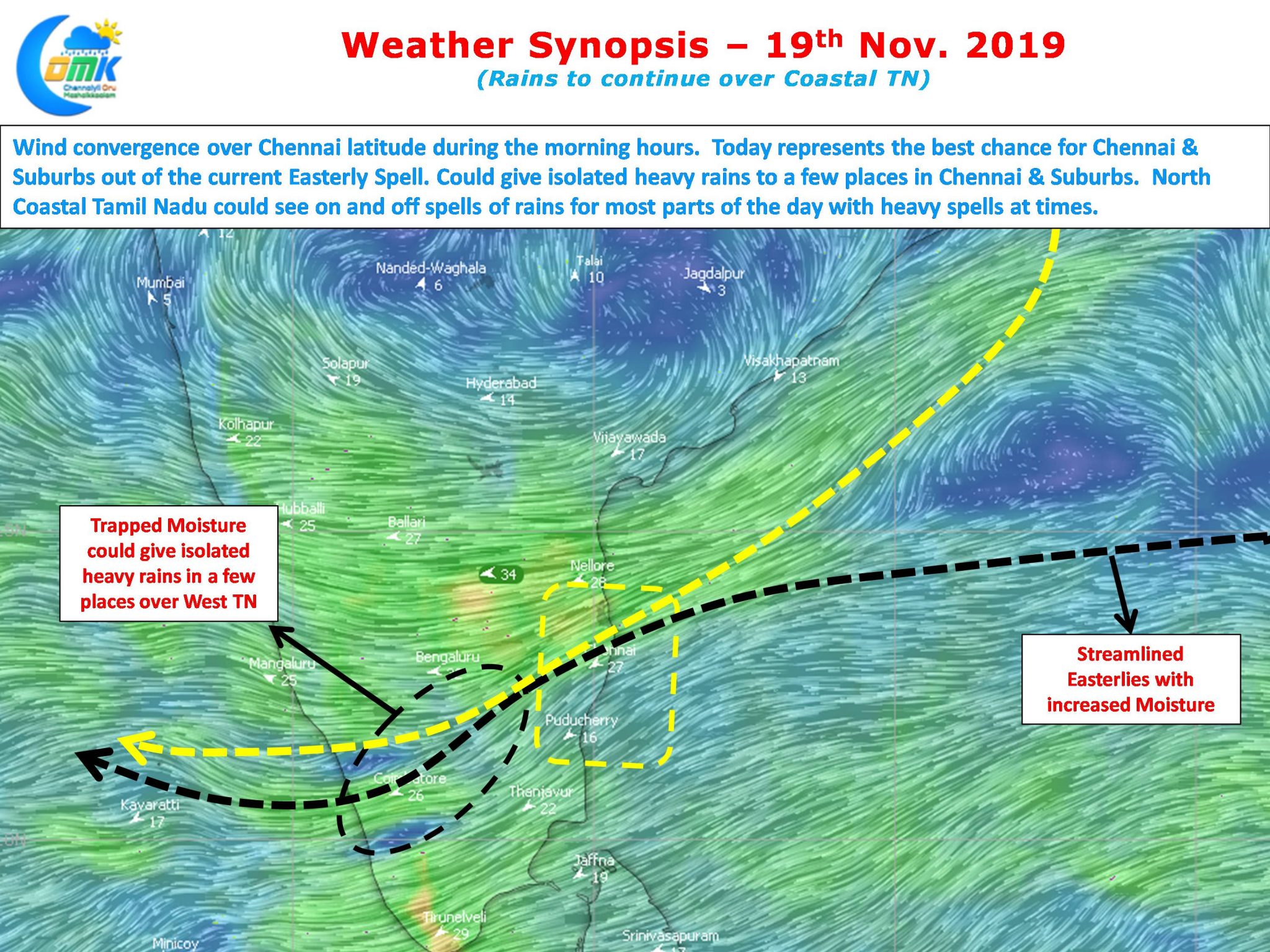
After stuttering for many days finally Northeast Monsoon 2019 has started showing signs of recovery once again thanks to strengthening Easterlies. Though South AP enjoyed the better spell of rains yesterday it was some bit of relief to see many parts of Chennai record light to moderate rains. Since midnight the spells of rains have improved over most parts of the city with today promising to be better than yesterday.

The wind convergence zone continues to sit over Chennai latitude with today promising to be a good day for North Coastal Tamil Nadu. With Dry Line Boundary running over North Coastal Tamil Nadu we could possibly see isolated places around Chennai & Suburbs to get heavy spells of rains during the day. Chennai and most parts of North Coastal TN will continue to record on and off spells during the day. Rest of the coastal areas also are likely to record moderate rains today with the next few days relatively better off in terms of monsoon activity.

Due to trapped moisture brought by the Northeasterly winds isolated places in the Western Ghats and a few interior places in West Interior TN and South TN are likely to record sudden burst of heavy spells. These spells will be of high intensity / short duration pattern later in the evening over places along the Western Ghats.
Today represents the best chance for Chennai and suburbs in terms of getting a heavy spell of rains in nearly 3 weeks. But what turns out in reality is to be seen.


