NEM 2019 continues to stutter though Easterlies have been fairly strong over Peninsular India and South Bay. While on Thursday many parts of South AP got good rains, places like Chennai had to feel satisfied with just some light rains in a few places and some cloudy skies leading to frustration not only to weather enthusiasts but also common people.

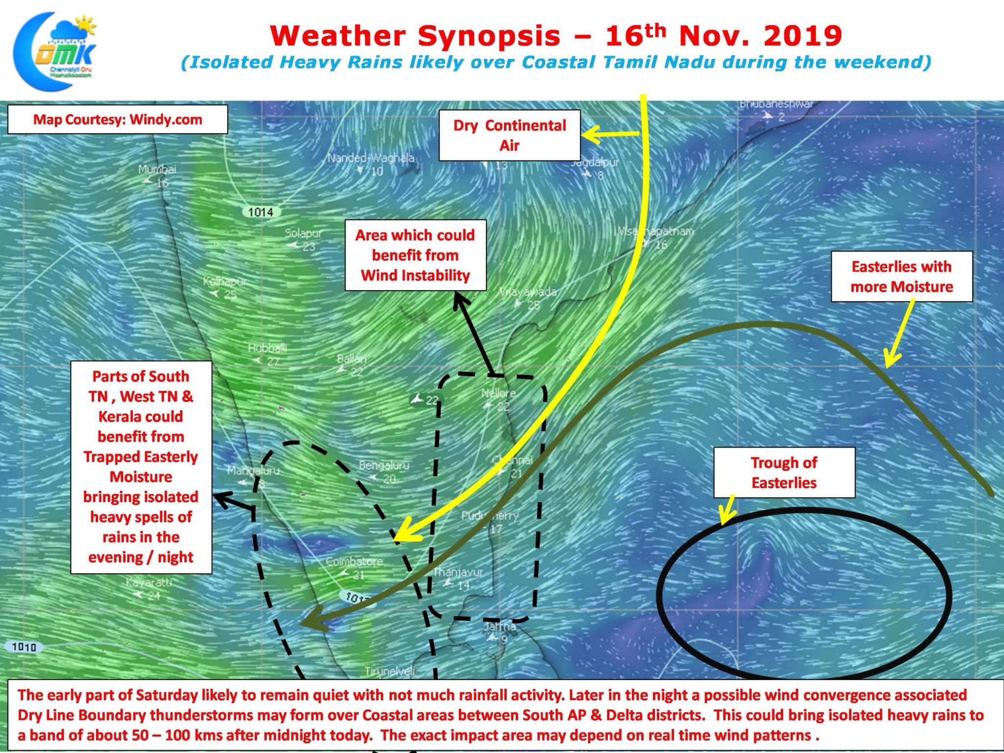
A trough of Easterlies up to a height of 1.5 kms ASL is prevailing over South Bay area influencing the Easterlies in the region. The convection created by this trough of Easterlies currently lies to the NE of North TN / South AP coast and is expected to move in a SW direction under the influence of prevailing wind pattern. This may give some light to moderate rains over the coastal areas during the weekend while places along the Western Ghats could benefit from moisture incursion through Peninsular India.
But not all is lost as weather models indicate there is a possibility of some Dry Line Boundary Thunderstorms to happen over the weekend in about 18 to 36 hours from the time of this post. The stretch between Nellore & Delta is likely to be the zone which could benefit from this wind pattern. A narrow stretch of about 50 to 100 kms could see heavy spells of rains where the actual Dry Line Boundary (meeting point of Dry Continental Winds with the Moist Easterlies) happens.

Trying to identify this exact spot of dry line boundary through weather models is futile as the real time wind pattern is likely to decide the actual impact area but the stretch between Marakkanam and Delta possibly has better chance than the places to the North of Marakkanam to fall under this dry line boundary zone.
A word of caution though as Krishnamachari Srikkanth often uses these dry line thunderstorms are வந்தா பாக்யம் வரலென்னா லேகியம் . As Weather Bloggers we could try to provide a realistic estimate of what is likely to happen on how weather models interpret things. Not always they end up as expected.


