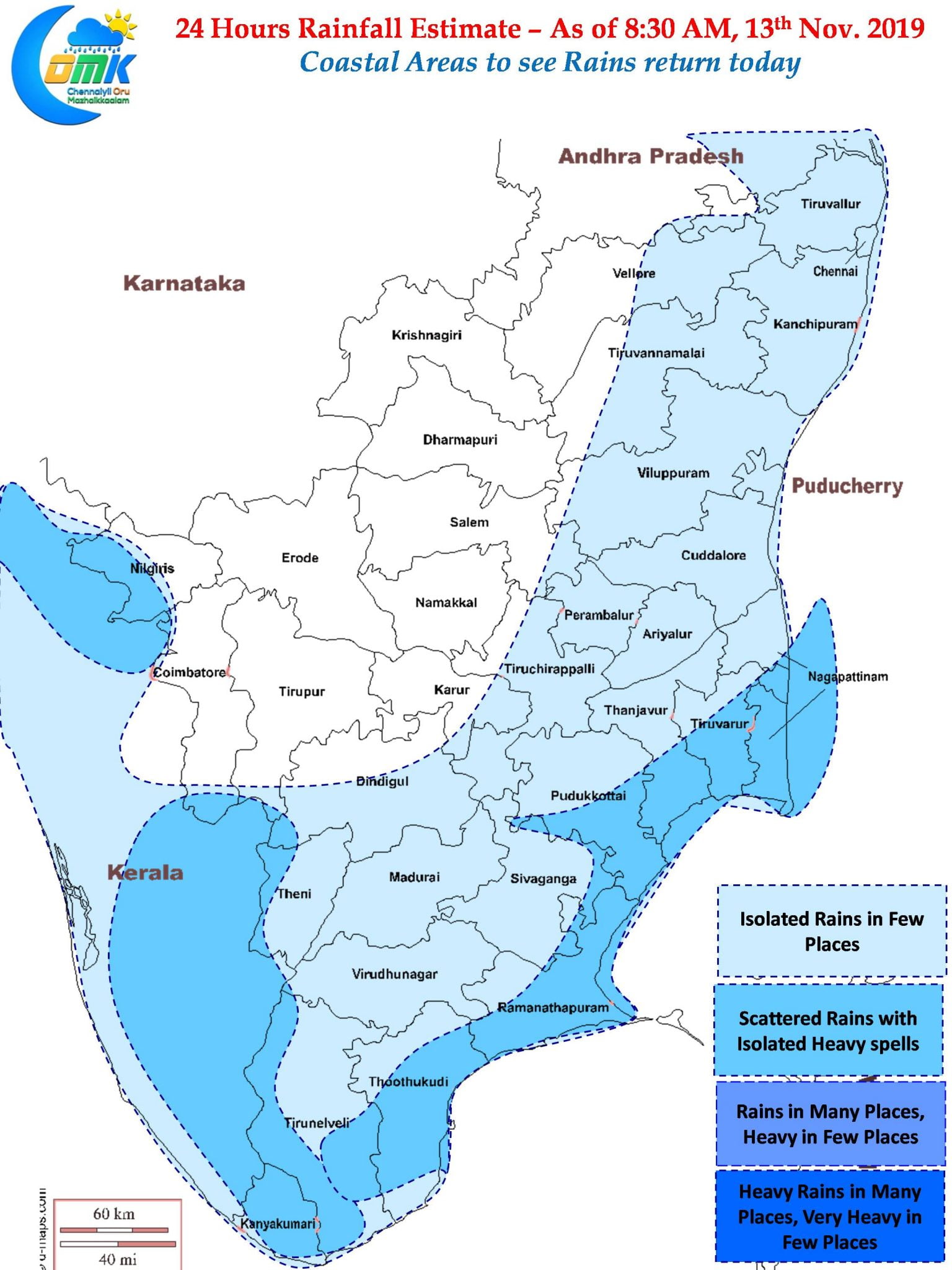
In what could bring a cheer to most of Tamil Nadu after a break for more than a week or so Northeast Monsoon is likely to show a gradual revival over the course of next few days. The Northerly winds over the past few days have not only brought an overall dry atmospheric conditions over most of Coastal Tamil Nadu along with it increased the pollution levels also over places like Chennai in conjunction with other factors.
Slowly from today weather models are indicating the strengthening of Easterlies which is likely to bring more moisture into Peninsular India. While we are not yet into full scale revival of Northeast Monsoon 2019 surely things are going to pick up from now on. The possible entry of remnant pulse of Tropical Storm Nekuri could give some impetus to the strengthening Easterlies. It remains to be seen if the entry of this pulse into Bay develops into an organized disturbance like Matmo though Models are giving less probability for the same.

On the one hand the return of Easterlies will improve moisture availability over the course of next couple of days or so we can see Dry Line Thunderstorms develop over those areas where the Drier Northerlies meet the more moisture filled Easterlies. These dry line thunderstorms are not picked up accurately by the weather models in the precipitation charts.
Today wind charts indicate a confluence of winds of different masses over parts of South TN & Delta districts. This could result in possible thunderstorms giving moderate to heavy spells of rains over parts of Delta & South Coastal TN later in the evening / night. As the Easterlies pick up in pace this dry line will get pushed up bringing possible opportunities of similar conditions over North Coastal Areas including Chennai & suburbs sometime tomorrow.

Its fingers crossed as of now hoping the winds align and the expected Easterly waves do their job without any fuss over the next couple of weeks. Now is the time to remain more patient as a Weather enthusiast rather than react & panic with each model outputs making adjustments to changing weather dynamics.


