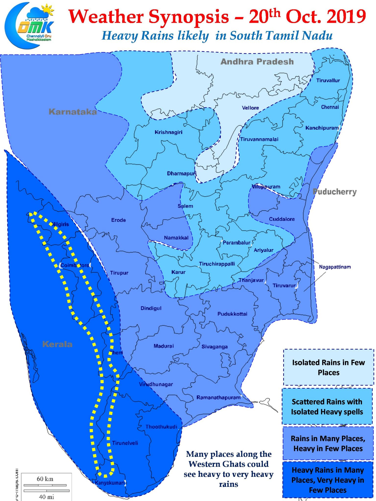
Northeast Monsoon continues to be active over Peninsular India. Yesterday saw parts of South TN record moderate to heavy rains in many places. Coastal TN continued to clock in the seasonal rainfall tally on an almost daily basis. Chennai was no exception with many areas of the city recording spells of rains during the afternoon and late evening.

Over the next few days we can expect Northeast Monsoon to notch up a gear or two through the developing support from a disturbance in Bay of Bengal. The Arabian Sea LPA is expected to intensify into a Well Marked Low over the next 24 to 48 hours. In the meanwhile the Trough of Low currently persisting over Southwest Bay and off the Lankan Coast could evolve into a possible LPA during this week bringing more momentum to Northeast Monsoon.

On a slightly larger context it may be prudent to keep a watch on the possible interplay between the incoming MJO that’s seen gradually showing its influence over Arabian Sea and the already present Equatorial Rossby Wave over the Indian Ocean region. It appears the ER wave may modulate the effect of MJO. This could possibly influence how developing disturbances could intensify in the days to come.

Today weather models indicate an increased rainfall activity over South TN due to the influence of trough of low along with a convergence of winds created by the Arabian Sea LPA. Along with South TN most parts of South Kerala is likely to see heavy rains. One or two places in South TN & South Kerala along with few places along the ghats are likely to receive very heavy rains.
As far as Chennai & rest of North Coastal TN is concerned intermittent spells of rains are likely to happen today to mostly during the morning and night hours. Some of the spells could be heavy as has been the pattern for the past few days.


