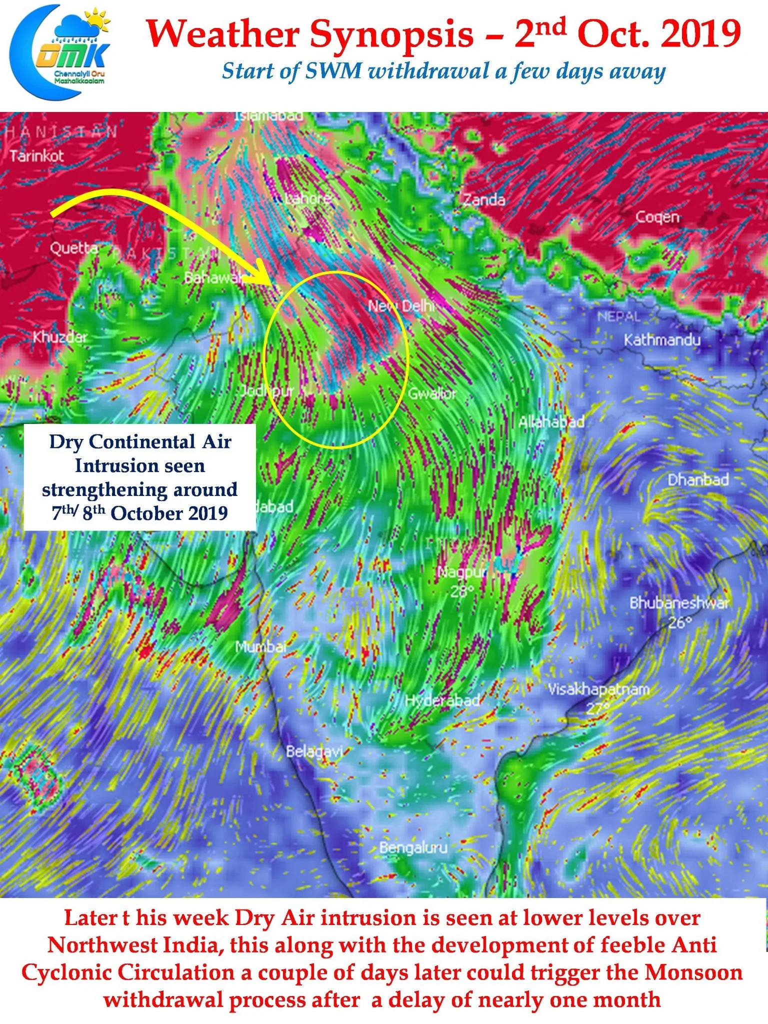
Officially the Southwest Monsoon season in India extends between 1st of June to 30th September from the statistical perspective. According to IMD the traditional monsoon onset date over Kerala (MOK) is 1st June while the withdrawal process from West Rajasthan, where monsoon stays the shortest time, is expected to start from 1st September. In this context it is interesting to note the mean withdrawal date from West Rajasthan is nearer to 15th of September than 1st of September over the last couple of decades.

But current year’s Monsoon seems to behave like an overstaying relative with no signs of Monsoon withdrawal from West Rajasthan showing up yet. 2019 will see the most delayed start to the withdrawal of Southwest Monsoon more than a month behind schedule. 1961 was the only year possibly where the start of withdrawal spilled into the month of October. 2019 has already crossed that date and withdrwal is unlikely to start until early next week.

IMD has a clear protocol for withdrawal too just like Onset Criteria in the form of cessation of rainfall for a period of 5 days, reduction in atmospheric Moisture & an establishment of lower level anti cyclone over Northwest India. Weather models indicate the intrusion of Dry Continental Air into North India around 7th / 8th October. Simultaneously we can also see the development of a feeble anti cyclone at lower levels too in the region. Given this we could finally see Southwest Monsoon start its retreat around 9th / 10th October 2019.

On the thunderstorm front South India will continue to see thunderstorms in the interior areas with West & Northwest Interior Tamil Nadu once again well placed to receive rains. One or two places in this region could see heavy spells of late evening / late night thunderstorms. Chennai as usual will remain a spectator with firm Easterlies preventing any movement of thunderstorms towards the coast. Additionally the convergence will almost always remain further over the interior areas.


