Tamil Nadu has always been a big beneficiary of transition season thunderstorms. Both during the time winds change from East to West that happens around April / May and post Southwest Monsoon period transition from West to East wind change.

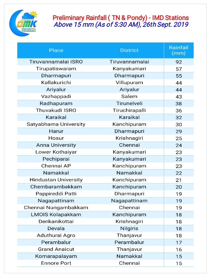
Yesterday was no exception either with many places recording moderate to heavy rainfall in Dharmapuri, Tiruvannamalai & Kanchipuram districts. As though reminding people what to expect in the days to come Chennai & suburbs received two seperate spells of rains, early morning & once again late in the night, bringing nearly 2 cms rains to both the IMD observatories in the city.

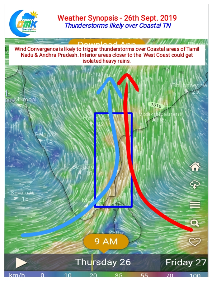
Today once again things look good on the thunderstorm front for Peninsular India due to prevailing wind convergence induced instabilities. There’s a fair chance for coastal areas of Tamil Nadu & Andhra Pradesh to receive a spell or two of sharp showers during morning / late night through this convergence. One or two places in interior Tamil Nadu along the western ghats could see heavy spell of thunderstorms later in the night.

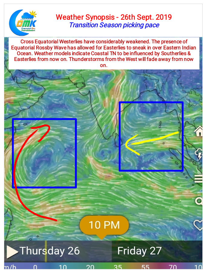
But the bigger picture though is Wheels in Motion for the transition to Easterly regime seems to be falling in place. Wind charts indicate Cross Equatorial Westerlies to be losing intensity while aided by the presence of Equatorial Rossby Wave the Easterlies / Southerlies are sneaking in over the Eastern Indian Ocean side. There’s a fair bit of consistency in the models to indicate thunderstorms from the West are fading away for places like Chennai.
It is important though to point out here, the changes towards direction change of winds is not indicative of a Northeast Monsoon onset yet.


