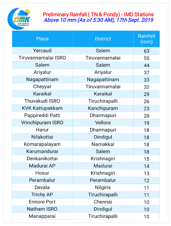
Thunderstorms continued their daily check ins over Tamil Nadu as yesterday saw widespread thunderstorms over many parts of the state. Parts of Delta districts along with few parts of Tiruvannamalai district recorded heavy spells of rains under the influence of circulation in Bay.

While the Northern suburbs of Chennai recorded moderate thunderstorm activity last evening the remnant interior Thunderstorms meant light showers greeted most parts of the city as day broke today leading to pleasant conditions.

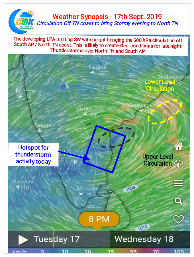
As we have been mentioning for the past couple of days the circulation over the Bay has been creating the right atmospheric conditions for Thunderstorms to thrive. The Circulation is tilting SW with height bringing the Mid Tropospheric Circulation Off North TN and South AP coast while the lower level circulation is further North closer to North AP coast.

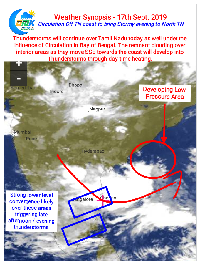
This creates ideal conditions for Thunderstorms over North TN for the next day or two while the circulation moves across Peninsular India. Additionally weather models indicate strong lower level convergence over two patches in Tamil Nadu bringing these areas under the Thunderstorm radar later in the evening. Possible interplay between remnant clouding from overnight Thunderstorms in interior Rayalaseema and the lower level convergence storms could bring heavy rains in one or two areas of North TN.
As usual the case of Chennai remains unique so let’s enjoy what ever comes our way it could be a Super Cell or Another Miss. There is no grey area for Chennai.


