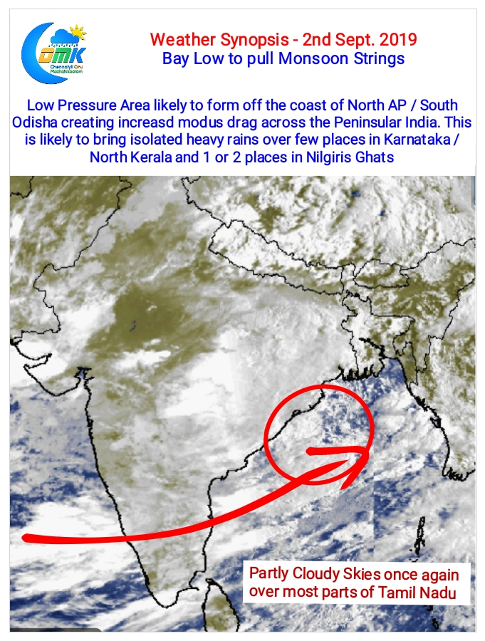
The developing low pressure in Bay of Bengal is likely to pull monsoon strings during this week. Expected to form off the North AP / South Odisha Coast it’s likely to bring an increased moisture drag across Peninsular India over the next few days.

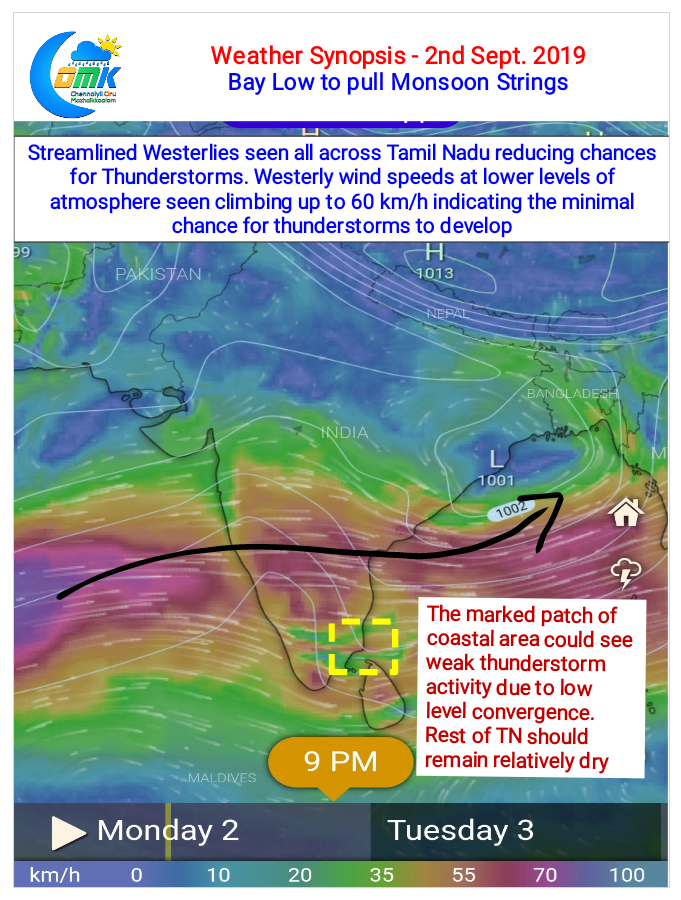
Weather models are already indicating an increased Westerly wind speeds at lower levels of atmosphere indicative of the improving monsoon dynamics. Additionally the Westerlies are also more streamlined pretty much taking away the wind instabilities over Tamil Nadu and the southern parts of Peninsular India. The increased moisture drag over Peninsular India along with an offshore trough thats seen along the coast of Karnataka is likely to bring heavy rains in a few places over the Western Ghats due to trapped moisture.

As we often repeat wind instabilities either in the form of convergence or Line of Wind Discontinuity (LWD) is a key ingredient in the thunderstorm equation. When the Westerlies streamline the chances for Thunderstorms fades away. Additionally during the Southwest Monsoon time increased strength of Westerlies also mean lesser chance for Thunderstorms to consolidate.
Looking at the wind charts today it may be relatively subdued day of thunderstorms over Tamil Nadu except for a small patch of coastal areas over Delta, Pudukkottai & Sivaganga districts where a weak lower level convergence could trigger isolated thunderstorms. Chennai is likely to see partly cloudy skies during the day keeping temperatures around 35°C with higher than normal humidity.


