Heavy overnight Rains lashed many parts of Chennai as slow moving thunderstorms that intensified closer to the coast dumped more than 7 cms of rains in less than three hours at the IMD observatory in Chennai AP.

While Southern parts of the city recorded this monster spell Northern parts of Chennai was left with only bread crumbs indicated by just 3 mm recorded by the IMD AWS at Madhavaram. The COMK PWS at Anna Nagar also recorded a modest 9 mm. Last night’s rains peaked around Chennai while rest of Tamil Nadu was relatively quiet.
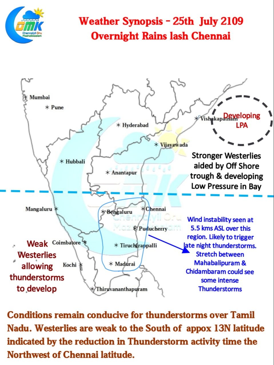
A look at the wind charts possibly gives an explanation on why the rains slowed down as we moved North. Roughly around 13 N latitude a sort of demarcation line is prevailing for the Westerlies. North of this, aided by the Offshore Trough & developing LPA in Bay, the Monsoon winds are stronger while South of it is weaker. The weaker Westerlies are allowing thunderstorms to develop triggered by either low level convergence or a broad zone of wind instability at 5.5 kms ASL currently prevailing over many parts of Tamil Nadu.

Today once again there’s a very good chance for some late evening / night thunderstorms over North Interior TN and adjoining parts of Karnataka & South AP region. While the day after late night heavy Thunderstorms are always tricky today the stretch between Mahabalipuram & Chidambaram could witness a spell or two of intensive Thunderstorms later in the night.
As we say always the exact direction of thunderstorms is very tricky to judge so depending on where the storms form chance for Chennai exists like rest of the coastal places of Tamil Nadu


