Monsoon onset over Kerala is a phrase that evokes a lot of emotions to not only weather enthusiasts but also the professionals among the weather community. What starts as a trickle a month or so earlier observing sea surface temperatures, pressure charts over Southern Hemisphere & looking at change in wind directions reaches its crescendo when the Monsoon Onset over Kerala is officially confirmed by IMD.

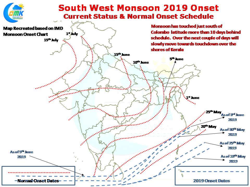
Yesterday saw monsoon reach just short of Colombo, touching down up to Kattunayake, the Southern suburb of Colombo where the international airport is located. Under normal conditions Colombo would be under the influence of Southwest Monsoon by 25th of May this year it is behind schedule by more than 10 days.

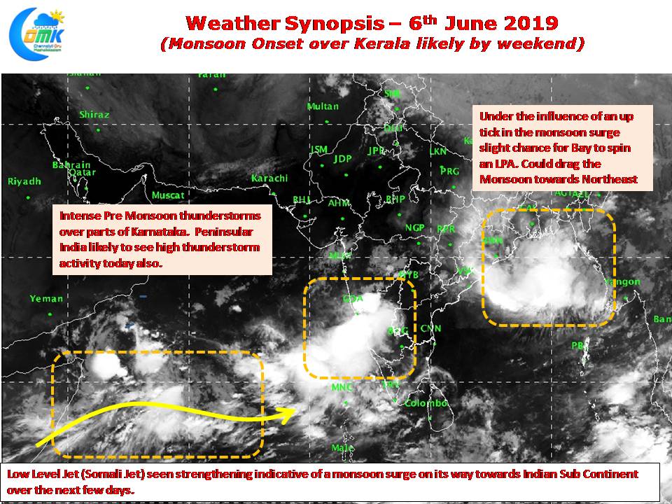
The Bay branch is also making slow progress though there is a possibility Head Bay may spin a low under the influence of Monsoon surge which could drag the Monsoon towards Northeast. Satellite images clearly indicate an uptick in the Low Level Westerly jet along the equator which could possibly bring the Monsoon onset over Kerala by weekend.

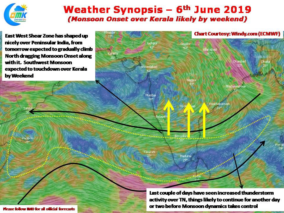
Last couple of days have seen increased thunderstorm activity over Tamil Nadu and many parts of Peninsular India. The arrival of East West Shear Zone has created a zone of instability providing conducive conditions for thunderstorms to thrive and travel over long hours & long distances. From tomorrow the East West Shear Zone is likely to move up pulling the Monsoon onset along with it. Today & tomorrow could see thunderstorms continue over Tamil Nadu before monsoon dynamics takes control.


