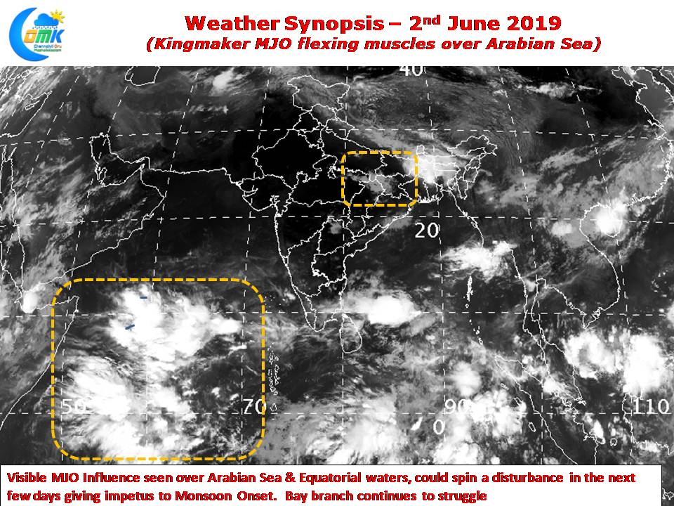
As the wait for Southwest Monsoon onset continues, thunderstorm activity has been quietly giving some much needed rains to interior Tamil Nadu. Yesterday saw few places in Vellore & Kanchipuram district record moderate thunderstorms in the evening as isolated rainfall activity was seen over Interior TN & South Interior Karnataka.

Satellite Images indicate a visible influence of MJO over the western parts of Indian Ocean. This could trigger a disturbance over the Arabian Sea in the coming days giving momentum to the Monsoon dynamics. Bay branch remains a worry though with none of the major observatories over the Andaman & Nicobar Islands recording any 10 cm day yet despite monsoon onset happening over many pars of the archipelago.

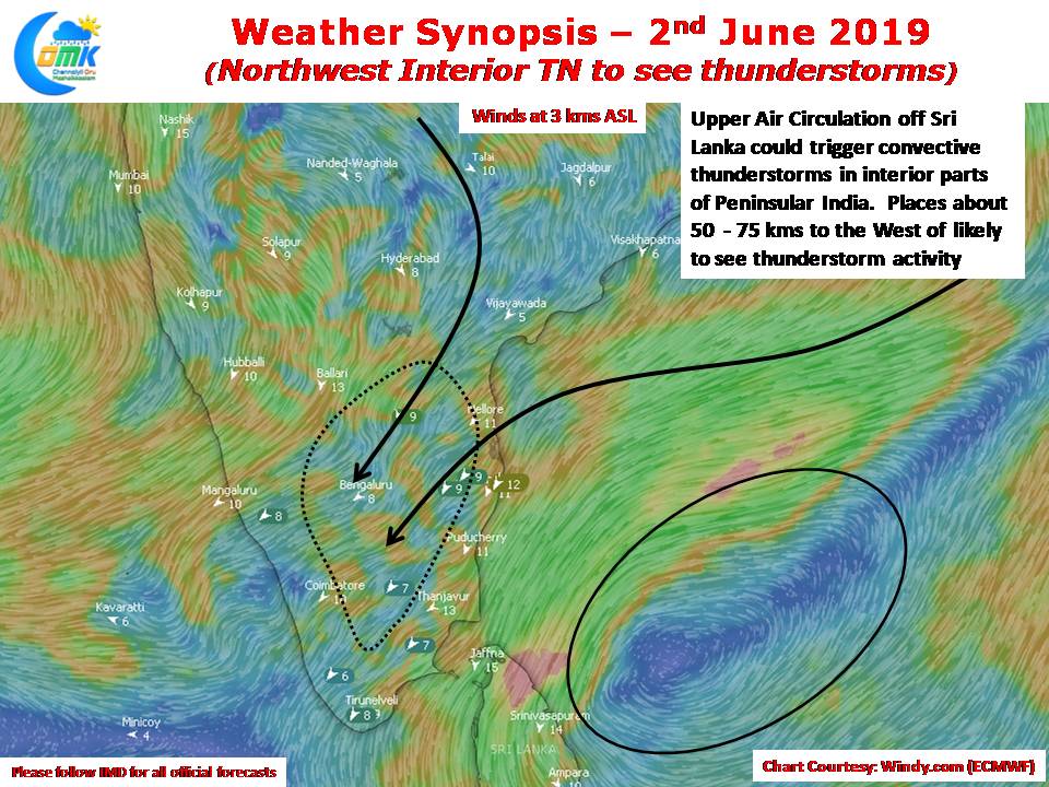
An Upper Air Cyclonic Circulation see at 3 kms ASL off the coast of Sri Lanka could provide the right wind convergence over parts of Interior Tamil Nadu giving thunderstorm possibilities today also to places in Vellore, Krishnagiri, Tiruvannamalai districts. After what is likely to be another fairly hot day over these areas the evening thunderstorms may bring much needed respite with once again places as close as 50 – 75 kms to the West of Chennai in line for some thunderstorm activity while Chennai may remain a spectator.


