While focus is always on summer and monsoons more often than not there are many areas of Tamil Nadu that look forward to the thunderstorm season. Especially parts of Kongu belt which come under the Leeward side of Western Ghats during Southwest Monsoon and too far away during normal Northeast Monsoon time get their majority of seasonal rains during pre monsoon & post monsoon thunderstorms.
This year though Westerlies have remained very inconsistent for thunderstorm season to pick pace in many of the interior areas. While overall the pre monsoon rainfall status for TN & PDC is at -64% the best performing district, Krishnagiri, is at -11% indicating the poor state of thunderstorms this season.

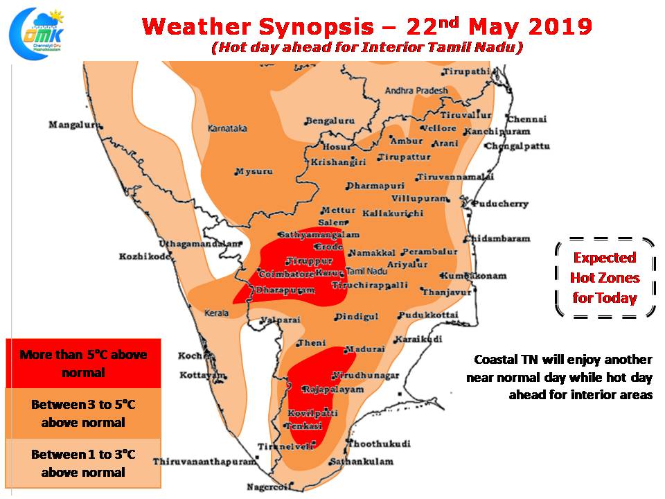
The stronger Easterlies has meant the coastal areas of Tamil Nadu like Chennai have enjoyed a relatively comfortable summer from temperature aspect except for a few days during Cyclone Fani though Interior areas have been seeing hot conditions.

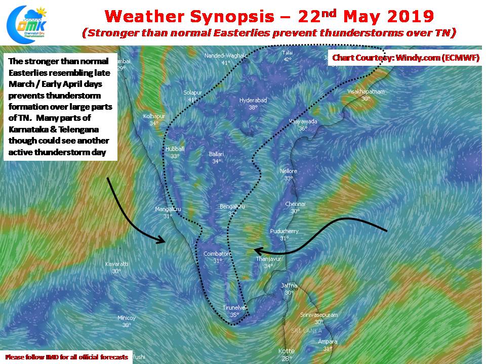
Today once again the stronger Easterlies would mean thunderstorms in isolated places along the Western Ghats while more areas of Karnataka, Telengana could see another day of good thunderstorm activity. With weather models still not showing any consensus on the strengthening of Westerlies yet there remains question marks on how many active thunderstorm days are left for Interior TN before Monsoon dynamics set in.


