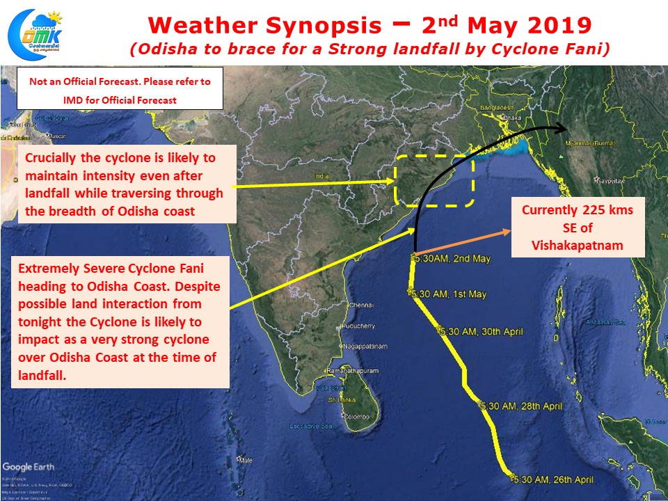
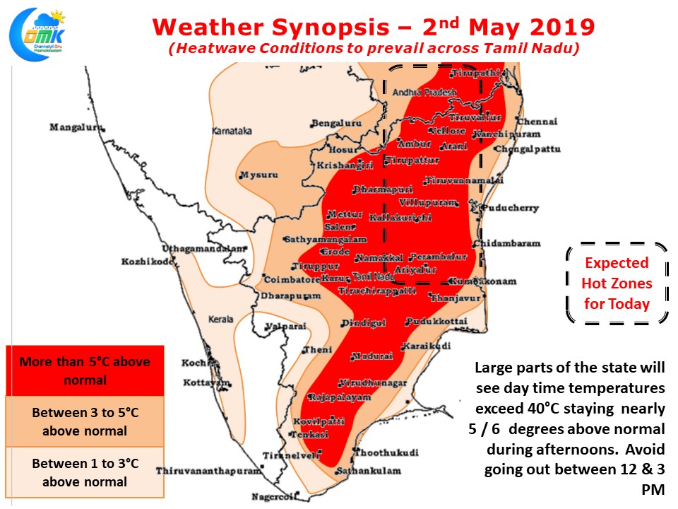
As Extremely Severe Cyclone Fani heads north towards Odisha coast Tamil Nadu should brace itself for heatwave conditions across the state starting today. Currently lying about 225 kms Southeast of Vishakapatnam it is expected to further track roughly in Northwardly direction with a slight tilt to the East interactive with the Odisha coast from tonight.

Though the land interaction is likely to disrupt the consolidation of Cyclone Fani it is still likely to be an extremely strong cyclone at the time of landfall which is expected to happen between Gopalpur & Puri. The larger worry though is due to the angle of direction Cyclone Fani is likely to travel the entire breadth of Odisha coast as a strong cyclone leading to large scale devastation.

In the meanwhile down south Peninsular India including almost all of Tamil Nadu is likely to head into Heatwave conditions under the influence of strong Westerlies triggered by the North Moving Cyclone Fani. Additionally devoid of moisture as it moves further North the heat quotient will increase drastically over the region. With westerlies taking strength the Easterlies in the form of Sea Breeze will struggle to move in bringing relief only late in the evening to places like Chennai.


