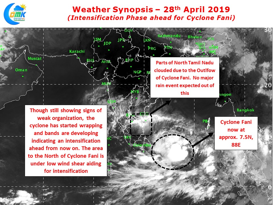
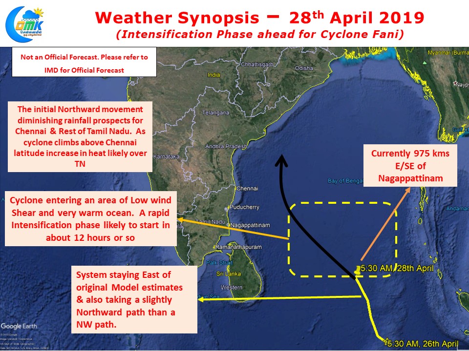
Cyclone Fani, currently lying at 7.3N, 88E, about 975 kms E/SE of Nagappattinam, has been taking a Northward track climbing up the latitudes. With its entry now into the open waters of Bay the system is looking at an active intensification phase ahead.

Compared to yesterday’s satellite image today Cyclone Fani is certainly looking better in terms of organization and banding. While there is still a long way to go moving out of the Equatorial Waters has ensured the system has developed a better spin allowing it to intensify.
While the sea surface temperatures have been warm all along so far it was in a zone where there was a moderate wind shear. Now it is about to enter a zone of Low Wind Shear Zone that is likely to trigger a phase of Rapid Intensification. Cyclone Fani will become Severe Cyclone within the next 12 hours and by tomorrow morning expected to become Very Severe Cyclone.

Cyclone Fani is slightly to the East of what models originally estimated. Additionally there is an initial Northward tilt in the track so far which has possibly diminished what ever small chance that existed for rains over Chennai and rest of Tamil Nadu. With further Northward track expected in the coming days coinciding with the rapid intensification phase the system is heading towards Coastal Andhra Pradesh as a very intense cyclone. Models firmly indicate a Northeast recurve after 15N latitude which could possibly prevent any large scale damage in the form of landfall over Coastal AP.
COMK will continue to monitor Cyclone Fani actively though the chance for any major rainfall event in Chennai is very less. As the cyclone climbs up a spell of heatwave is likely to be triggered for which Chennaites have to brace for


