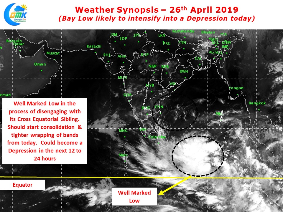
The Low Pressure Area in Equatorial Bay intensified into a Well Marked Low last evening and is likely to intensify further today into a Depression. The overall theme though continues to remain fluid with the disturbance keeping both weather watches & weather models on tenterhooks alike.
Overnight satellite images show the disturbance trying to cut its umbilical cord with its Cross Equatorial Sibling and start its own journey towards Peninsular India. Remaining very close to the Equator has been a handicap so far for the well marked low to wrap its band tighter, a process very essential for intensification & Consolidation.

Nevertheless its very clear slowly but steadily the cord between the two siblings is becoming less pronounced thereby allowing the system to cut itself off and climb up. We can expect the Well Marked Low to become a possible depression over the next 12 to 4 hours with further progress expected subsequently.

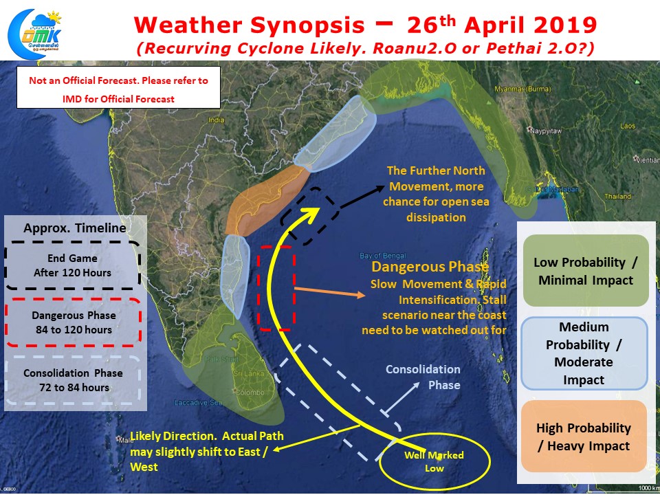
With models still going through Yo Yo changes in terms of outlook for this well marked low it is still not time yet to put an estimate on the final path, impact locations & Precipitation estimates for this disturbance. Keeping in mind the need for information dissemination without going over board we at COMK are providing with an estimate of our version of impact & timelines. While we have not provided an actual path yet the likely direction is indicated in terms of overall movement.
As we always say Keeping Expectations Low will allow us to enjoy anything that comes our way as a Bonus.
Please follow IMD for all official forecasts.


