The Pre Monsoon thunderstorm season has well and truly begun with heavy thunderstorms lashing parts of Kanyakumari, Dindigul, Virudhunagar district last evening. Rajapalayam recorded 12 cms while Lower Kothayar in Kanyakumari district recorded 10 cms rains. Similarly Kodaikanal recorded good rains as well.

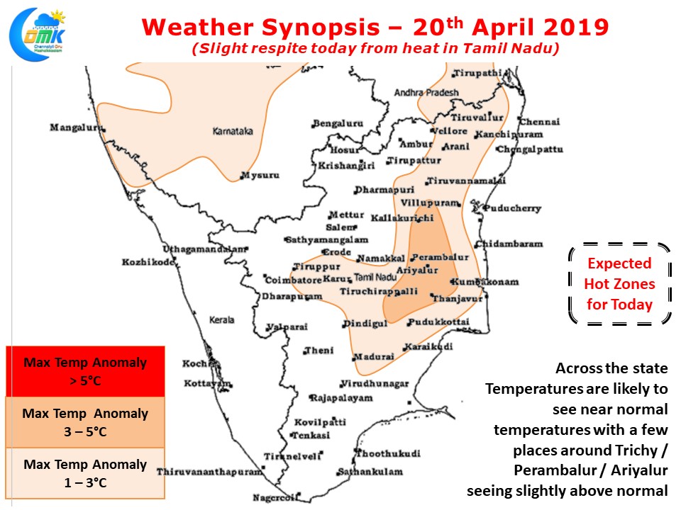
The advent of thunderstorms though has brought some respite to temperatures as the parched land has cooled a bit in many areas reducing the ground radiation to some extent. Today most of the state may see near normal temperatures. Parts of Trichy, Karur, Ariyalur & Perambalur districts may see slightly above normal temperatures. The strengthening Easterlies have also brought isolated rains in the coastal areas especially around delta region & South TN.

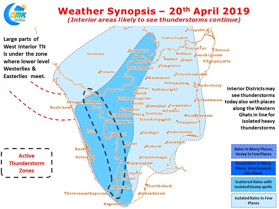
Interior parts of Tamil Nadu will once again see thunderstorms continue today. Both Western Ghats & the broken Eastern Ghats play a crucial role in providing an impetus to the rising air particle through orography so places closer to the mountains typically benefit more from these thunderstorms. Depending on localized wind patterns places on either side of Western Ghats fall on the windward side thereby witnessing intense thunderstorms at times.


