While parts of North & East India have been seeing rains / hailstorms / thunderstorms Peninsular India including Tamil Nadu has been relatively dry. So far since the start of 1st March 2019 when the summer season kicked in TN & PDC has recorded 3.2 mm against the average of 11 mm till yesterday.

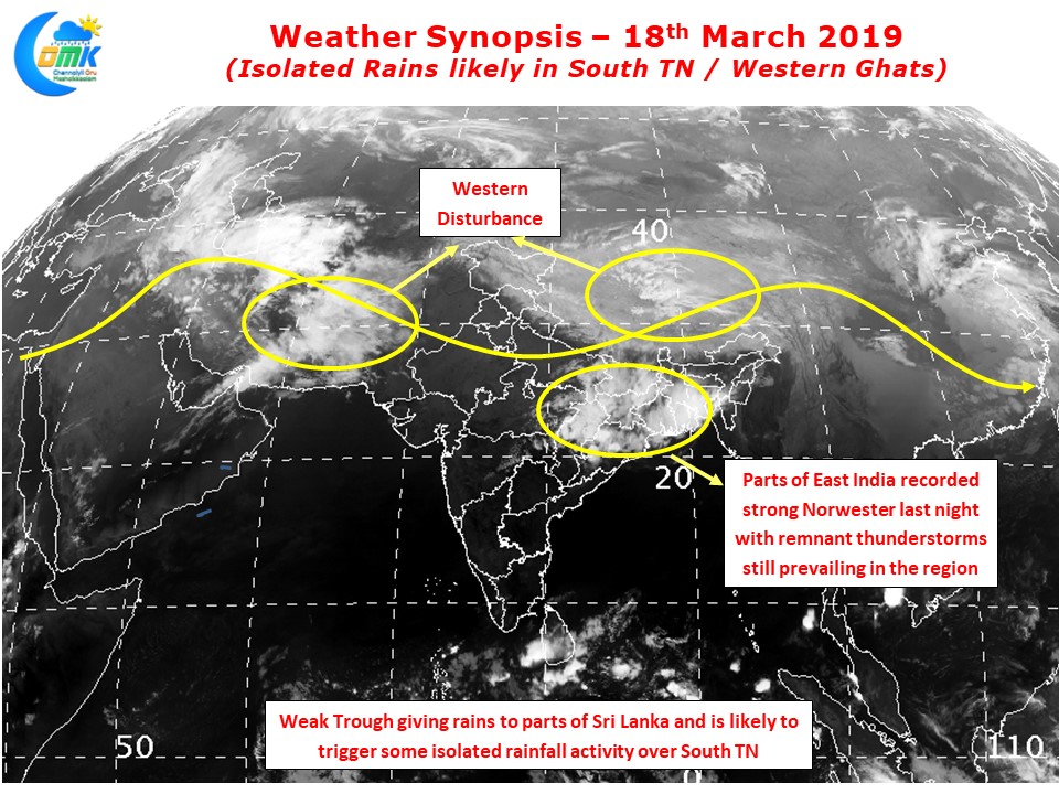
Yesterday saw parts of Jharkhand / Odisha / West Bengal see intense thunderstorms as converging wind of different masses created conducive conditions for Kalbaishakis / Norwesters to develop and intensify last evening. The almost weekly Westerm Disturbance schedule for North India is not showing any immediate signs of stopping as another one is expected to hit the region this week.

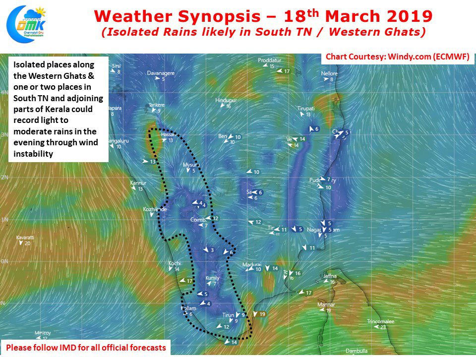
A weak trough like feature existing in the Equatorial waters is likely to trigger some thunderstorms over Sri Lanka and also over parts of South TN. Places along the Western Ghats on either side in TN & Kerala may see light to moderate thunderstorms in one or two places.
On the heat front while interiors may not blaze afternoons are going to be hot in the interior parts of Tamil Nadu while coastal areas like Chennai will continue to benefit from the moderating effect of Easterlies


