Most of us know the peak pollution season in North India including New Delhi coincides with winter. A combination of atmospheric factors during winter, like temperature inversion, and few other man made factors like stubble burning, Construction activities etc increase the pollution levels drastically. Additionally the lack of regular rainfall activity during winter prevents the dispersion of pollutants on a periodic basis.
It is in this context Western Disturbances play a crucial role in improving the air quality time to time over North India. While on most occasions the western disturbance influence is restricted to extreme North West India and upper reaches of Himalayas time to time the dip in the Mid Latitude trough brings rains to more parts of North India and to parts of Central India as well.

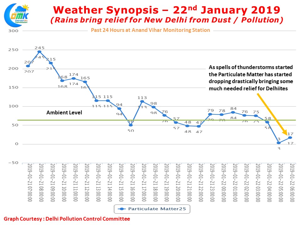
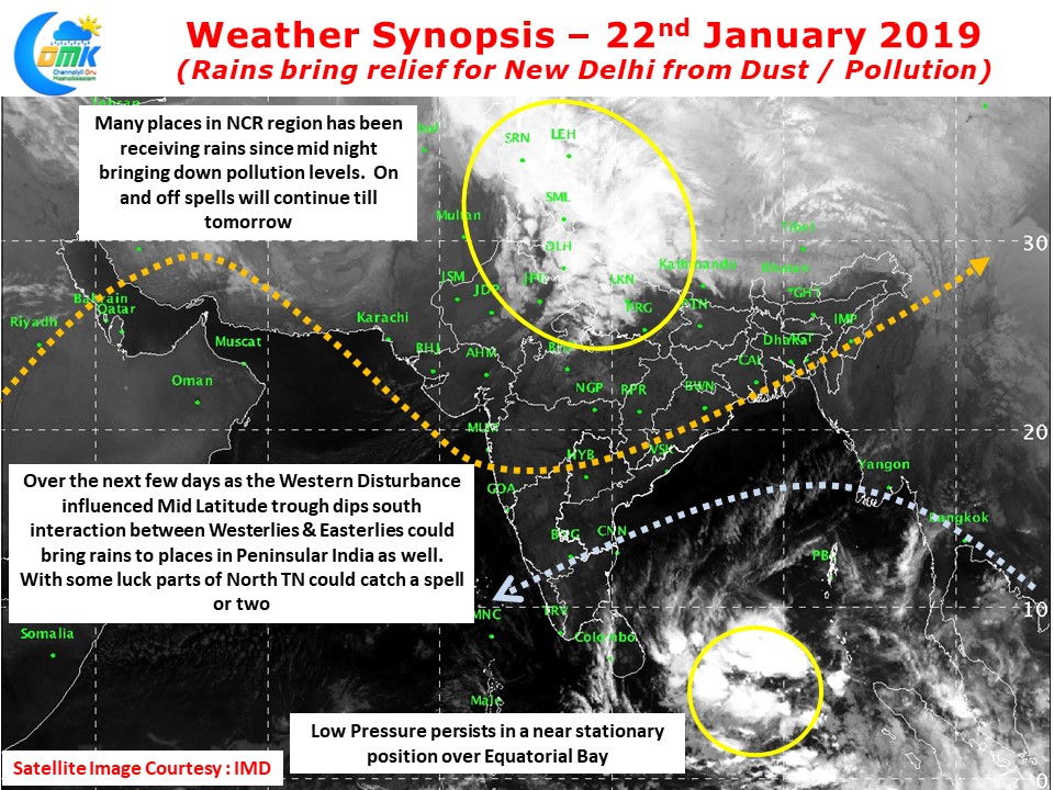
Bringing a fair bit of cheer to the citizens of New Delhi & adjoining parts of NCR the first spell of rains in nearly two weeks has brought down the dust & pollution levels in the capital. The Suspended Particulate Matter across many monitoring stations in the capital region have shown an appreciable decline since mid night coinciding with wider spells of thunderstorms around the region. The Anand Vihar monitoring station saw the SPM25 levels hover around 60 by evening yesterday and since midnight has been seeing consistently below this threshold level indicating much better breathing conditions for the citizens.

Down south the Low Pressure Area in Equatorial Bay continues to persist in the same region with not much movement compared to yesterday. The interplay between Easterlies influenced by the Low Pressure and the incoming Western disturbance has given an opportunity of wind convergence induced atmospheric instability over parts of Peninsular India in the next few days. With some luck and a more southward dip by the Westerlies than model estimates could provide some chance for places in North TN.


