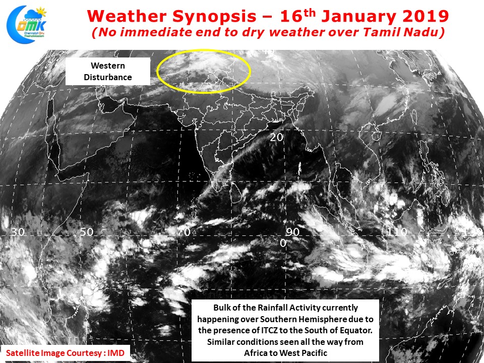
As Pongal festivities continue across Tamil Nadu winter continues to hold a firm grip over the Indian Sub Continent. Dry Weather has been prevailing across most parts of the country except for the high altitude areas of extreme North India which has been recording some rain / snowfall due to the regular arrival of Seasonal Western Disturbances. The regular occurrence of WD is likely to bring good spell of rains to parts of North India in the coming days

Satellite image clearly indicates the dry weather prevailing over the Indian Sub Continent with bulk of the convective activity & clouding happening to the South of Equator. With the ITCZ, the foundation for Rainfall & Monsoon activity, firmly placed in Southern Hemisphere its a similar story right from Africa to Western Pacific.

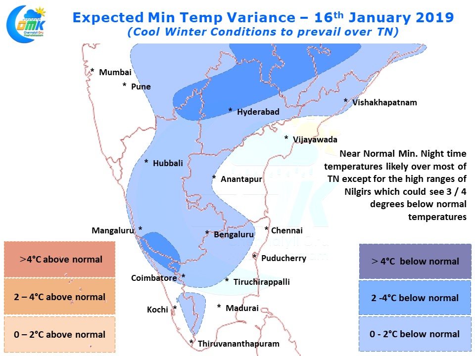
During the early days of 2019 many places of Tamil Nadu were seeing fairly intense cold wave conditions, in particular interior places along with Western Ghats saw nearly 4 / 5 degrees below normal temperatures on a daily basis. Things have eased well for the past couple of days with night time temperatures much closer to normal. Similar conditions are likely tonight as well though parts of Nilgiris could see couple of degrees below normal minimum temperatures.


