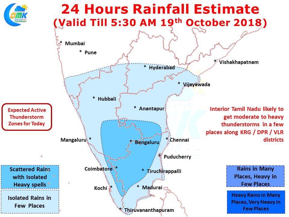
In a precursor to Northeast Monsoon 2018 many parts of Chennai recorded moderate to heavy thunderstorm activity. While some of the areas were lucky enough to catch a spell of thunderstorms yesterday afternoon the southern suburbs and places like Airport recorded an intense spell of thunderstorm during the wee hours of today.
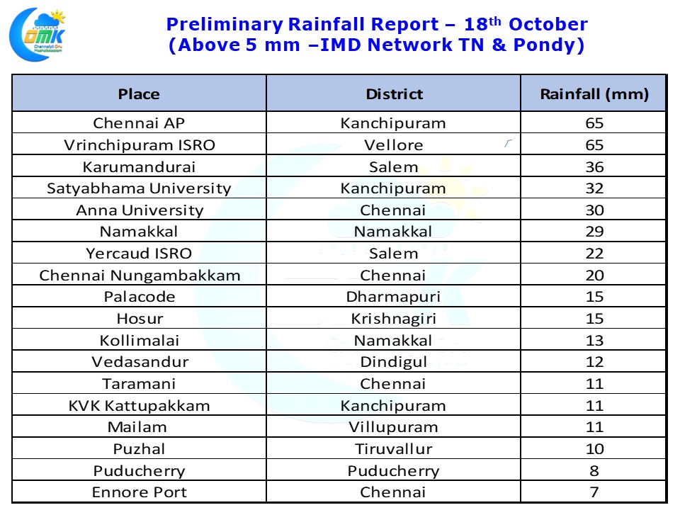
Just as estimated by the models the wind instability over North Tamil Nadu & adjoining parts of Rayalaseema region recorded good rains from last evening and some of the areas continue to receive light to moderate rains as this post is typed. Vrinchipuram a few kms to the West of Vellore recorded 65 mm rains while Chennai AP recorded same amount bulk of which fell after midnight.
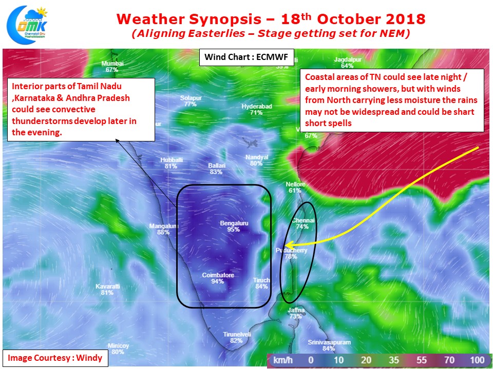
A look at the winds charts indicate the Easterlies have started to align to set the stage for the onset of Northeast Monsoon. We had a spell of Easterlies during the first week of October which brought widespread rains for most of Tamil Nadu. While this spell of Easterlies was triggered by the circulation that developed over Arabian sea, the development of Cyclone Titli over North Bay brought back Westerlies for a few days. Now will Southwest Monsoon getting ready to completely bid adieu from the Indian Sub Continent we can look forward to the onset of Northeast Monsoon.
The last few days have seen very good thunderstorm activity all across the state, in particular the interiors, brought about by the scrambled wind patterns. With Easterlies aligning we can see a reduction in heavy thunderstorm activity instead look at rains typical of Monsoon over the coastal areas. Interior areas will benefit from convective thunderstorms developed by the interplay between moisture travelling from the coast and day time heat radiation.
Coastal Areas like Chennai could receive sharp spell of showers at times, but keeping in mind the winds more Northerly than Easterly we may not see widespread heavy rains yet.


