The spell of thunderstorms over Peninsular India continues to chug along with a very good day of rainfall activity seen over many parts of Karnataka, Andhra Pradesh and few parts of Tamil Nadu too. Yesterday also saw the return of Easterlies over coastal areas bringing some sharp spell of showers to a few places along the coast. Few places saw light rains today early morning around Chennai.
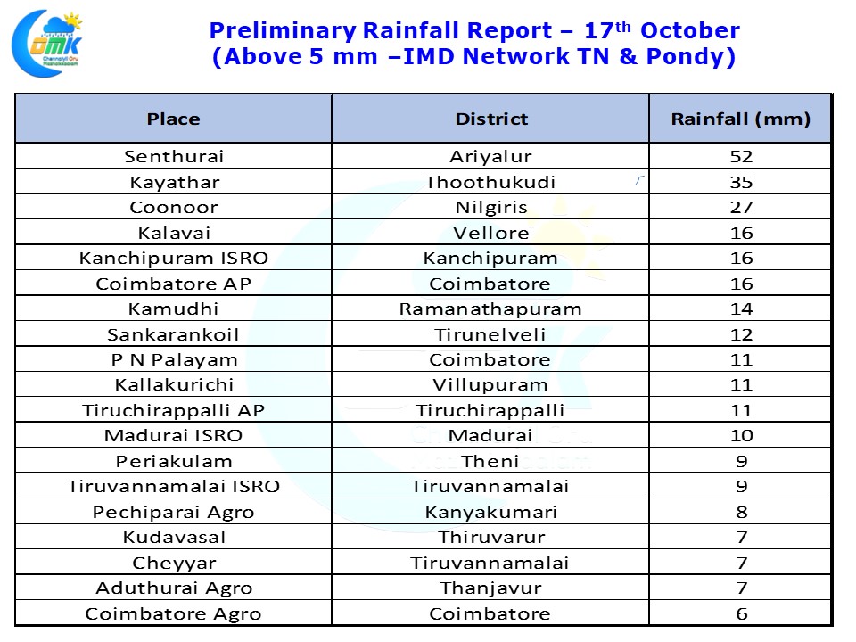
Senthurai in Ariyalur district recorded 5 cms from thunderstorms in the evening while light to moderate rains where seen in a few places over Villupuram, Tiruvannamalai, Vellore & Kanchipuram district. Kayathar in Thootukudi district recorded moderate rains for another day yesterday
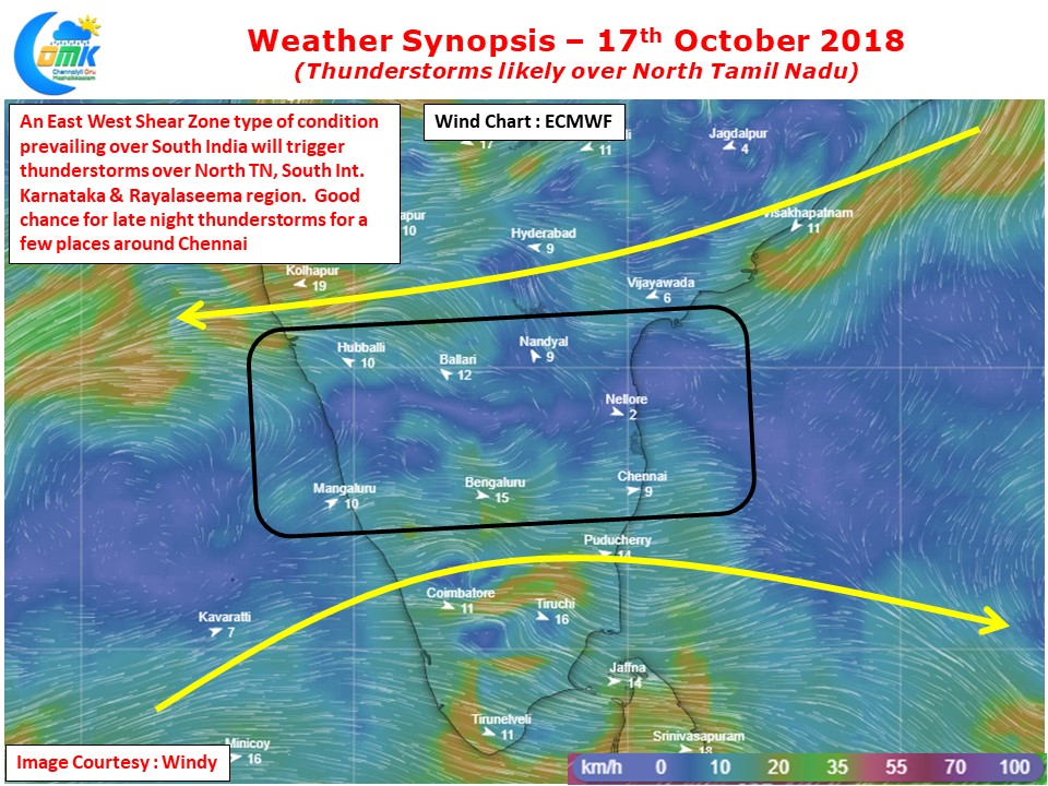
An East West Shear Zone type of feature, typically seen before Monsoon onset, is seen over parts of South India. This is likely to trigger thunderstorms around the zone between 12N & 14N latitude today. The winds at 1.5 kms ASL to the North of this zone is Easterly while below it is Westerly giving a zone of instability in between.
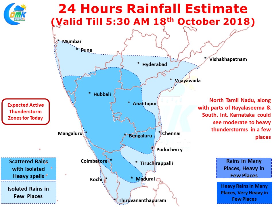
Areas around South Interior Karnataka, Rayalaseema & adjoining parts of Tamil Nadu are likely to see late night thunderstorms with one or two places coming under fairly heavy spells of thunderstorm activity. With a long weekend ahead a lot of traffic is likely to move out of the urban centers like Bengaluru / Chennai, the thunderstorms could play a spoilsport on the traffic plans so those planning to go home for Ayudha Pujai / Dusshera please plan accordingly.
The key question today is will Chennai get lucky with some Westerly winds just as Northeast Monsoon is so near to us. Fingers Crossed.


