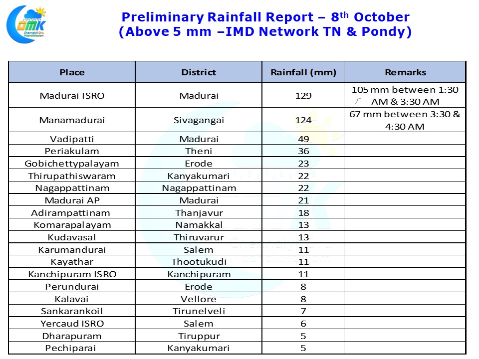
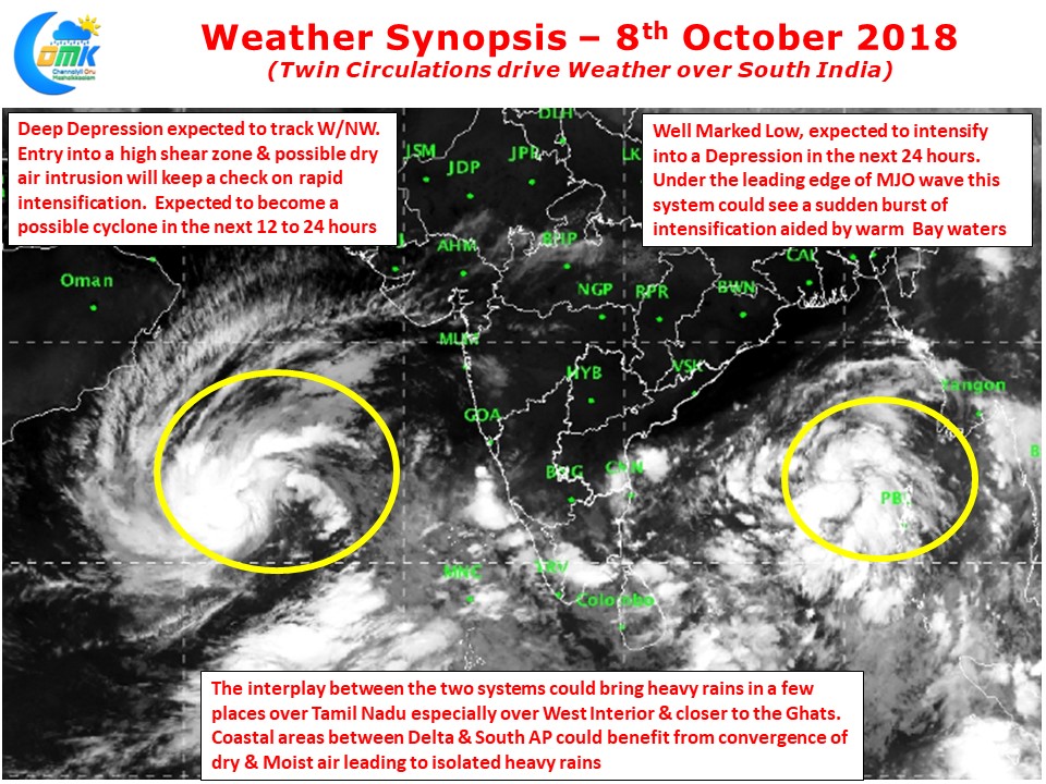
As Southwest Monsoon withdrew from across India to pave way for the onset of Northeast Monsoon over parts of South India the twin circulations on either side of Peninsular India continues to drive weather in the region. Unlike the past few days yesterday saw rainfall over Tamil Nadu reduce spatially though few places around Madurai got heavy spells of rains after midnight.
While Madurai AP recorded only 21 mm until 5:30 AM today the IMD Automated Weather Station at Madurai ISRO not far away recorded nearly 13 cms for the same period with more than 10 cms falling in two hours between 1:30 & 3:30 AM. Similarly Manamadurai in Sivagangai district also recorded more than 12 cms for the same period.
The interplay between the two circulations is likely to be the theme of weather today & tomorrow with convergence of winds thrown in the mix over coastal places too. While the Arabian Sea system could soon become a cyclone but rapid intensification may be difficult due to adverse conditions it might encounter. The Bay system though could benefit from the leading edge of MJO wave that might influence East Indian Ocean earlier than anticipated.
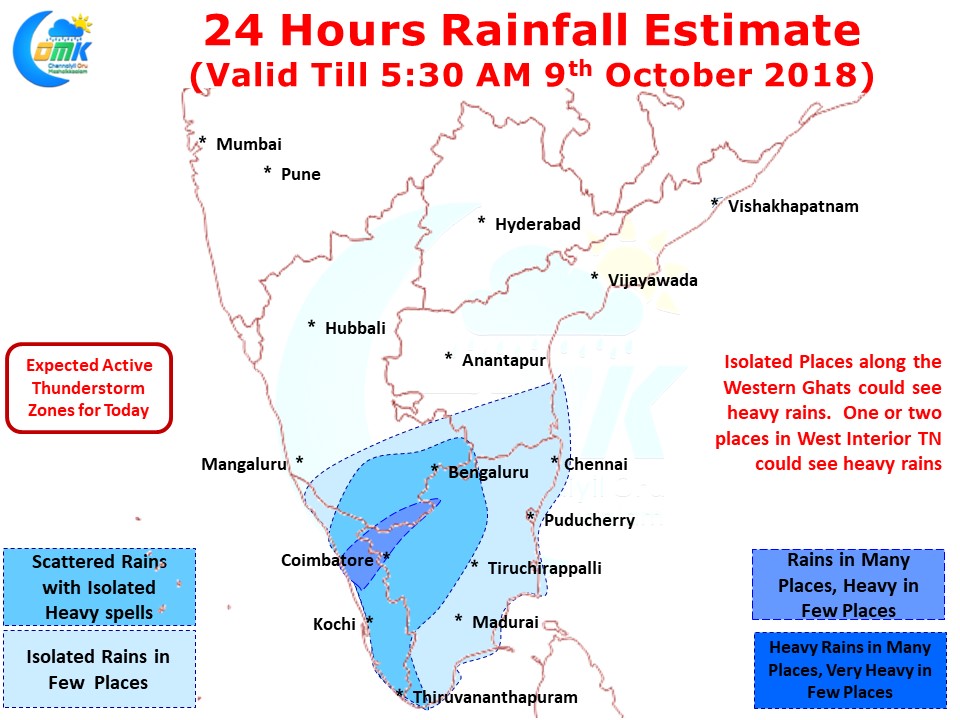
While the moisture drag across the Peninsular India is likely to trigger thunderstorms over West Interior TN & places along the Western Ghats, one needs to watch out for sudden spells of heavy rains along the coast between Delta & South AP as moist air circulated by the circulations and the dry air from North India gets converged along the coast. Lucky places could get dumped with heavy rains in a short time


