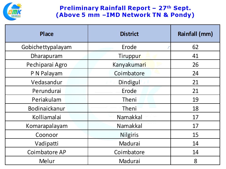
Thunderstorm activity has been continuing over the interior parts of Tamil Nadu with another good day for West Interior TN yesterday. Gobichettypalayam in Erode district recorded more than 6 cms rains while Dharapuram in Tiruppur district recorded more than 4 cms rains till today morning. Some of these interior areas were witness to thunderstorms even during the early hours of today.
In an interesting development some of the coastal areas recorded Easterly rains today morning. Places around Puducherry / Cuddalore / Chidambaram & some parts of Delta recorded these light to moderate spells of rains triggered by bands moving in from the sea. These rains from the sea is happening after many months and can be looked at as a precursor to the Northeast Monsoon Season.
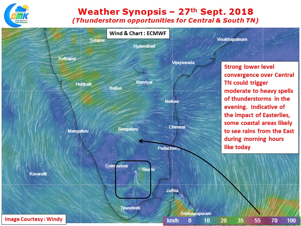
With strong pseudo Easterlies still prevailing till Mid Tropospheric levels the area of convergence continues to be in the areas further west from the coast reducing the opportunities of thunderstorms for coastal areas. Like today morning coastal areas are likely to see some sharp spells of early morning rains brought in my lower level Easterlies.
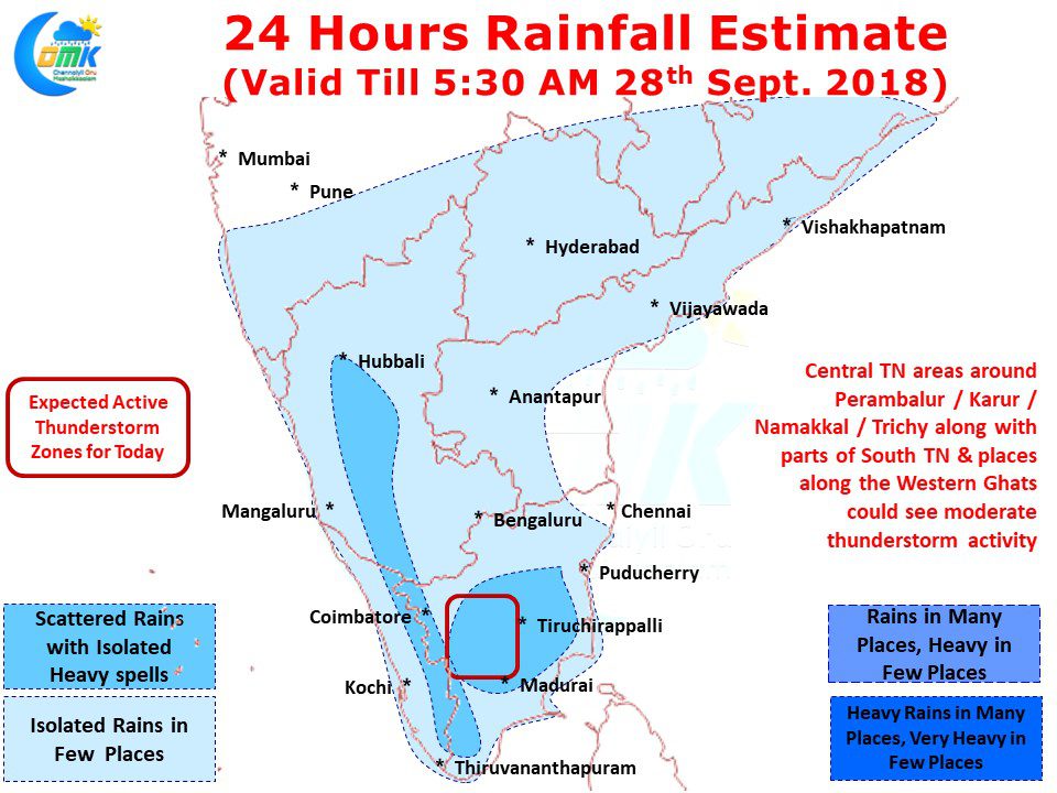
While like yesterday the places along the Western Ghats could witness thunderstorms today’s highlight could be the areas in Central TN & Parts of South TN. Places around Dindigul, Karur, Namakkal, Trichy, Madurai, Perambalur could witness moderate spells of thunderstorms in the evening due to the indicated strong lower level convergence by numerical models. Isolated places in this belt could see heavy spells of rains at times due to localized conditions.


